Diary/Photo Journal
Week of March 13, 2005
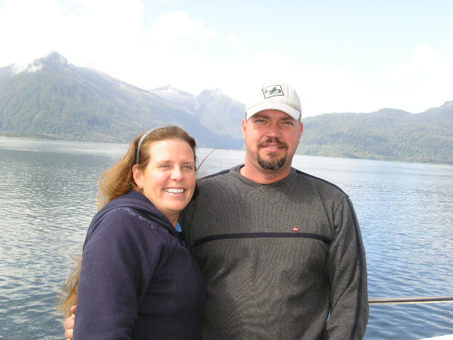
Getting out of Castro meant taking a five-hour ferry across a fjord and into Chaiten, a very dozy little town that supports the ferry traffic. We backed Cindy down the precarious ramp onto the bulky ferry and quickly clambered up to the top observation deck. No sooner had we arrived when I heard distinct "American" being spoken. Once we were discovered, a young man asked us if we "really drove here from California?"
Well, once the immediate queries were answered, we discovered that we were among four young backpackers from Southern California (Dana Point and Tustin) and a couple from Northern California (Santa Cruz) enjoying their motorcycle ride through Patagonia. One has to appreciate that we are in Chile, on the last ferry that took this run for the season, leaving a small town for an even smaller town, on a boat with approximately 60ish people, and over 10% were from California. Needless to say, we enjoyed hearing the individual stories of the ones that are living in Chile and teaching, the ones that have trekked through Peru and now Chile, the ones that make surfboards at home, etc. I would say these youngins have the right way of looking at life.
 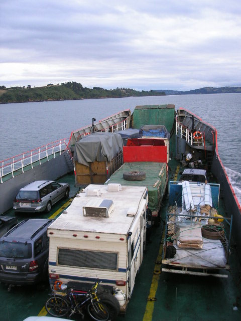  |
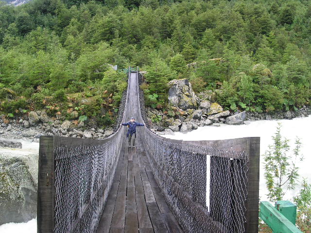
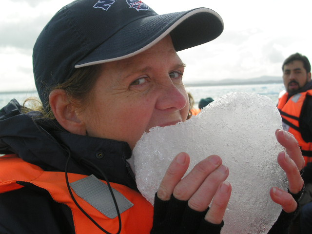
Cindy easing down the slippery ramp Cindy nestled in (uh, the |
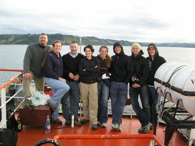  |
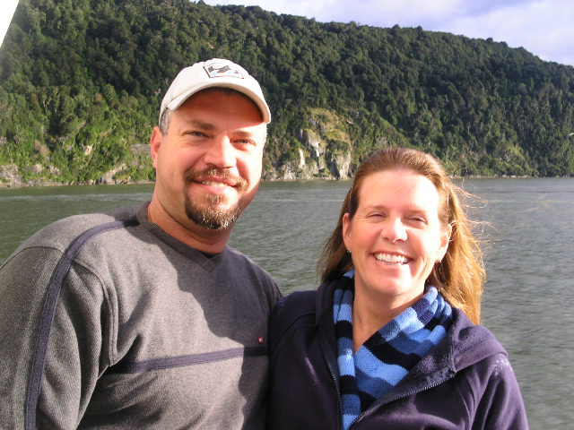
The Cali-crew: Gerson, Louise, Adam and Valerie (Santa Cruz motorcyclists), Alana, Drew, Seth and Ryan (Dana Point and Tustin thereabouts) Our departure sky |
We had not intended on staying in Chaiten; however, we still had a gremlin in Cindy's carburetor and we found a worthwhile mechanic to clean the carburetor and replace the fuel filter. We suspect that leaving Cindy parked for six months was not a good thing for the gasoline and the sedimentary deposits have mucked up the fuel system. Fortunately enough, the mechanic took a shine to us and let us stay in his shop with full privileges to his home (IE: hot shower - yipppeeee). Needless to say, we joked with the mechanic that he was now a "camping mechanic" and we paid for our night's stay.
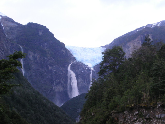
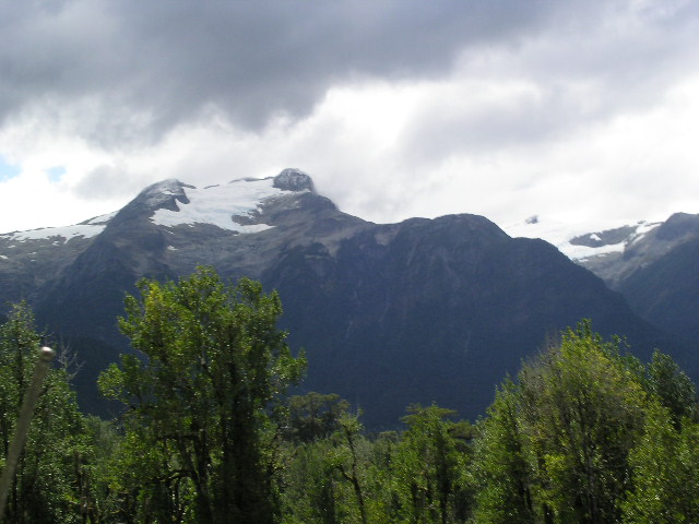
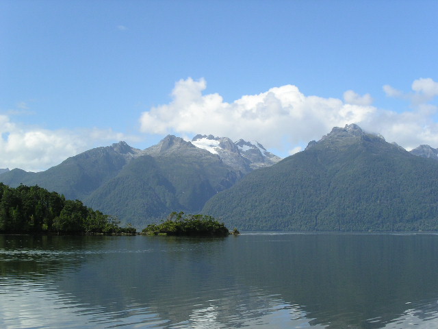
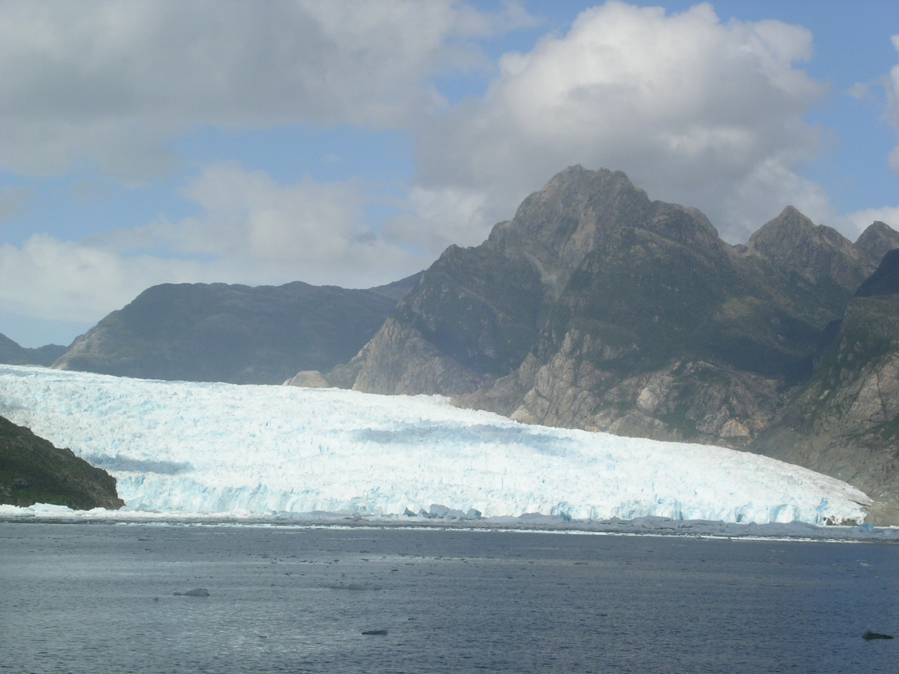
Under deluging skies, we left Chaiten and headed south for camping somewhere along the Carretera Austral, a barely two-car wide rock/dirt road that made certain that we acknowledged every muscle and bone in our body. Fortunately, it was easy to forget the jostling as the scenery was spectacular. Glimpses of bold rainbows were caught fleeting between the trees and we rounded one corner to be awed by the aquamarine translucent blue (hanging) Yelcho Glacier.
  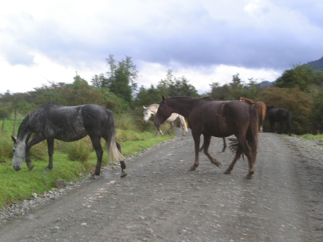 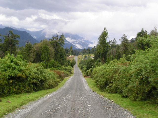 |
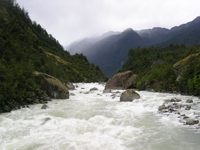
They should call this area the land of 10,000 waterfalls. Everywhere we looked, were scores of waterfalls. Beautiful mountains Sharing the road with others (Chile has some of the most beautiful horses) The Carretera Austral - breathtaking and bone jarring |
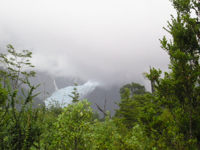  |
Yelcho Glacier. The aquamarine blue glowed in the sunlight - but just at I went to take the picture, the clouds returned. We decided to let the
rain-swollen |
And seeing as we are now in Patagonia proper, here is a touch on the history of the area:
Patagonia
The region of Patagonia includes the austral portion of the South American template zone, which begins at the mouth of the Maule River, in Region VII (Chile has Regions I-XIV) and extends to Cape Horn, south of Tierra del Fuego (Argentina). The latitude embraces 48° - 55° degrees which is the equivalent of Canada to Alaska with the terrain being similar to this North American-Pacific landmass.
Once this is understood, it must be pointed out that the fiber with which the history of Patagonia has been woven is formed by a vision, an adventurous spirit, and the efforts of all those who participated in the regional colonization process. It has been created with a weave of adversity, of remoteness and of natural challenges; that so many sorrows were inflicted upon those who arrived, from other lands, to discover the treasures that the end of the world could hide.
What would lead people to choose this southern destination? P'haps because those places relating to the beginning or the ending of something always have a singularity and a special attraction and that this place called Patagonia marks the end of the continent that breaks and is submerged in the icy waters of the southern Pacific. Nobody remains indifferent when the great extension of firm land, that for hundreds of kilometers has extended as far as the eye can see, suddenly becomes dozens of islands surrounded by an infinity of canals. Certainly, this scene must have captivated both those who arrived to these lands thousand of years ago as well as 19th century colonizers, much as certainly it continues amazing those who travel today, at the beginnings of the 21st century.
When did the history of this far away region of the world begin? When it began to exist for Europeans, that October 21, 1520, occasion on which it was visited by the Portuguese sailor Fernao de Magalhaes (pronounced "Ma-ga-yeahnce, not the Americanized version, Ma-jell-en), who was sailing the waters under the command of the Spanish crown. Since its discovery was announced, Europe fantasized about these lands, which it was thought were inhabited by fabulous beings and animals. Various Dutch, French, English and Spanish expeditions showed that although these lands were inhabited, there were no traces of legendary beings.
At this time, the presence of human beings in Patagonia is recognized to go back some 11,000 years. It is very probable that at the end of the last ice age there was a slow migration of groups of hunters that came from regions located further to the north and they found in this place an abundance of animals on which to feed themselves.
Human beings who managed to adapt themselves to the rigor of the climate, developed their culture, worshipped the wind and the water and managed to survive the cataclysms that exterminated the Pleistocene fauna. Unfortunately, they did not manage to survive their "civilized" counterparts and, during the 20th century, the last heirs to these primitive cultures disappeared, leaving a mute legacy that now can only be observed in museums and archaeological sites.
History lesson over, now back to the present...
Continuing south on the Carretera Austral, making about 150 km a day (it is
really slow going), we stopped in at Parque Nacional Queulat and found we had
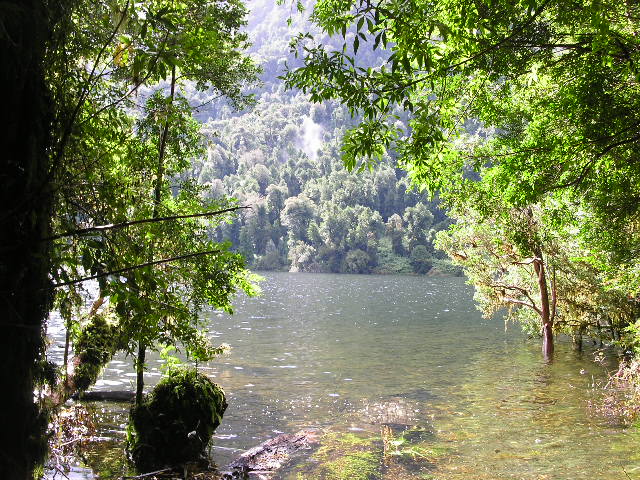
the entire campground to ourselves. A good thing as we found a terrific
site by the edge of Lago Risopatron; a not so good thing as the park personnel
did not turn on the gas to provide the hot showers. Obviously they thought
having the gas turned off and having the gas tank and the gas heating unit
locked up would deter the normal camper from trying to use the shower. Au
contraire, those of us that have become rather talented in removing the hinges
and therefore, bypassing the locks, can easily access the "on" valves. The
hot shower was very welcome after a very soggy, windy day.
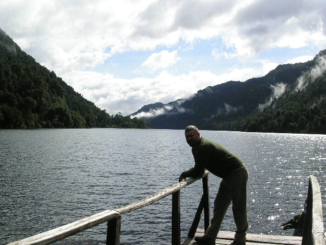  |
Gerson overlooking Lago Risopatron Peeking at the lake |
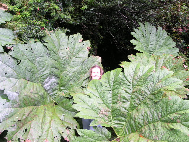 |
Houseplants gone wild! |
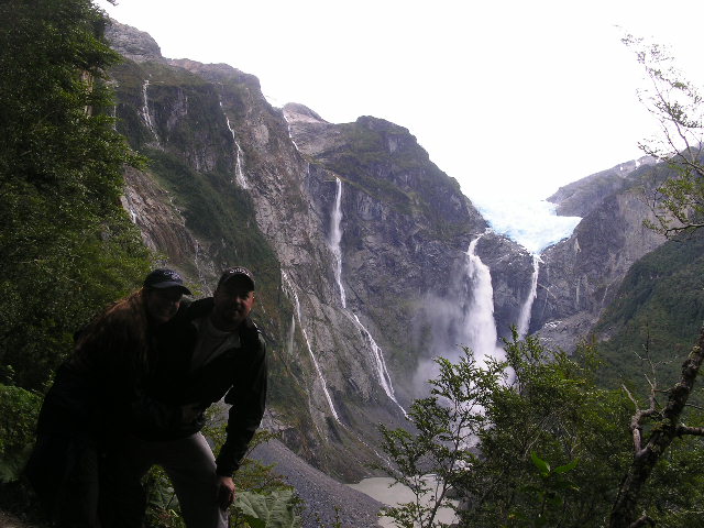
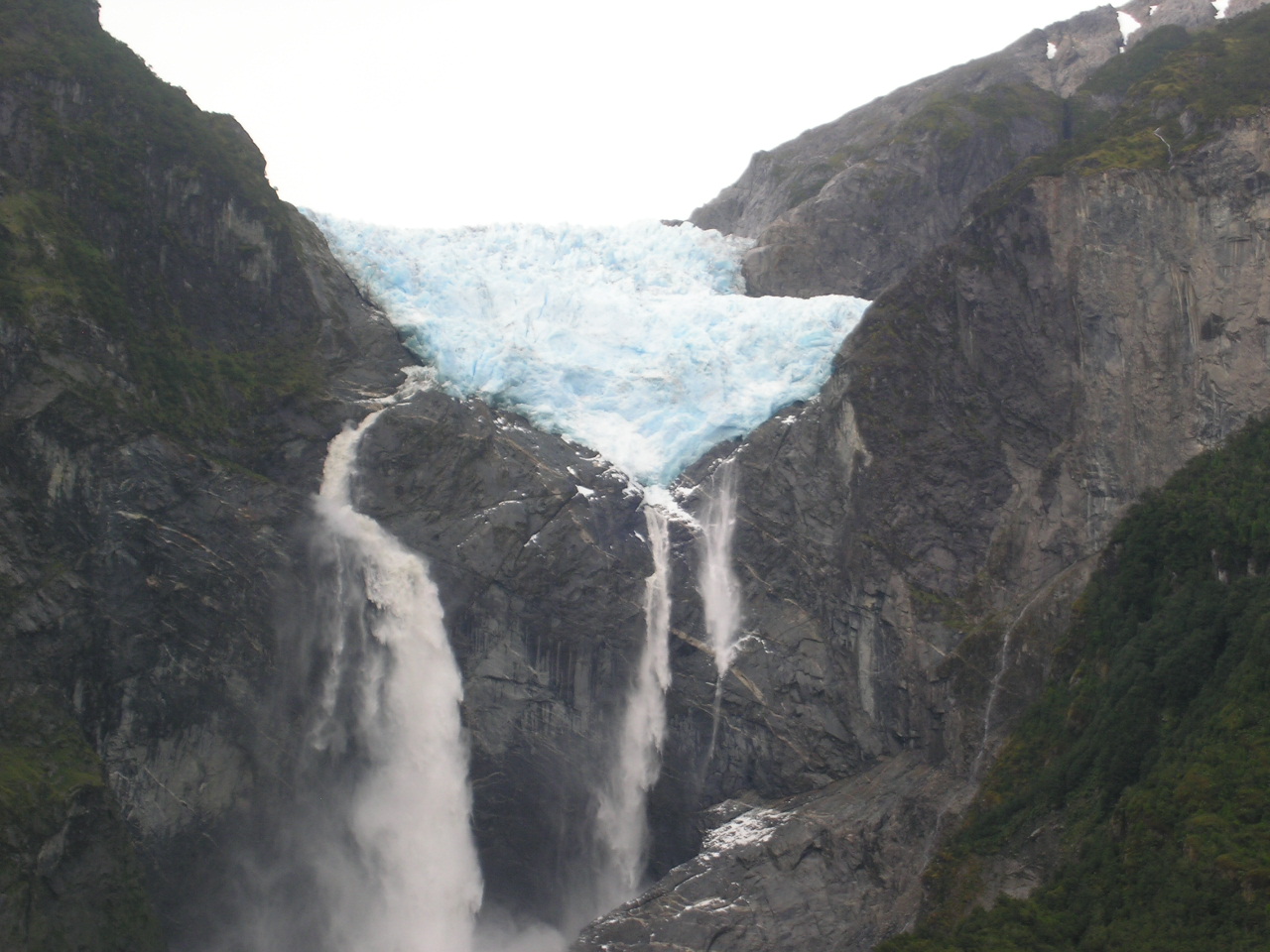
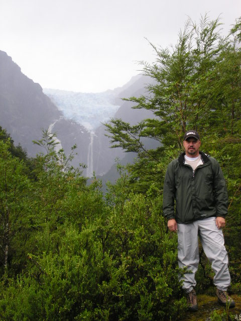
Again, suffering through a day of inundation, we crawled on down to another park that is the base for a trek to the Colgante (hanging) glacier. We camped Cindy and peered through torrential rain-covered windows with disappointment that we could not make the trek to see the glacier. But alas, the rain god Chaac (remember, the Mayan rain god) heard my prayer (obviously the rain god enjoys a few expletives) and the rain came to an abrupt stop. Gerson and I looked at each other and in moments we donned our rain gear and boots and headed up mountain.
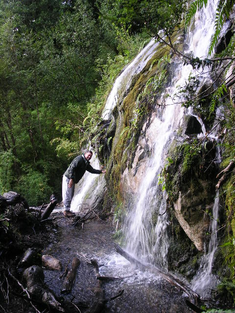
The trek was a little over 3km (2+ miles) and virtually up and over a heavily forested mountain. In a little over an hour, we tramped through small streams, sloshed across bogs, bridged fallen trees, skimmed past waterfalls and crested a steep ridge to be hit square in the face with this view:
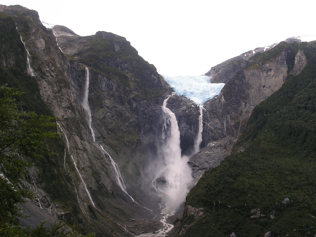 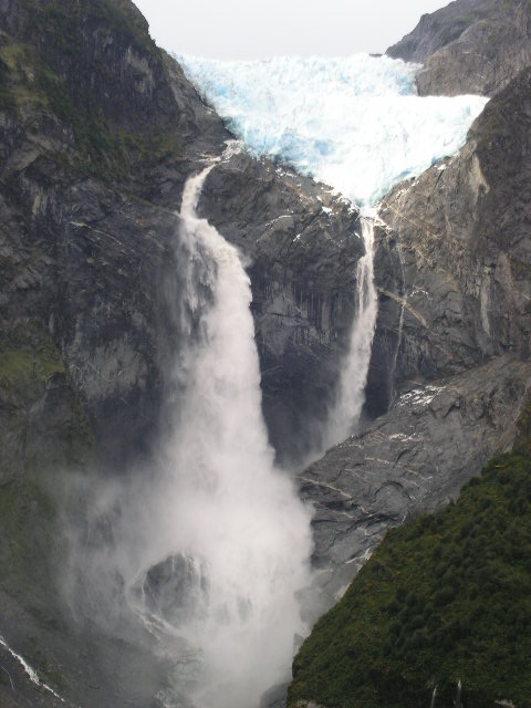  |
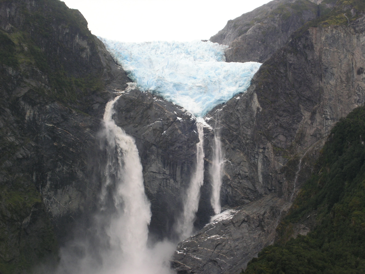
Colgante Glacier in all its glory - the glacier is several hundred feet across
I had to increase the size of my |
   |
The glacier-fed river at sunset The mountain bleeds waterfalls Cool bridge The view at the end of the trail |
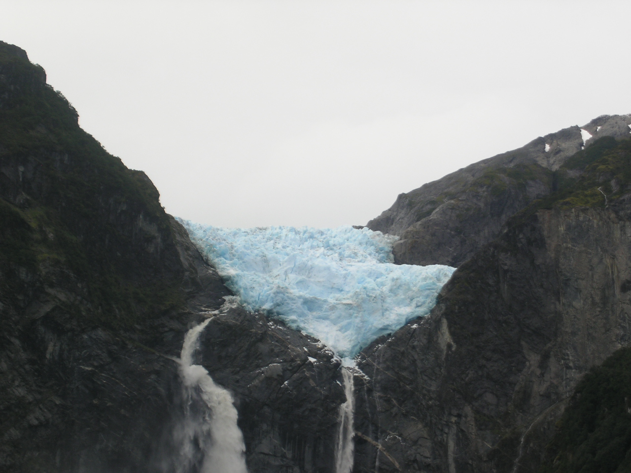
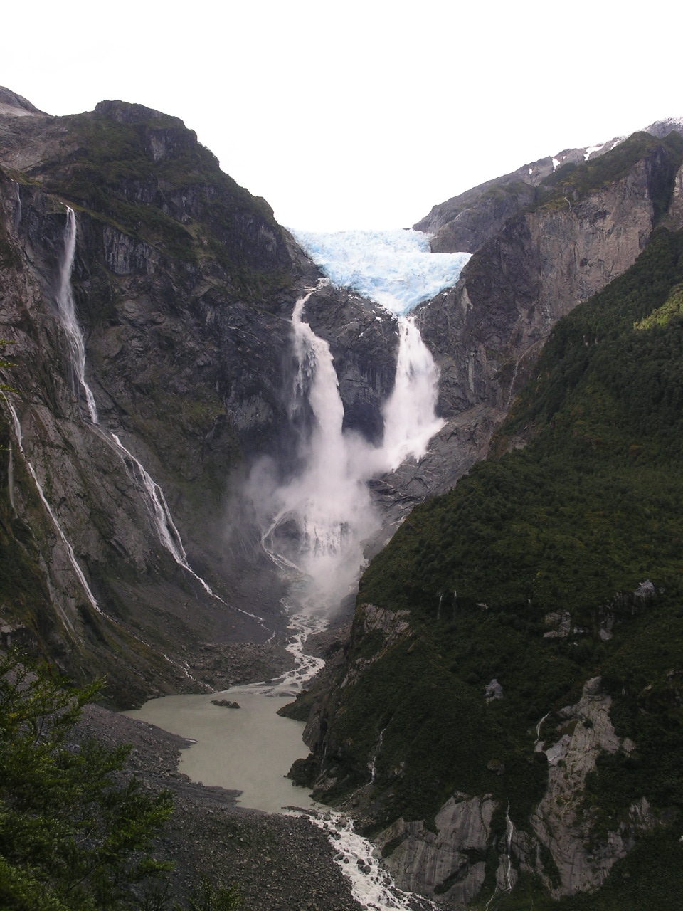
Now, it is one thing to look upon this magnificence of nature and another to witness one of nature's most stunning displays of power, the calving of a glacier. Yes, we not only saw one huge bus-size slab of ice plummet hundreds of feet to crash upon the teeth of the rocks below, we actually got to witness an additional smaller, yet no less remarkable, calving. Seemingly seconds after we saw the glacier break apart, we heard this resounding thunder-like "KABOOM!" and the roar of the water being flushed out of the waterfall's pond. Truly a hair-raising experience.
 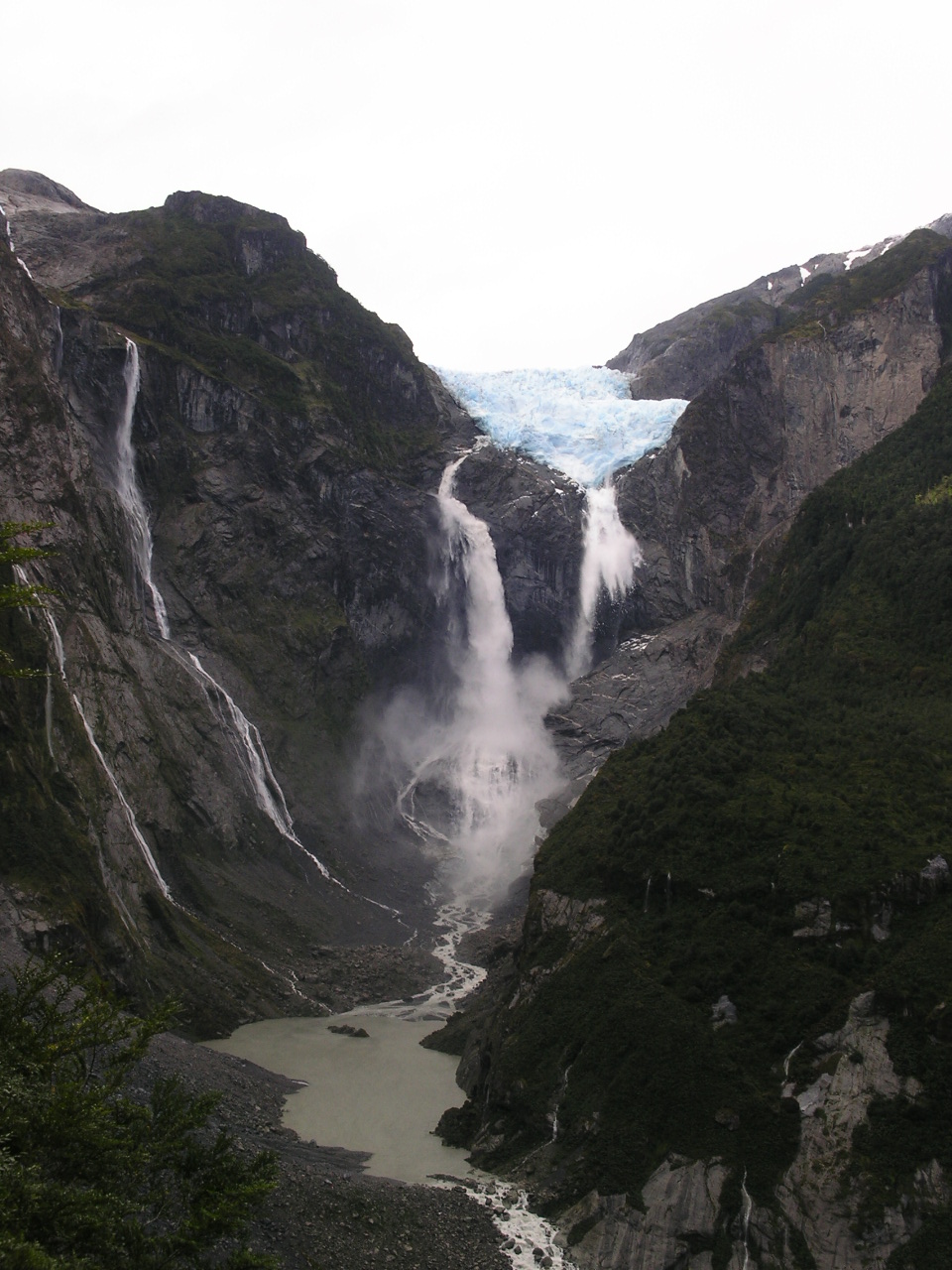   |
We first heard a cracking sound and this was followed by a long, low growl. Within a couple of minutes, we saw the break of the ice. |
  |
This is the smaller calving that occurred just minutes after the other one |
As night was coming upon us, we had to leave our perch and make our way back down the trail. As we made our way down, we heard the now recognizable "KABOOM!" and we could only wonder at what part of the glacier dropped to the depths below.
   |
Our trek to view the glacier. Quite beautiful |
  |
One last look from another mirador (lookout) The glacier-fed Rio Ventisquero. |
Later, as we were sitting in the warmth of Cindy, we heard a knock at our door and lo and behold, there were the four travelers from Southern California. They hired a driver to bring them to this park and had just arrived. It was great to see their smiles once again.
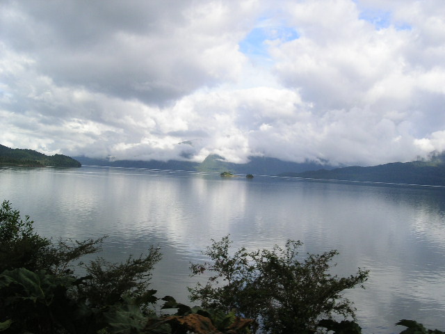
Making our way to Cohaique entailed a long drive for a short distance, up a very steep hill, down the other side, only to have to cross a section of road only open a few hours of the day. We had anxiously anticipated this part of the carretera austral and the 8km that took us over an hour to pass lived up to our expectations. Due to the deep trenches gouged into the road by the huge construction trucks, and due to the several road washouts that were being repaired, poor Cindy drug her dainty bottom several times. We fared well with only our outside step bent, a broken sway bar plate (the same part we have broken now eight times...we had lots of extras made), and sand/dirt caked underneath. A few hours in a dry, grassy campground and we were good to go.
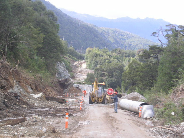  |
Why it took us over an hour to go 8km or about 6 miles. Our knuckles are still white from this section of road. A more tame Carretera Austral |
   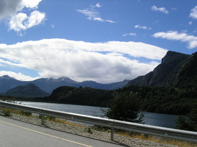 |
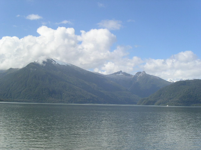
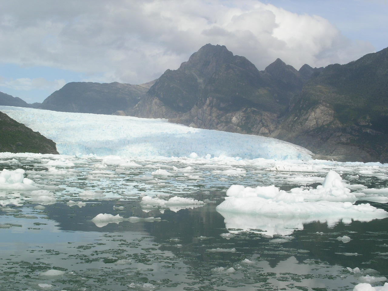
Another glacier view
Different fjords (yes, that is the ocean) |
Thought you had enough glacier pictures eh? Well, think naught...
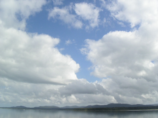
We took a fantastic day-trip to the San Rafael glacier via a luxurious catamaran. Besides serving us four meals during the 15 hour trip, we were treated to an open bar and drinks with 1000-year old ice harvested from the cold waters surrounding the glacier. The boat left from a small port town called Chacabuco and we were fortunate to journey on one of the 65 days that it did not rain (IE: it rains 300 days a year).
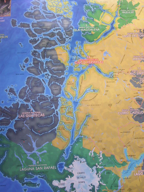  |
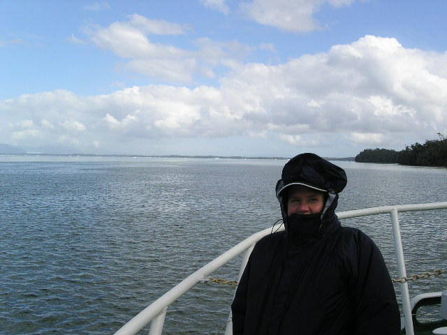
Our trip: We started from Chacabuco (see Puerto Aysen, to the far right of Cinco Hermanas) and ended in the Laguna San Rafael - about 230km We enjoyed the trip
immensely |
    |
Just boring pictures of the mountains and glacier-wrapped peaks |
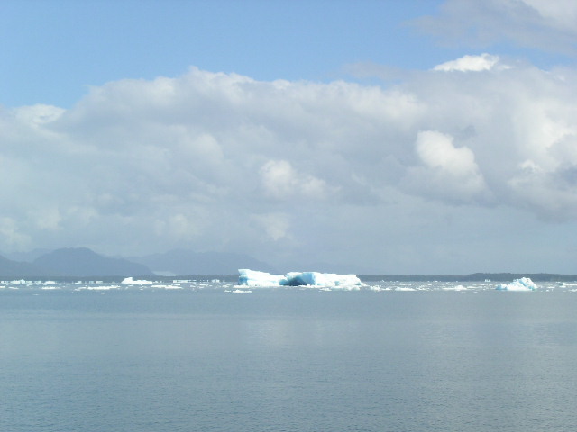
The landscape was truly astounding as seemingly every other jagged peak was wrapped by a glacier and the turquoise-white ice was in stark contrast to the deep green of the forest below. Needless to say, my camera got a workout.
 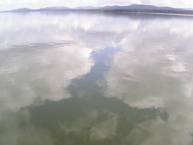 |
Which is up and which is down? A perfect day for reflection |
    |
More beautiful views
and, I may have looked funny, |
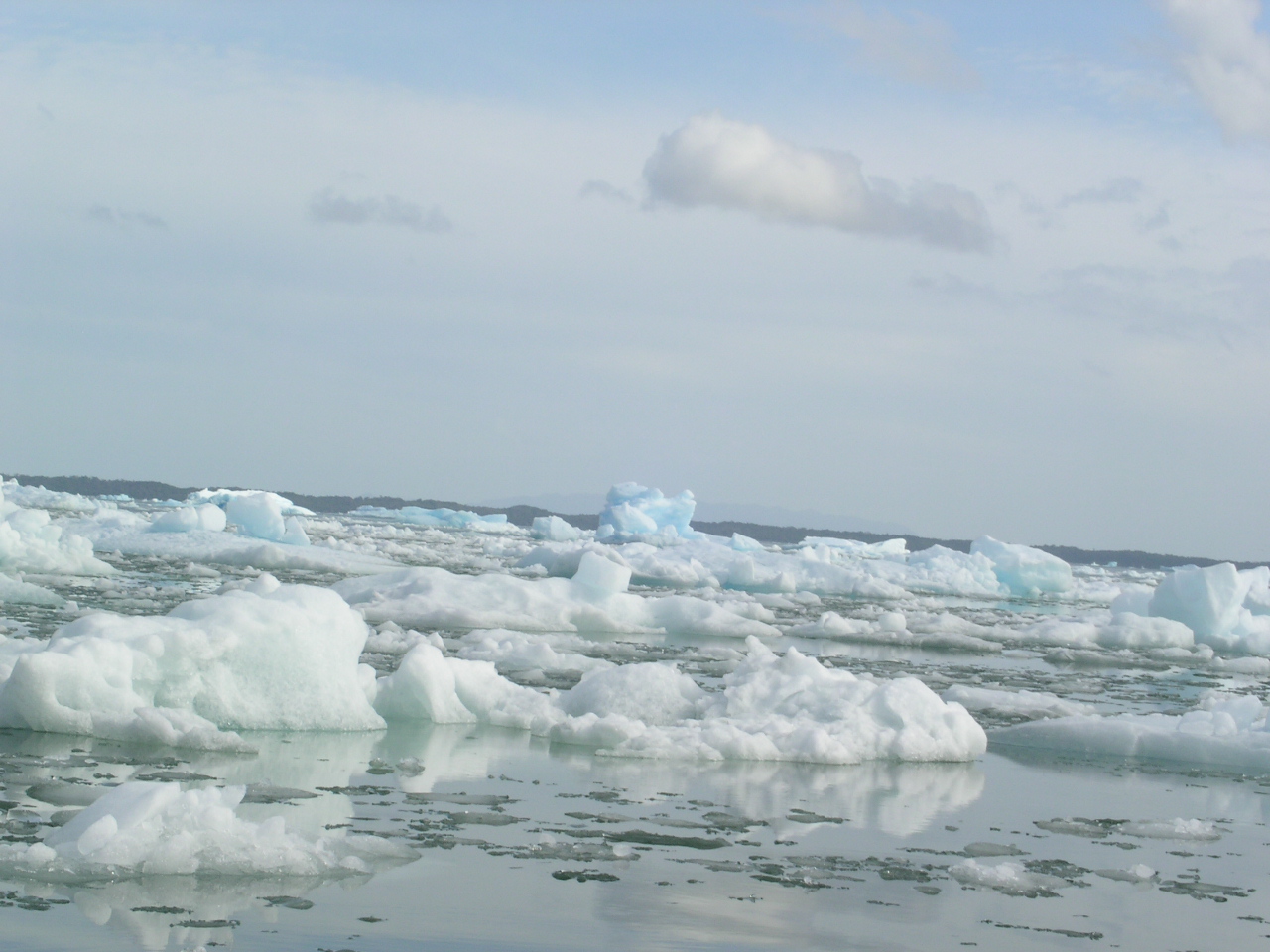
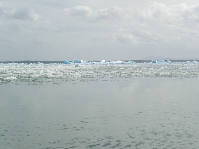
The trip to the glacier took over five hours and we were allowed ample time to ease through the ice bergs on zodiacs. Unfortunately, there was an unusually large amount of calving activity lately and thus the water surrounding the glacier was filled with sheets and boulders of ice. This abundance of ice prevented our getting close to the glacier wall; however, it did give us some pause when you look at the size of the bergs that you see above the water and how many more times that size the berg is under the water.
 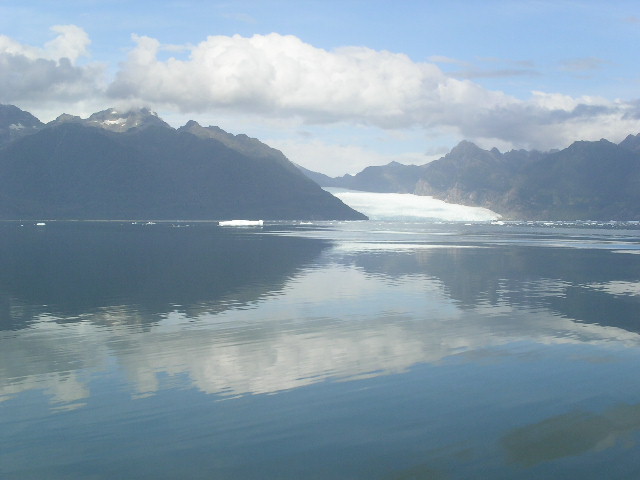   |
The San Rafael Glacier that ends into the Laguna San Rafael A picture perfect, |
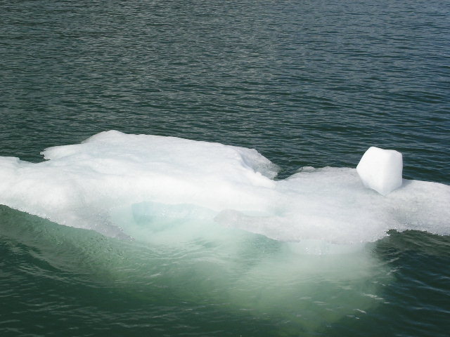   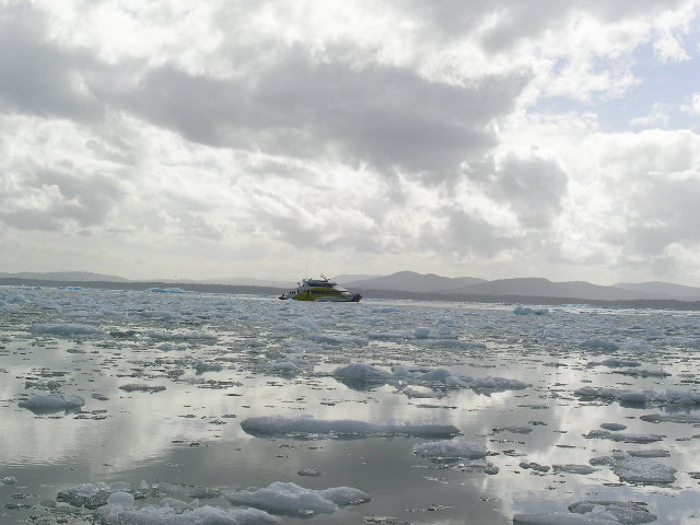 |
The ice berg was about 20 feet across with about 8 feet under water Notice the blue of the ice Our catamaran |
After our journey into the ice field, we enjoyed our unique beverages and regaled in our stories of our adventure. We met people from all over the world that had all come to this point and time, somewhere near the end of the world.
    |
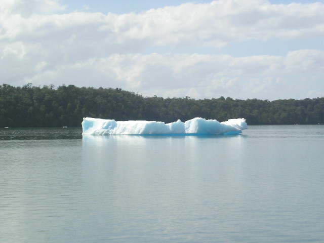
Some more of those translucent blue-bergs I thought I would find
out |
 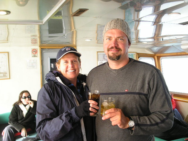 |
Harvesting the ice Enjoying our aged spirits
|
Now, if you have not had enough of the fjord scenery, here is a little 30-second video that gives you a glimpse of what we endured for 15 hours. Yes, we suffered greatly.
|
|
Some of your web browsers or computers may not play this video. I am trying this for the first time... Many glaciers can be seen atop the mountains. Sorry for the boat and wind noise |
We arrived rather late to Chacabuco so we just slept in Cindy in the parking lot of where we arranged our boat trip. We were quite exhausted, but in a very good way.
Home Page South America Diary Index Previous Diary page SA Diary page 30