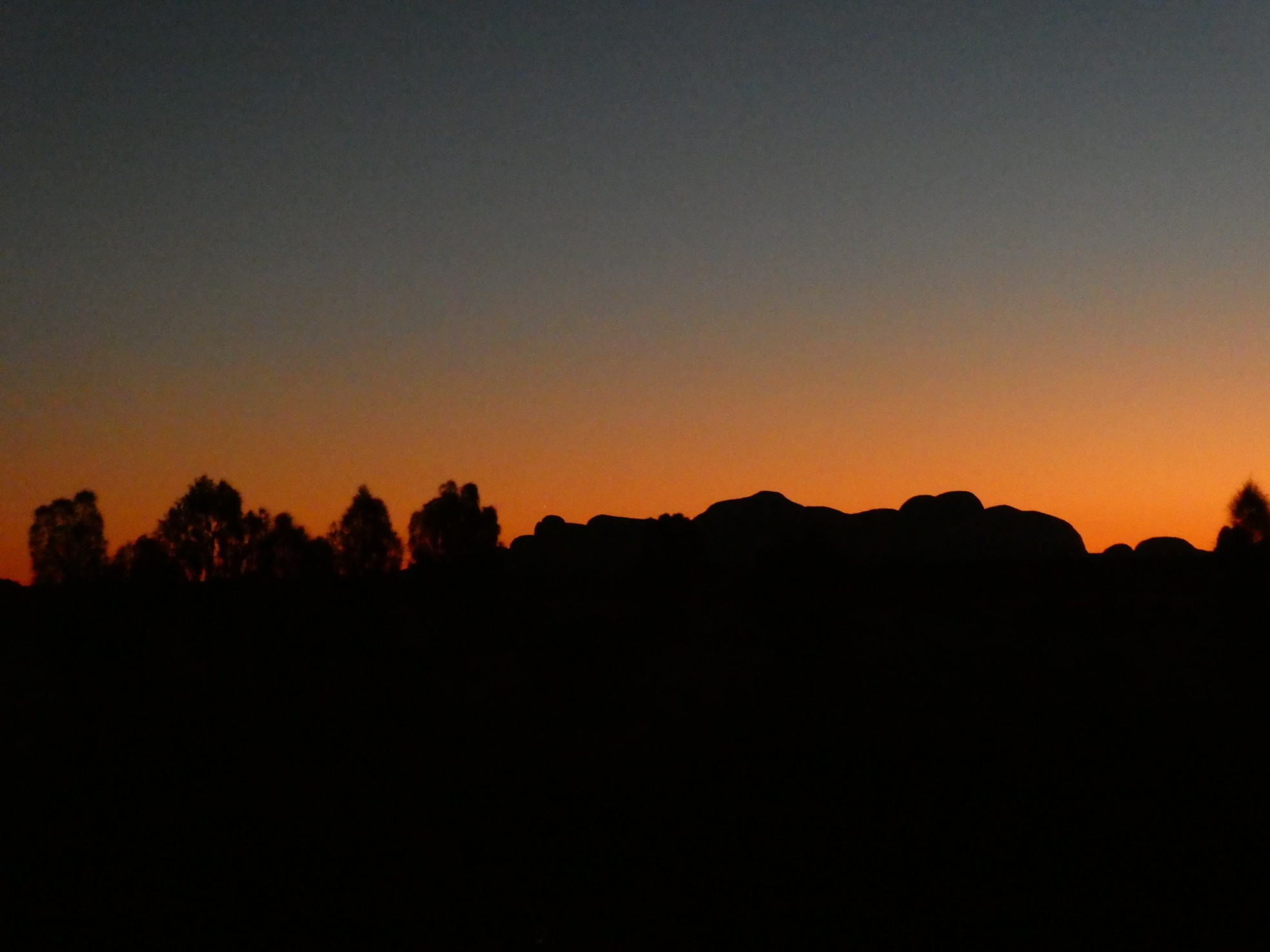
 Devil's Marbles

 We passed through the iconic Alice Springs
DIARY/PHOTO JOURNAL - Page 12
Week 17 - July 09, 2018 - July 15, 2018
This week was all about Uluru (Ayers Rock). About getting there (three long driving days) and several days spent around this marvelous monolith. Of course, a trip to Uluru would not be complete without passing through Alice Springs and enjoying a few other notable areas nearby.
Devil's Marbles
We passed through the iconic Alice Springs
 Cinderoo looking good
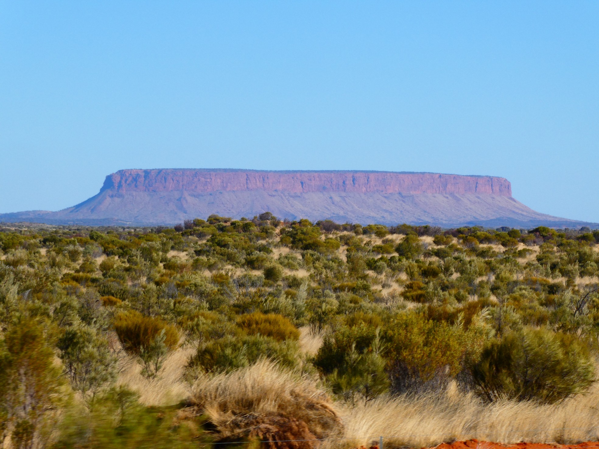
 Mount Conner in the distance
Although we were focusing on our time around and on Uluru, we took the time on the first afternoon for a brief hike along the Olgas, or better known as Kata Tjuta. This area has deep cultural significance to the 'traditional owners' (the Pitjantjatjara and Yankuntjatjara Aboriginal peoples or as they refer to themselves, Anangu) and they officially own the National Park. The rock formations reminded us of the Bungle Bungles, just in an earlier evolutionary form.
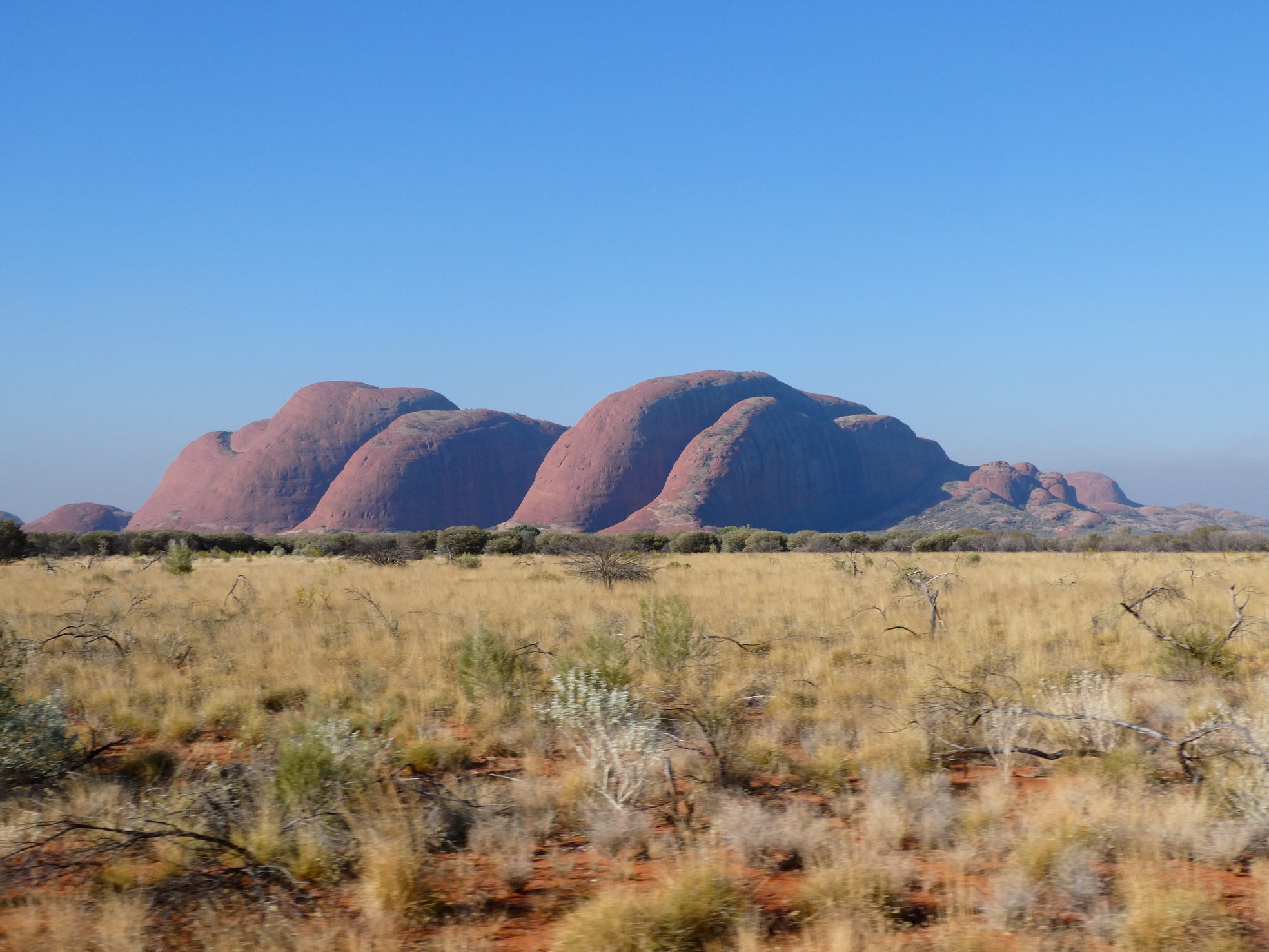
![]() Kata Tjuta with Uluru on the far right
Kata Tjuta with Uluru on the far right
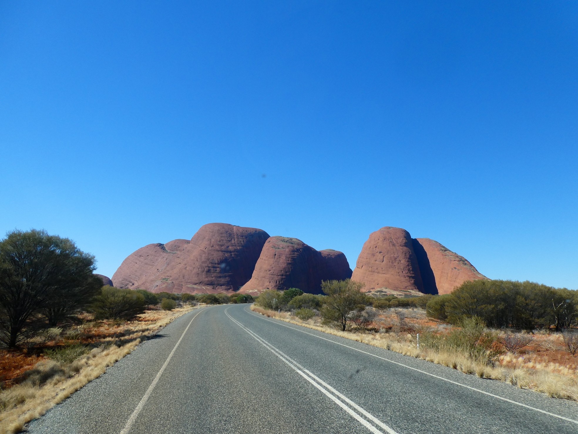
 Kata Tjuta, not your normal rocks
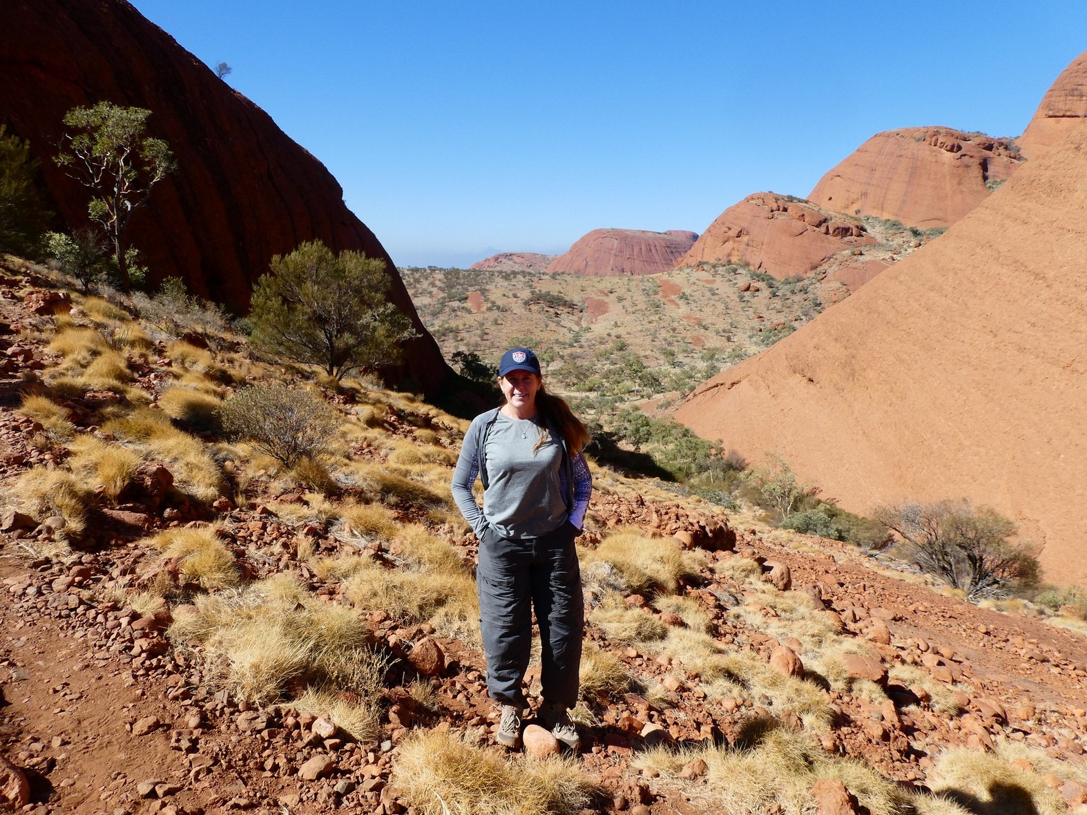
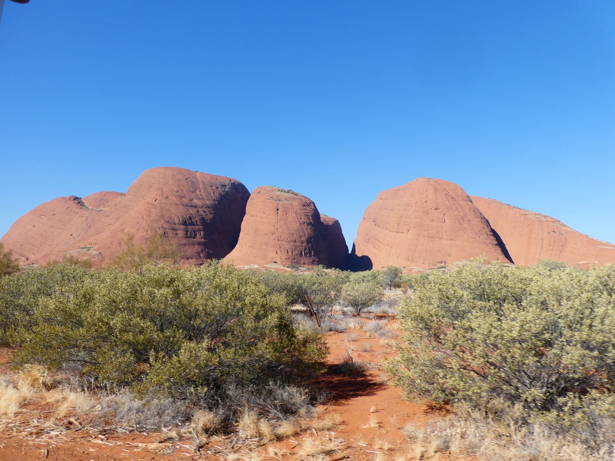
 Hike between the formations and view over 'backside' and out to the 'front' -
Valley of the Winds
Hike between the formations and view over 'backside' and out to the 'front' -
Valley of the Winds
Kata Tjuta was a nice way to introduce ourselves to the area and to get the 'feel' of this place that we both have heard and read so much of throughout our lives.
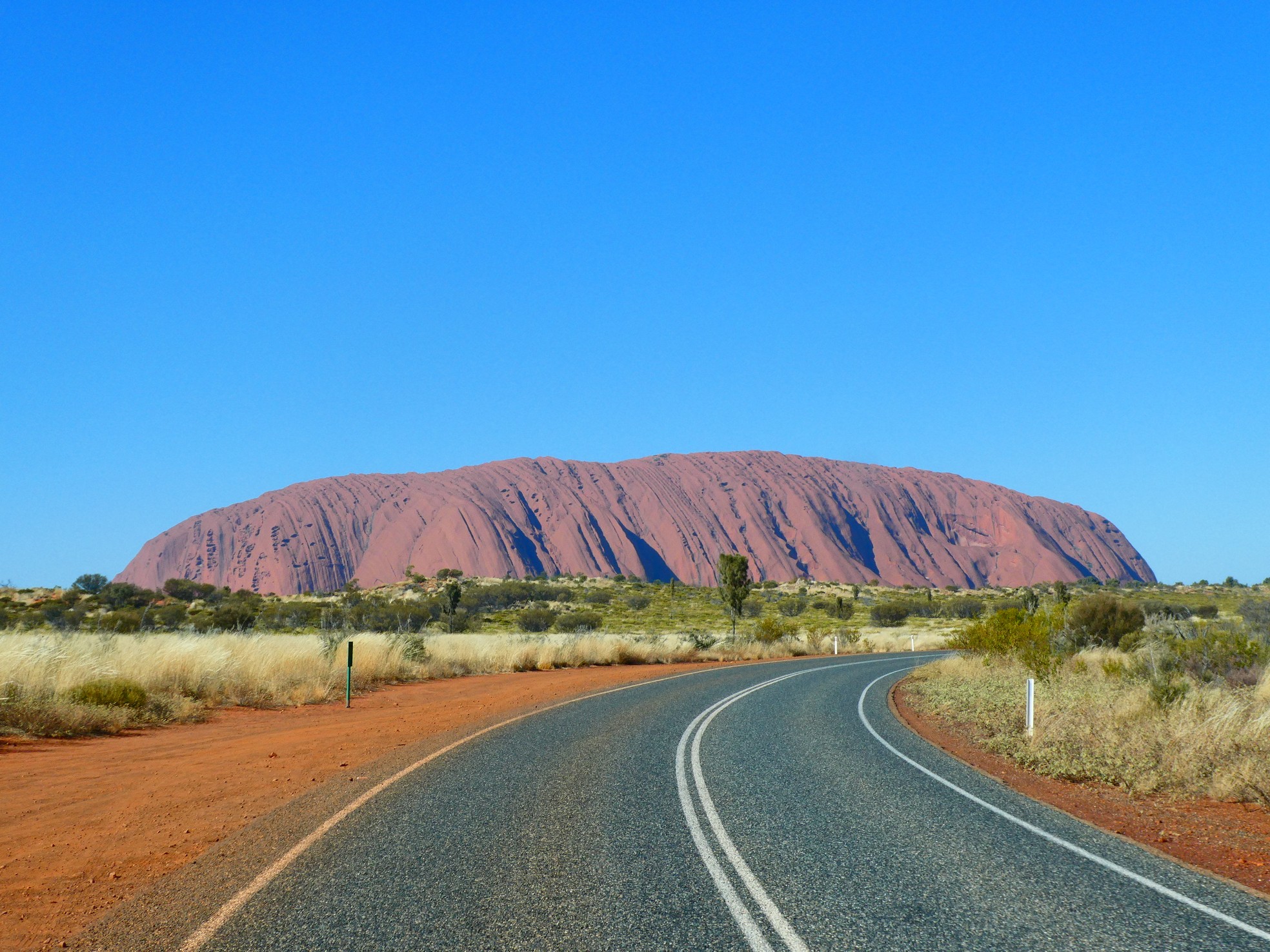
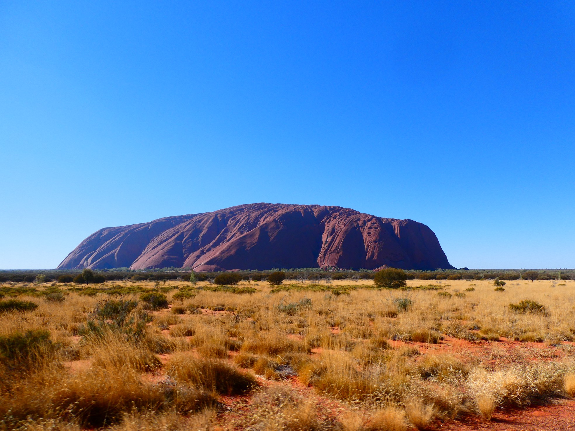
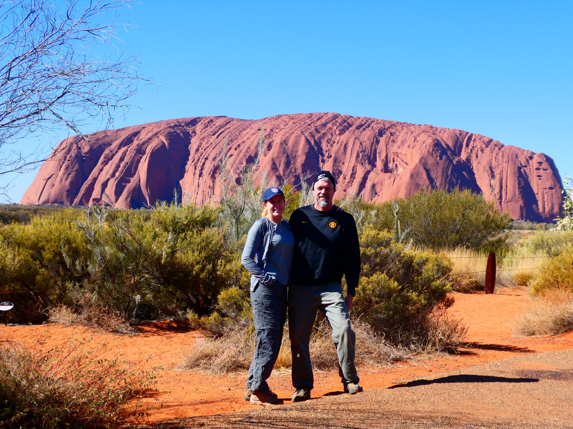
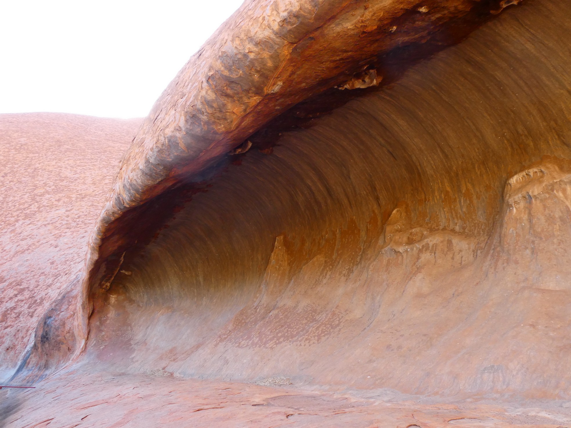
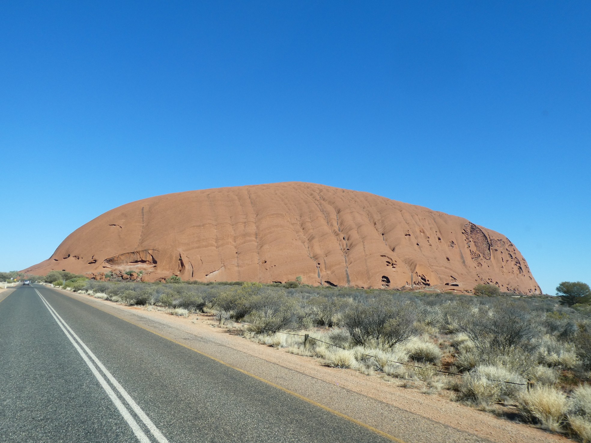
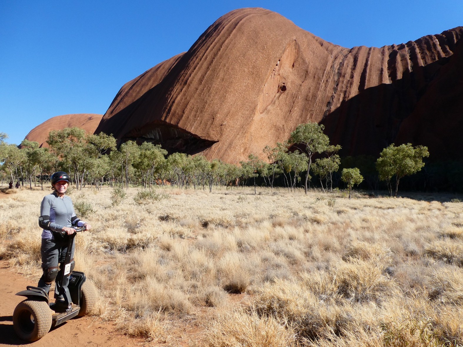
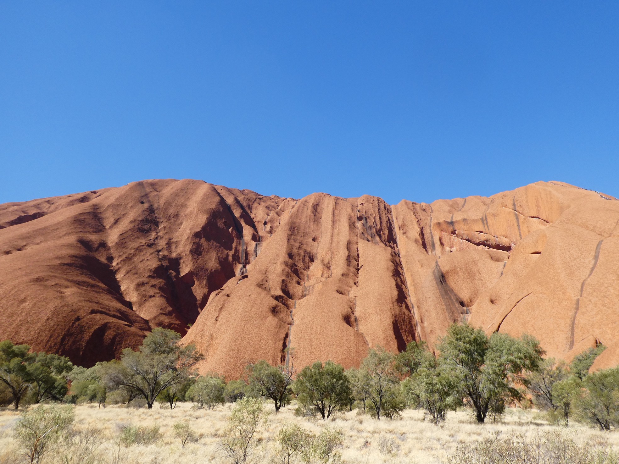
And then, there was Uluru. At 3.6km long (2.2 miles) and 348m high (1141ft), this massive monolith is believed to be showing, above ground, only 1/3 of its bulk. For us, the most remarkable and awe inspiring features of Uluru are the numerous waves and canyons etched in Uluru's walls and not to mention, the changes of moods and colors of the rock itself.

 These were taken on our way to Kata Tjuta.

 Even at different angles, the north-west and west sides had different shades of
colors.
Even at different angles, the north-west and west sides had different shades of
colors.
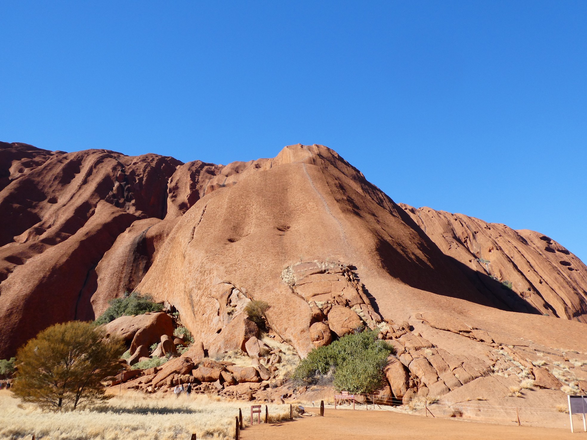
We arrived at Uluru with the intention of climbing to the top yet unfortunately, the winds were persistent and too much for a safe climb (as determined by a Ranger). This gave us the time to venture around Uluru while keeping an eye on the trailhead of the climb.
One thing that should be mentioned here is that the climb of Uluru will be closed in October 2019. The traditional owners, the Anangu, look upon Uluru as a sacred place and no longer want to have people climbing over their place of reverence. The climb's path was a route taken by the male Mala ancestors and has great spiritual significance. We discussed our want to climb Uluru and considered all we heard and read about its sacred designation and we chose to climb because we felt that with all that we had been told, it still struck us as a bit odd that the owners wanted to wait until an anniversary date (when they were given the National Park) to close the climb. We felt that if the rock was as sacred and as important as we were told, shouldn't the climb be closed as soon as they were given permission to do so?
 Gerson in front of the climb and closed because of wind
 Beginning of the Mala Walk
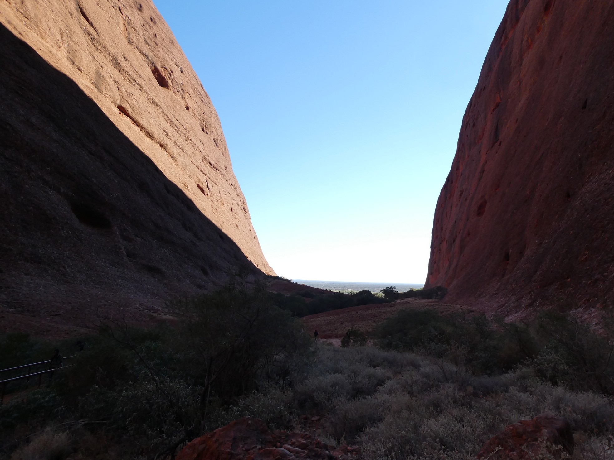
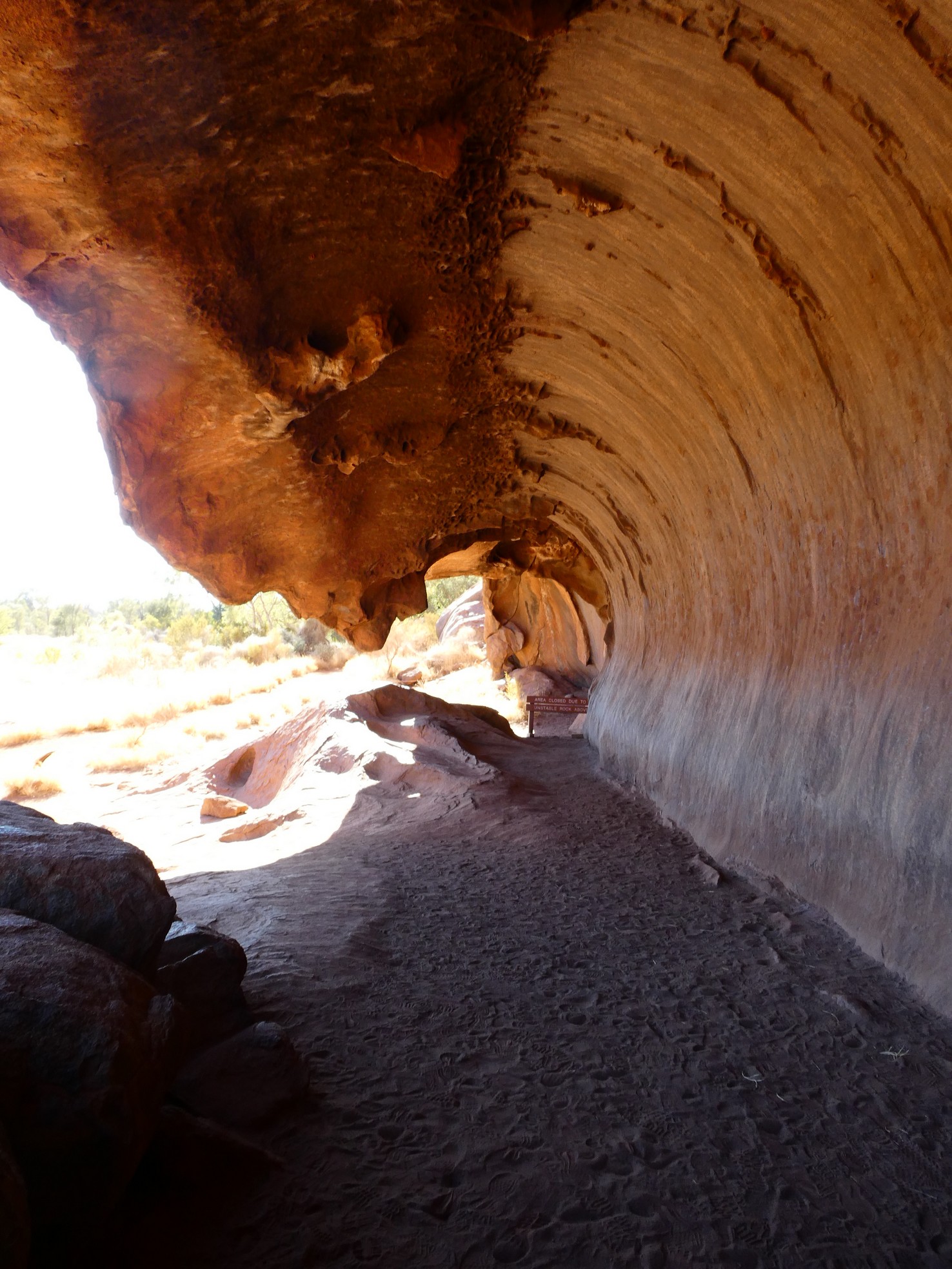
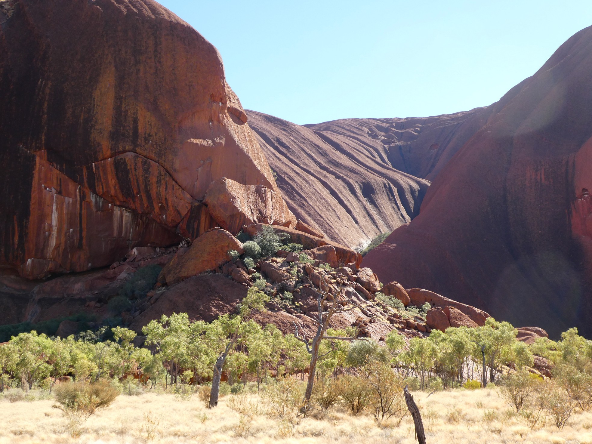
With the Uluru climb on hold, we chose to take the Mala
Walk along the base of the rock. The walk consisted of views of rock art,
a men's cave, a women's cave (as the men and women were separated) and various
other remarkable areas of use by the indigenous people.
![]()
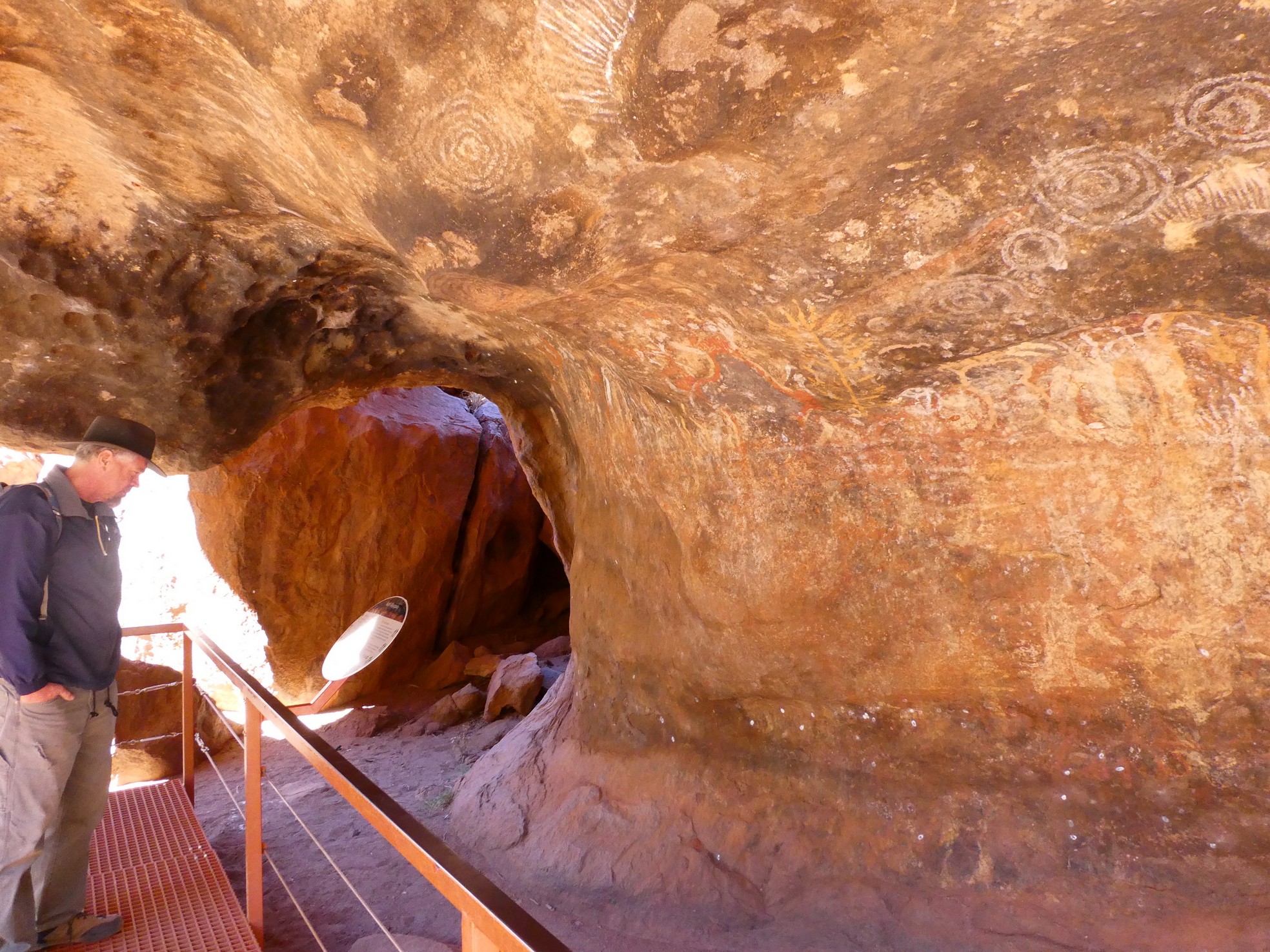
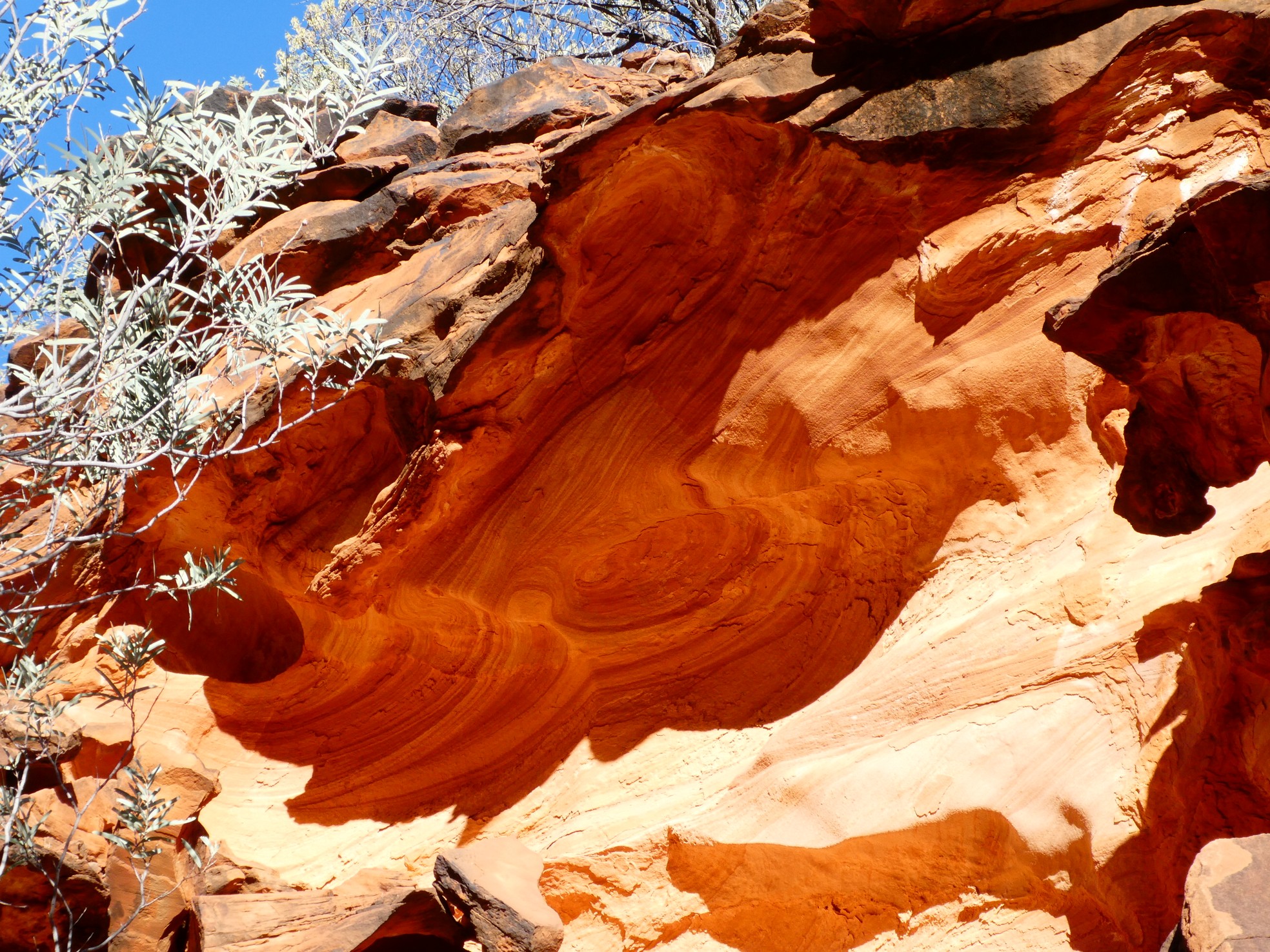
 Beautiful rock art and a 'wave' formation

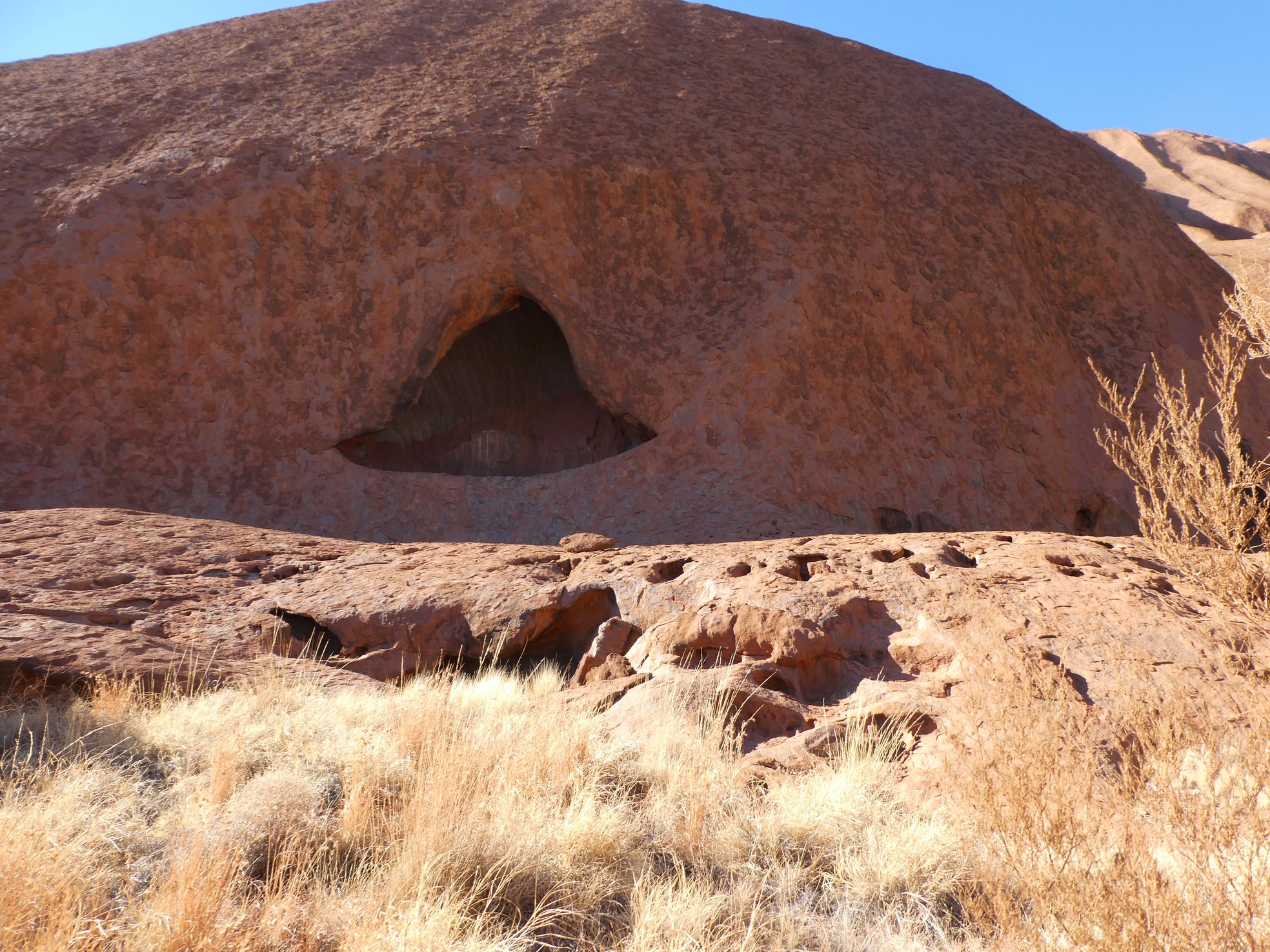
![]() One of the men's caves
One of the men's caves
 The women's cave
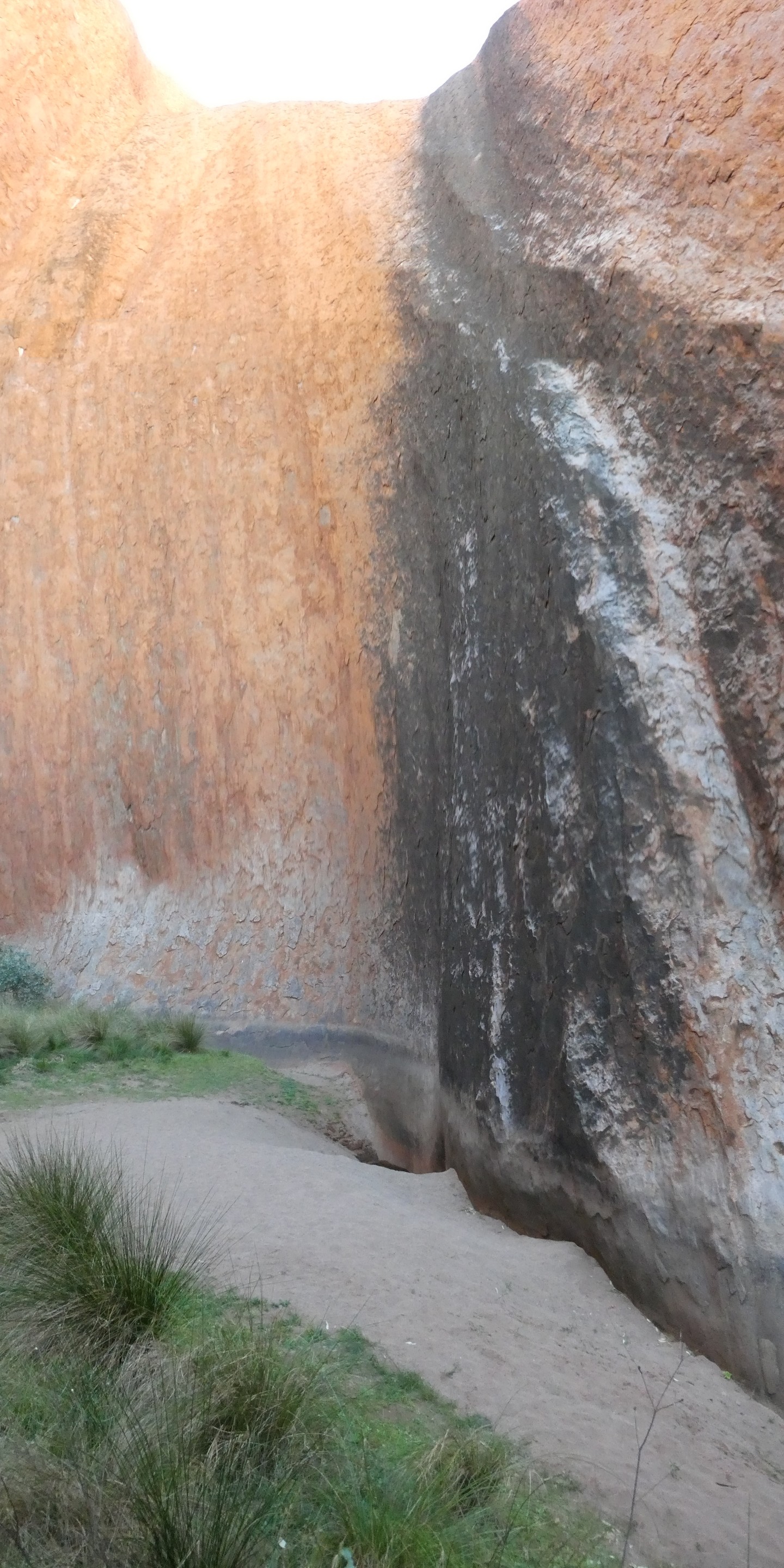
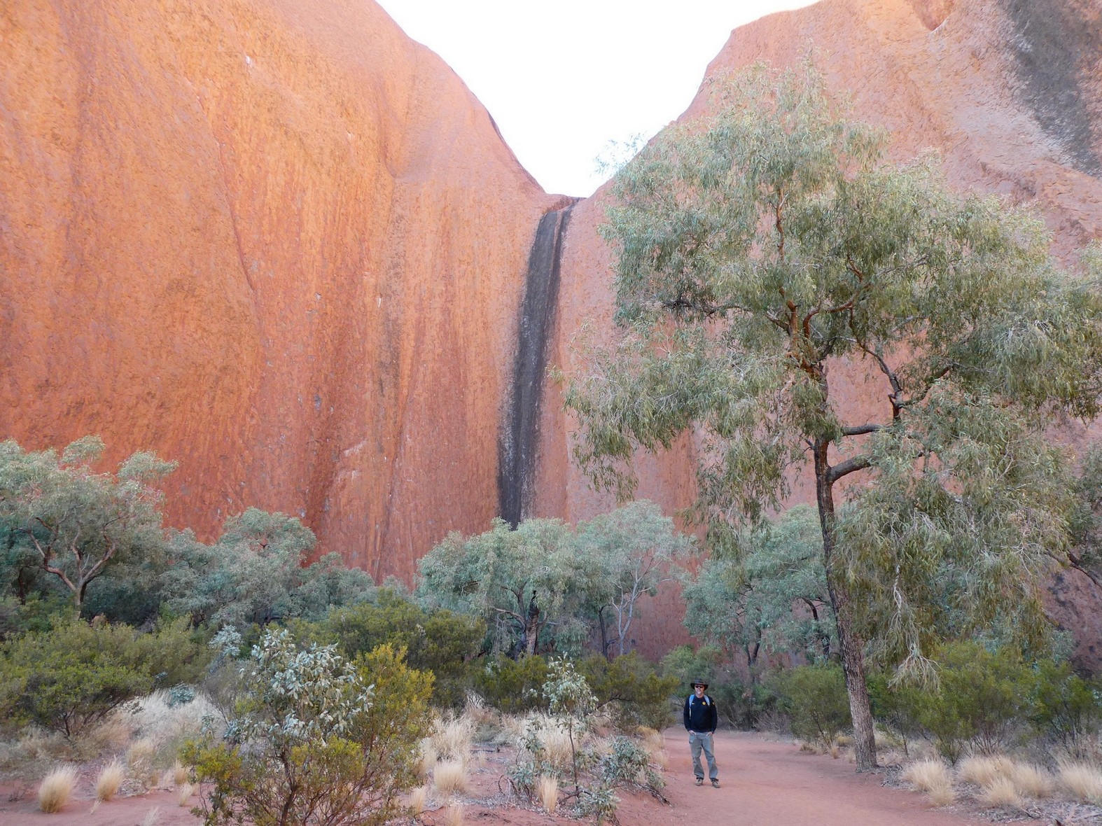
![]() Waterfalls to active water holes
Waterfalls to active water holes
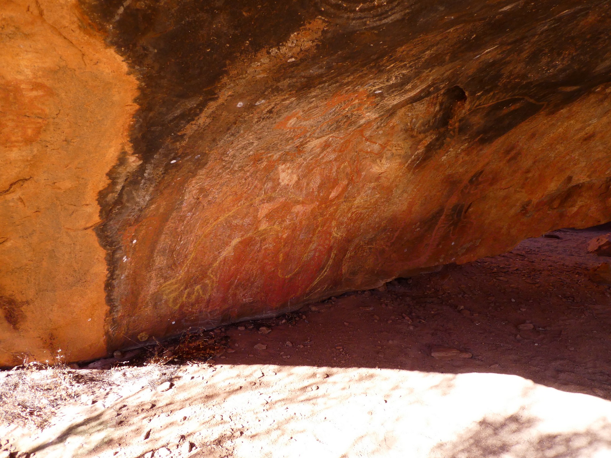 Cave with rock art and char from fire
 The rock formations were beautiful
![]() Uluru's 'west' side with the climb on the far right
Uluru's 'west' side with the climb on the far right
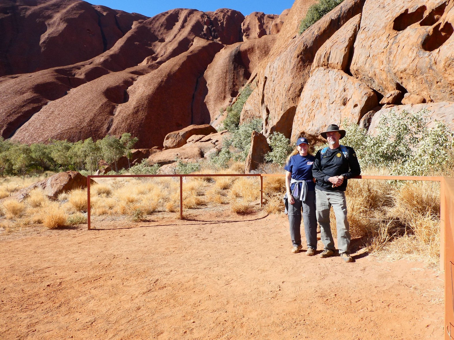
We returned to the base of the climb and were told that it was still closed (as the Ranger would check at 8, 10, 12 and 2 for wind speed) so we decided to take a drive around the base and take the Kuniya Walk to the Mutitjulu waterhole. After which, we stopped into the Cultural Center to view their exhibits and to keep an eye on the Ranger information board for a change in the climb's status.
 Nope, still closed
![]()
 The north(ish) side of Uluru
![]()

![]() The east-southeast side of Uluru
The east-southeast side of Uluru
 View to the Mutitjulu Waterhole
 Rock art near the water hole and another 'heart' rock impression
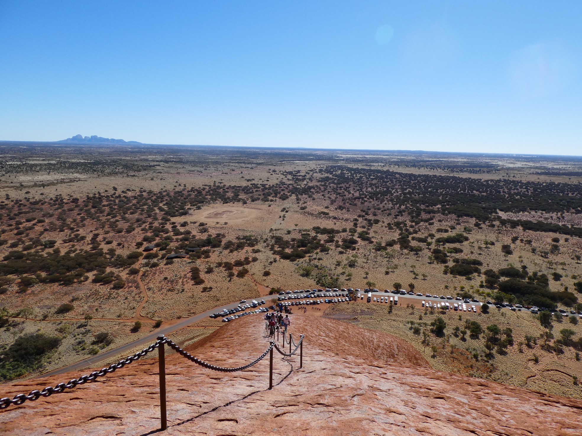
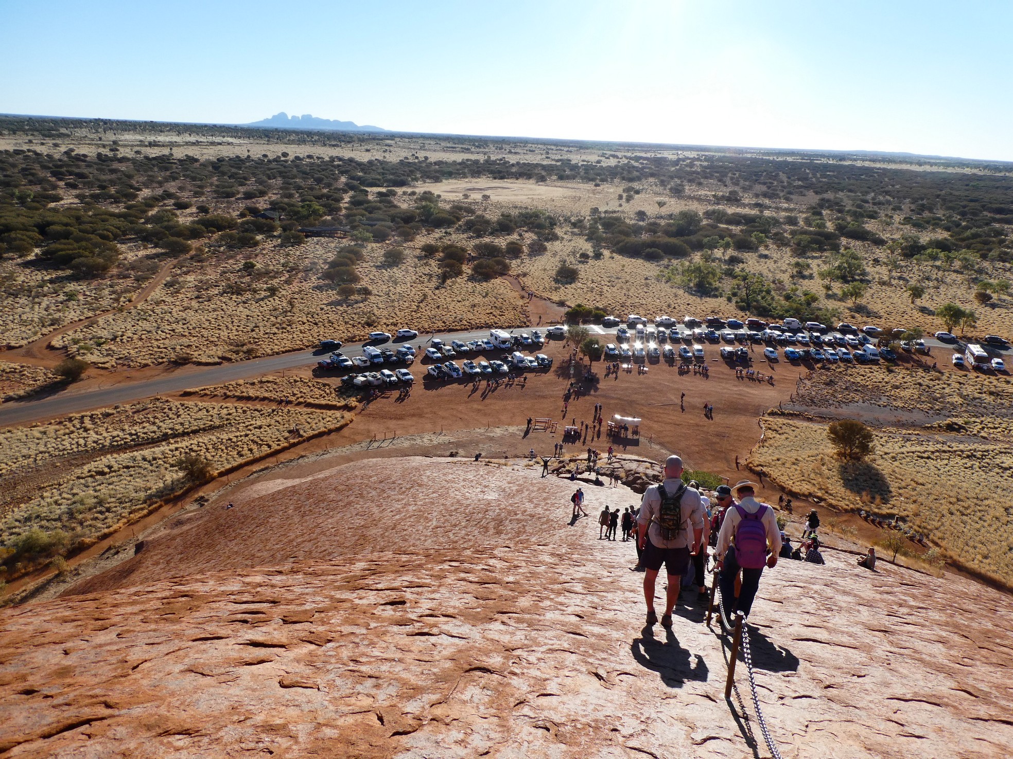
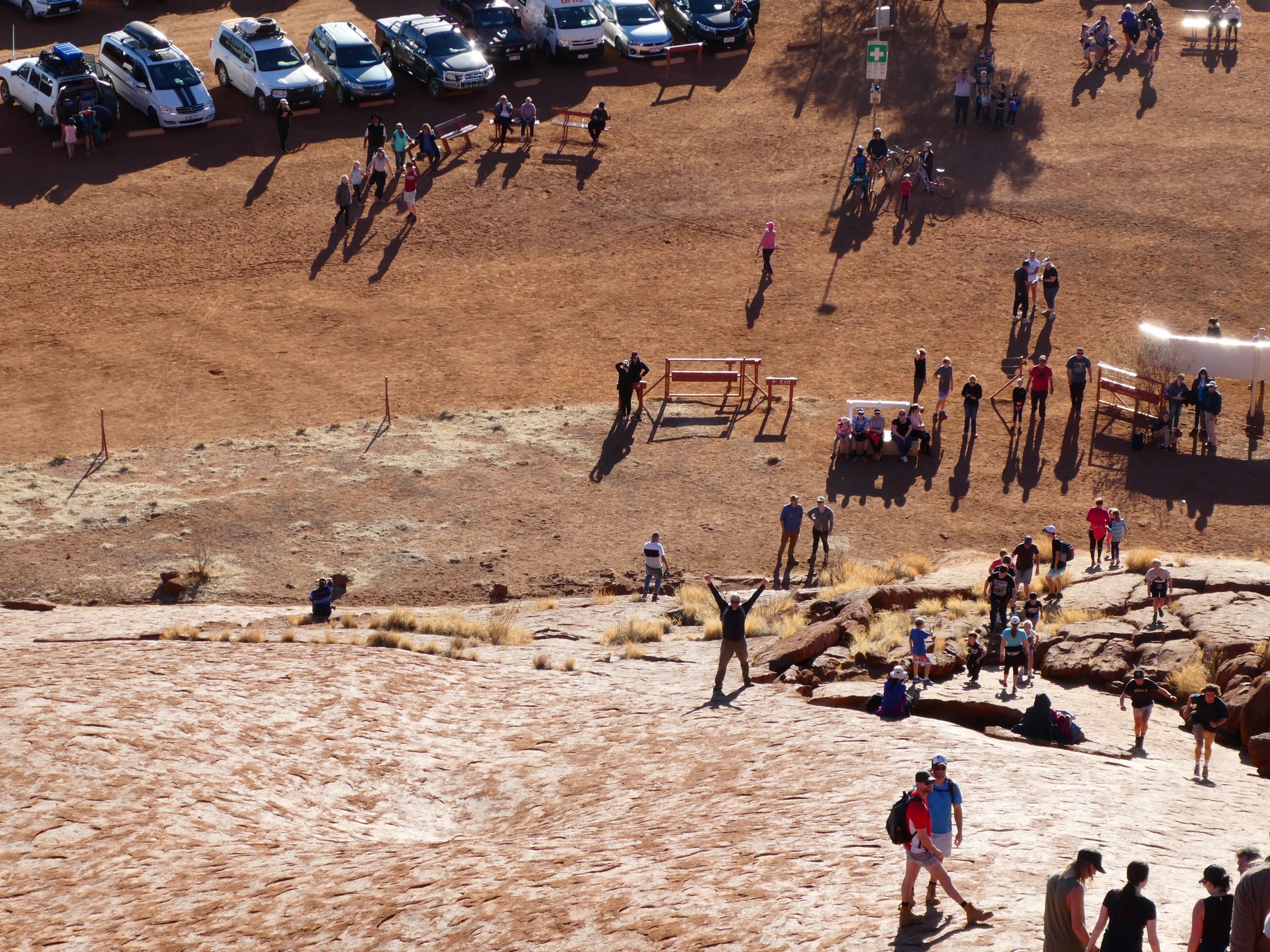
While we were viewing an interesting slideshow about that traditional owners (as they are called), I saw a Ranger approach the notice board with a sign that said 'open' and realized the climb was available. Gerson and I raced out of the center and over to the climb base and as we only had two hours to make the climb (as we had a dinner appointed at 5:00 p.m.), we had no time to waste.

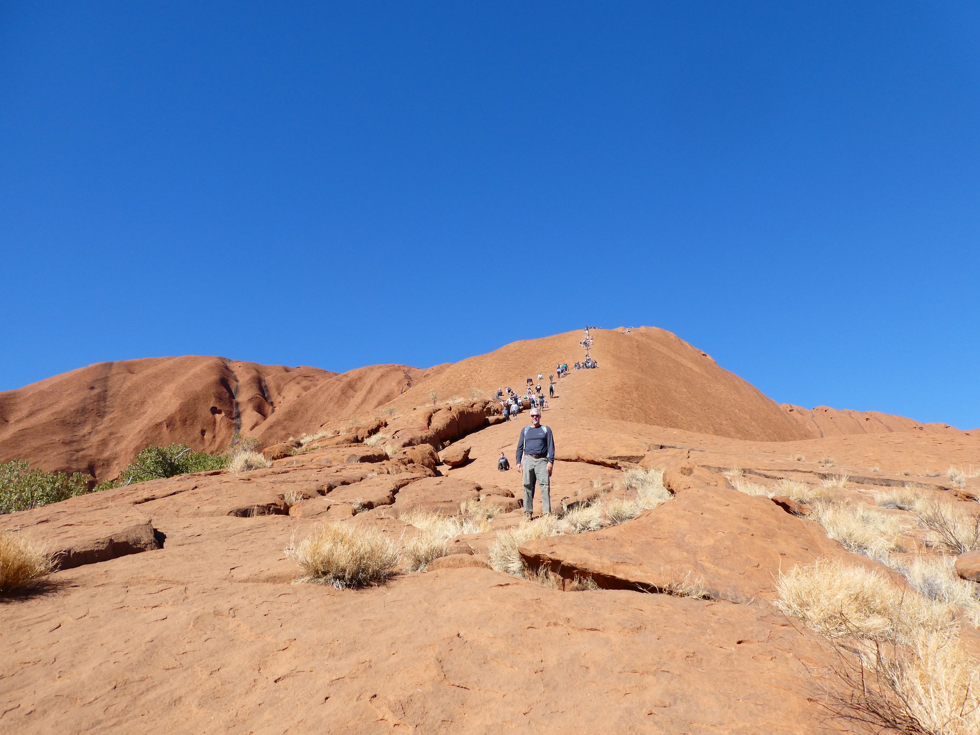
![]() It begins....the Uluru climb
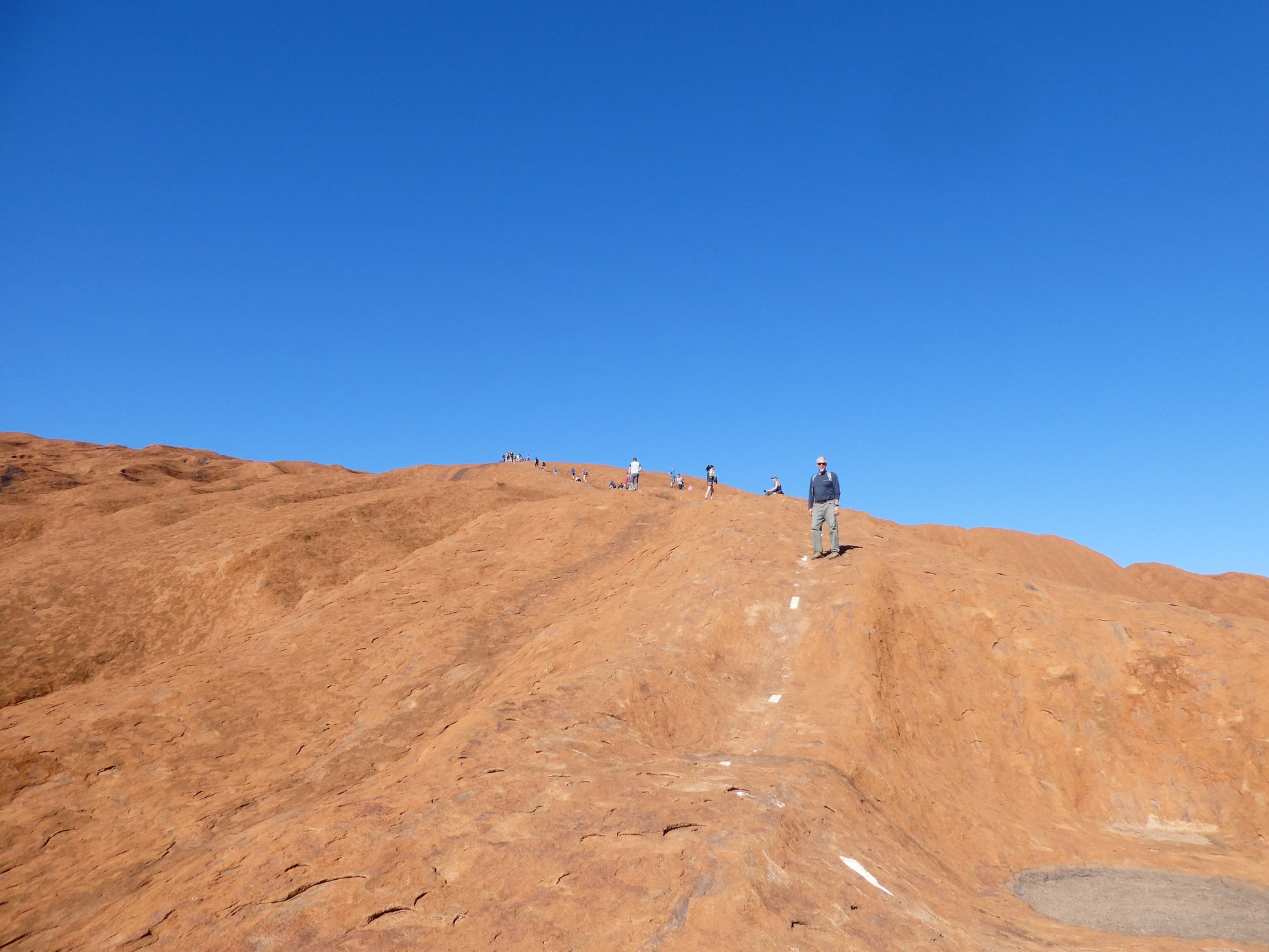
It begins....the Uluru climb
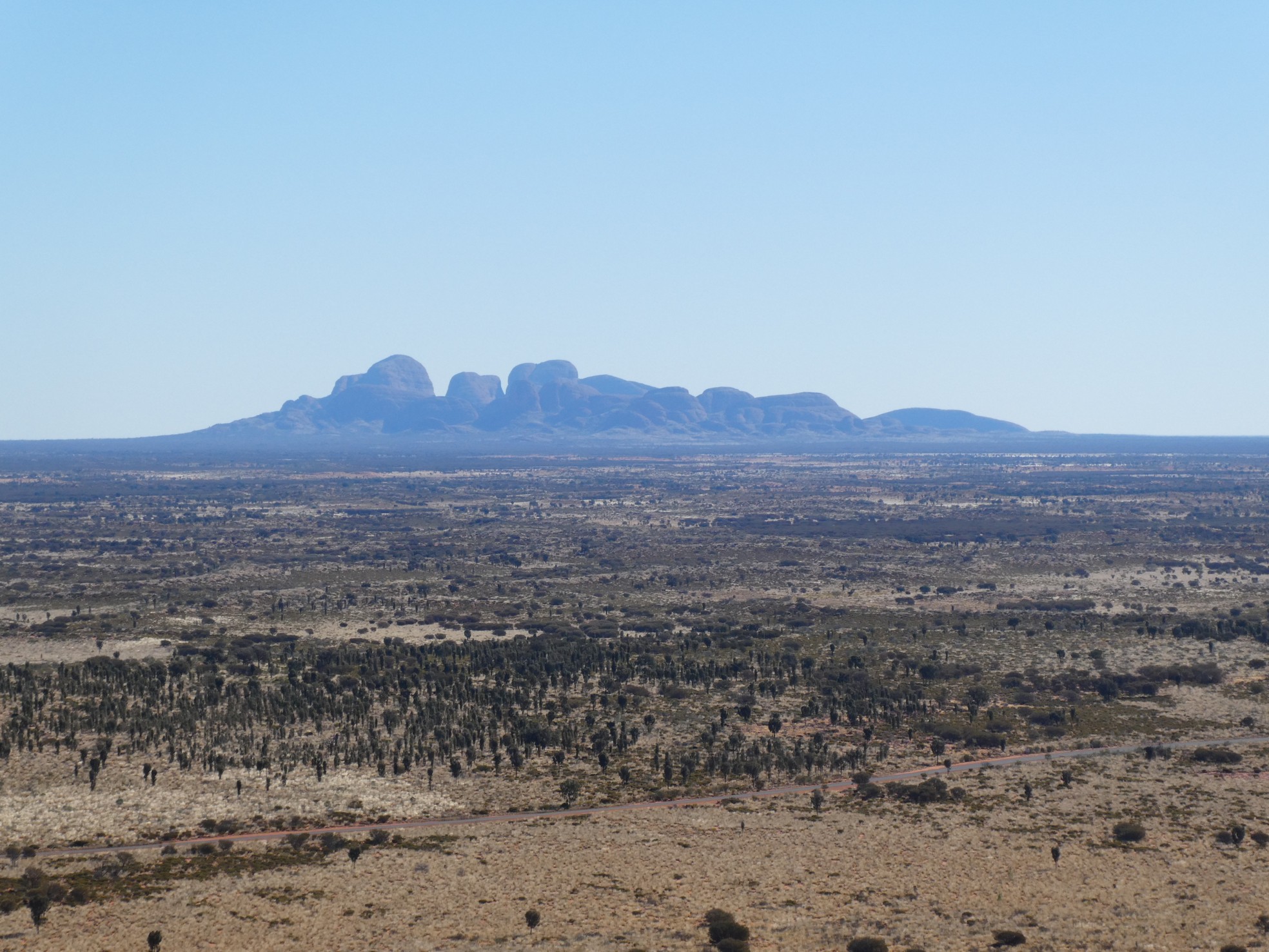 About half way and a needed break, Kata Tjuta in background
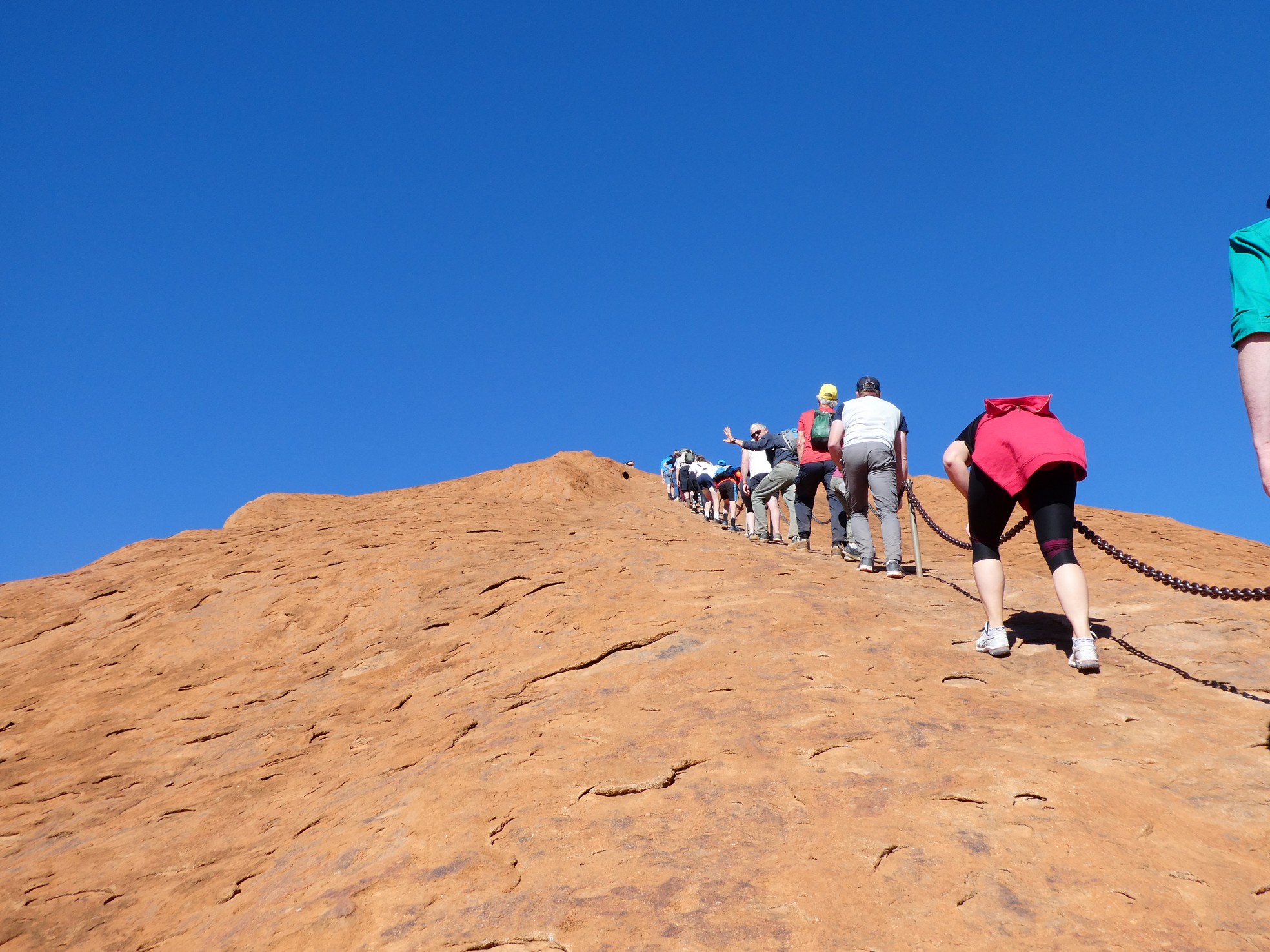 The chains were invaluable
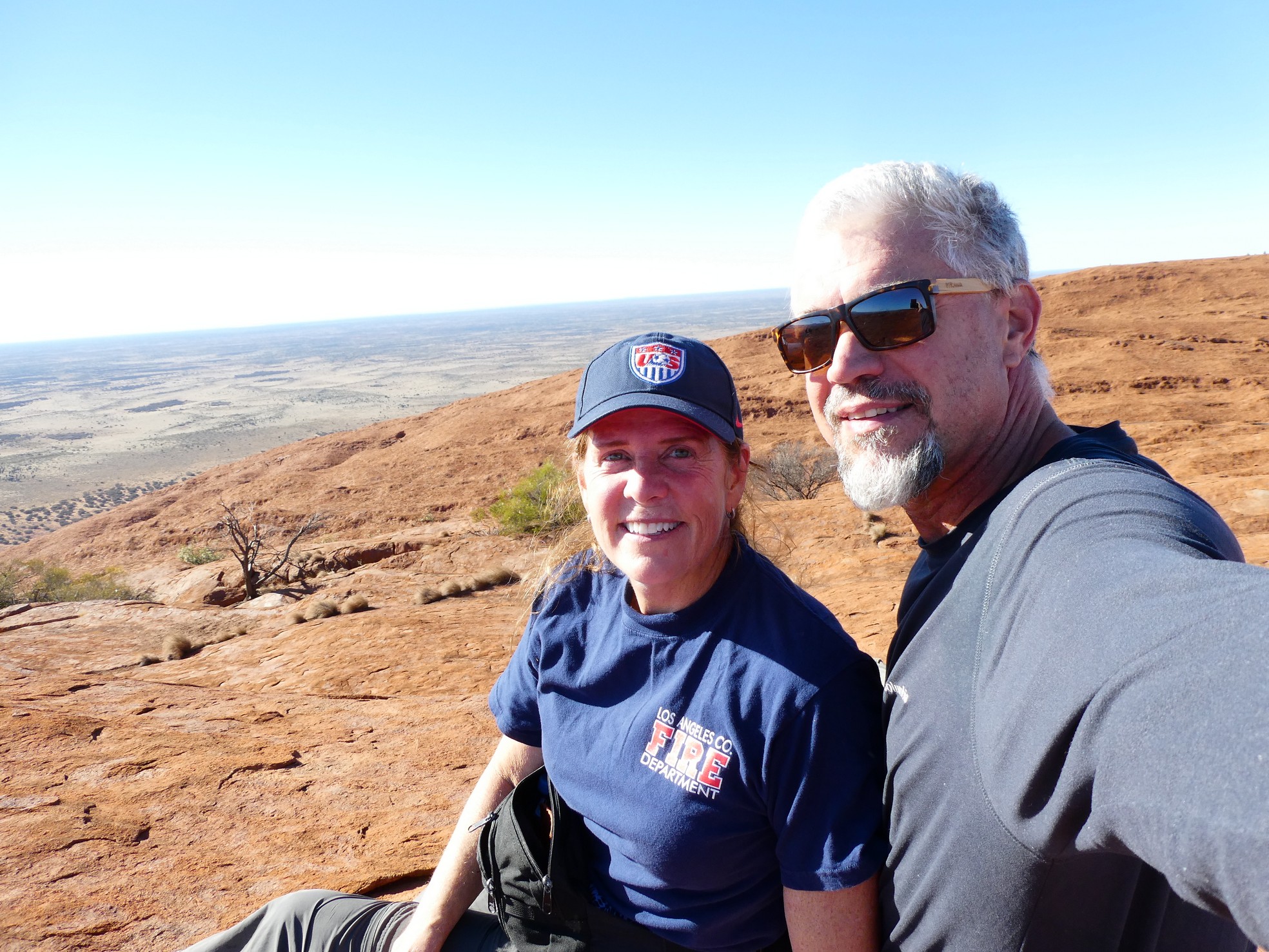
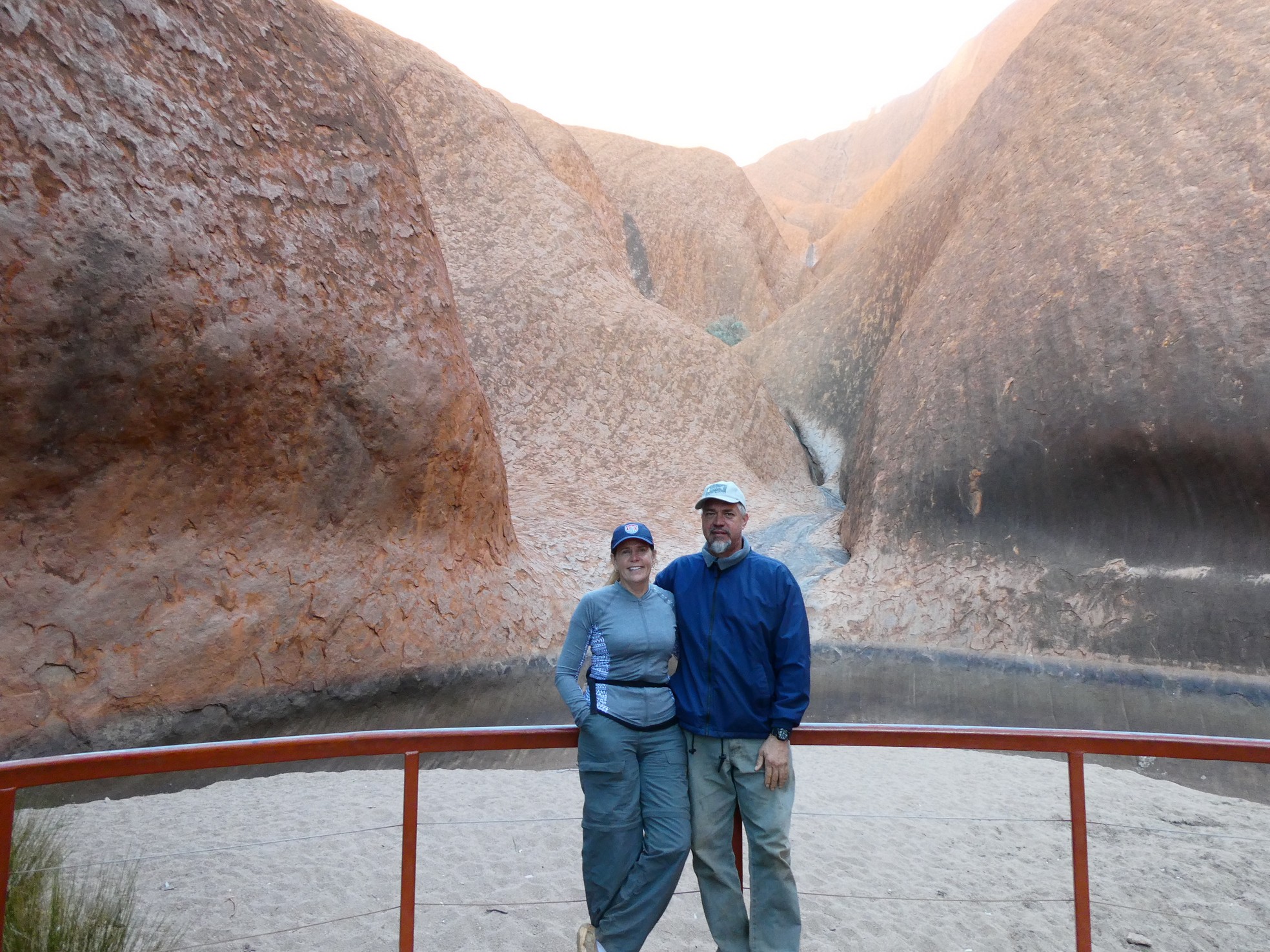
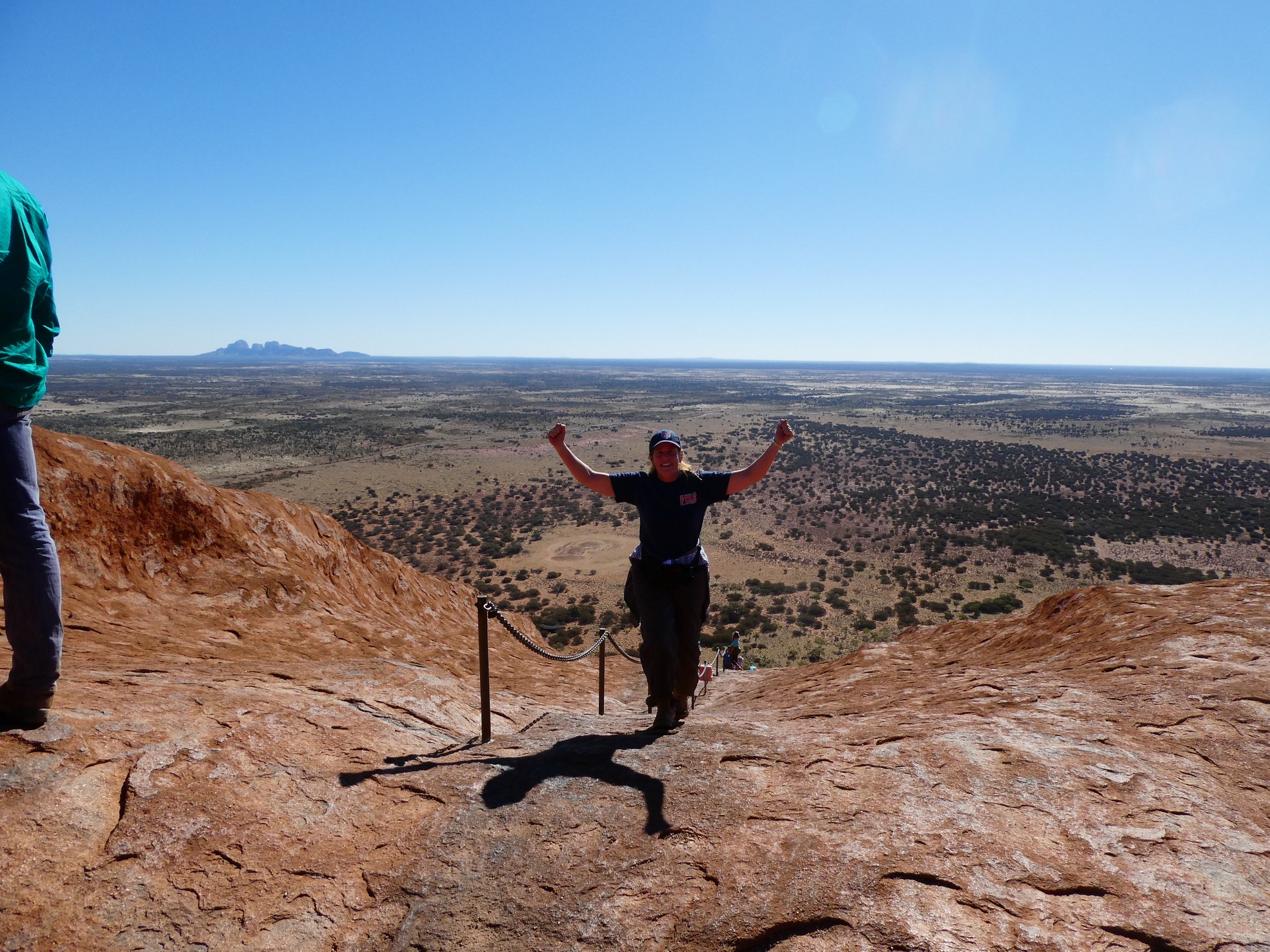 I made it (with immense exhilaration and relief)
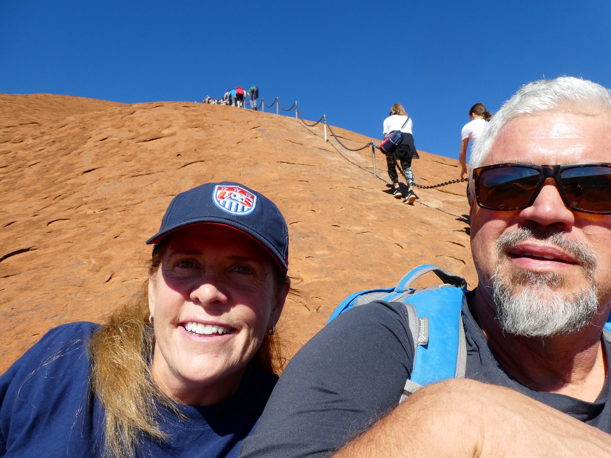
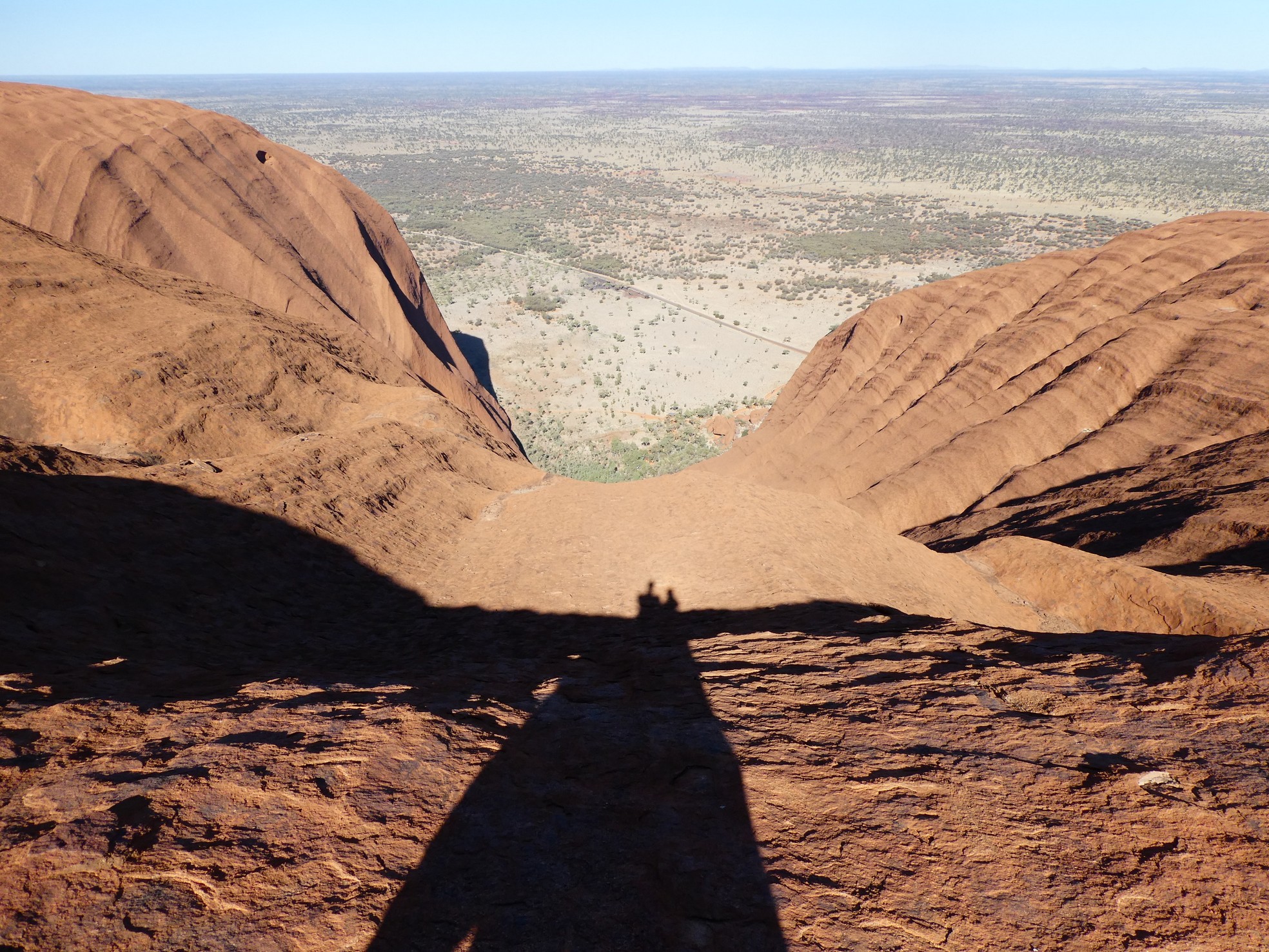
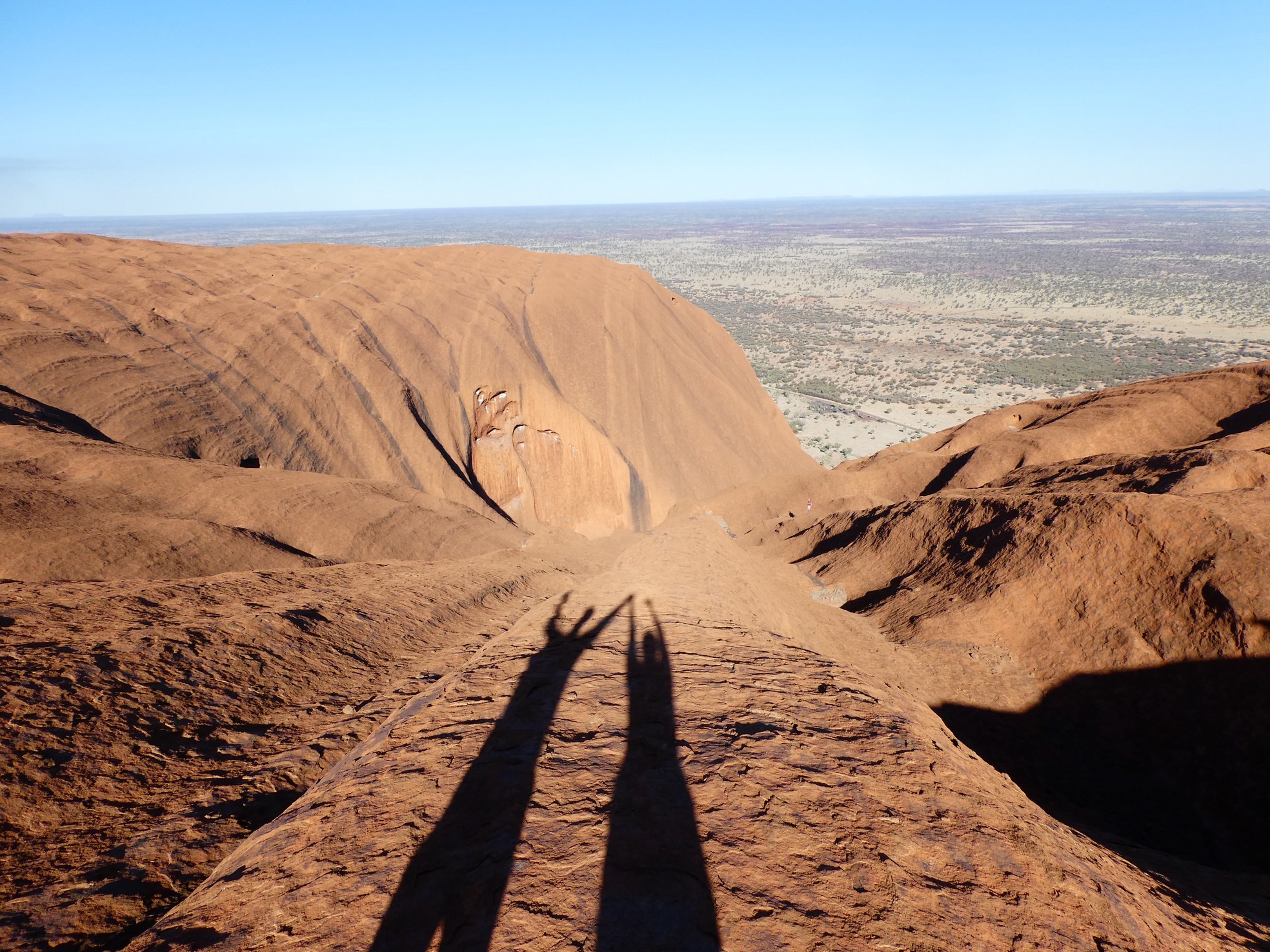
Climbing Uluru was one of the
most rewarding things that I have ever done. There was not a moment of
comfort or ease while standing on that steep rock with only the strength of your
severely flexed ankles holding you steady. Looking up, you would see what
looked to be the 'top', only to crest and find there was yet another face to
climb and another conversation with yourself that you can make it.
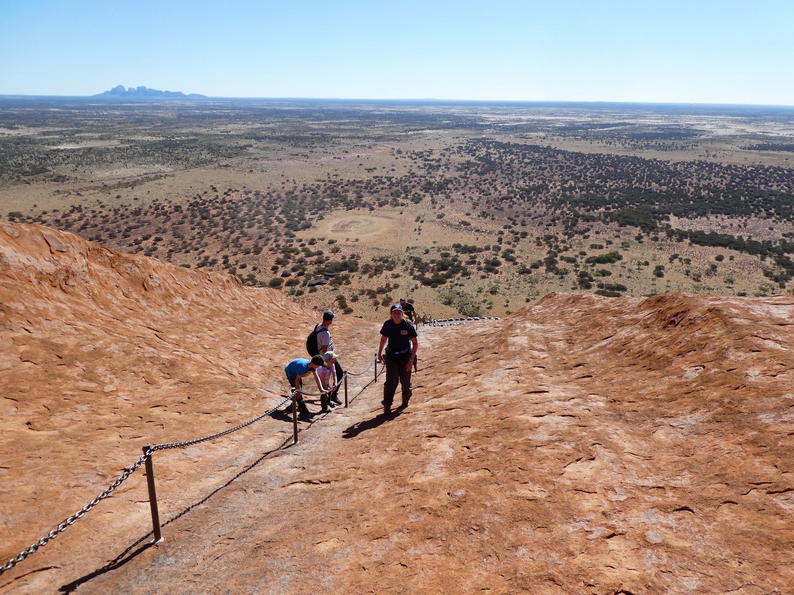
 Views from along the top
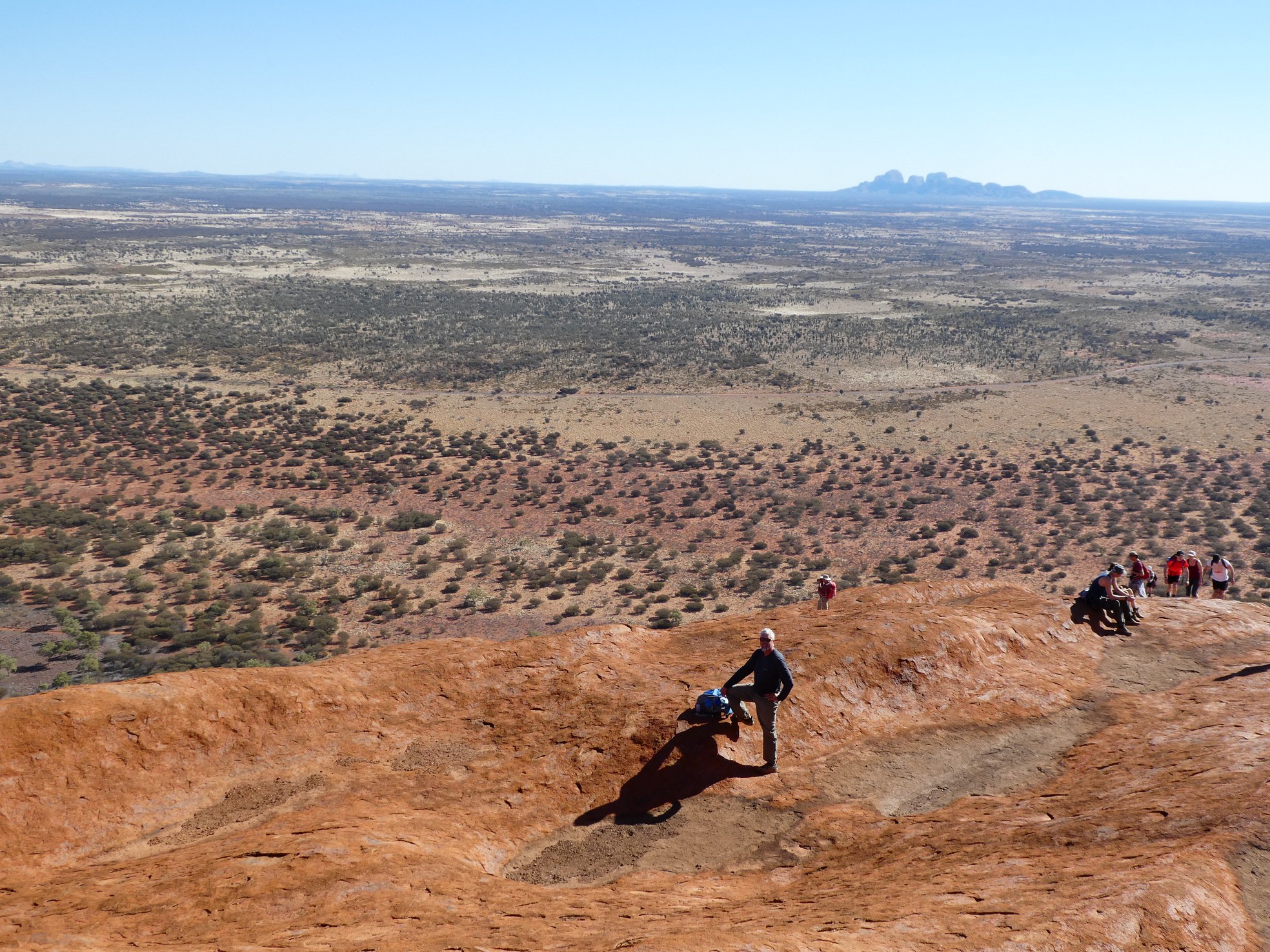
![]() Views out to Kata Tjuta
Views out to Kata Tjuta
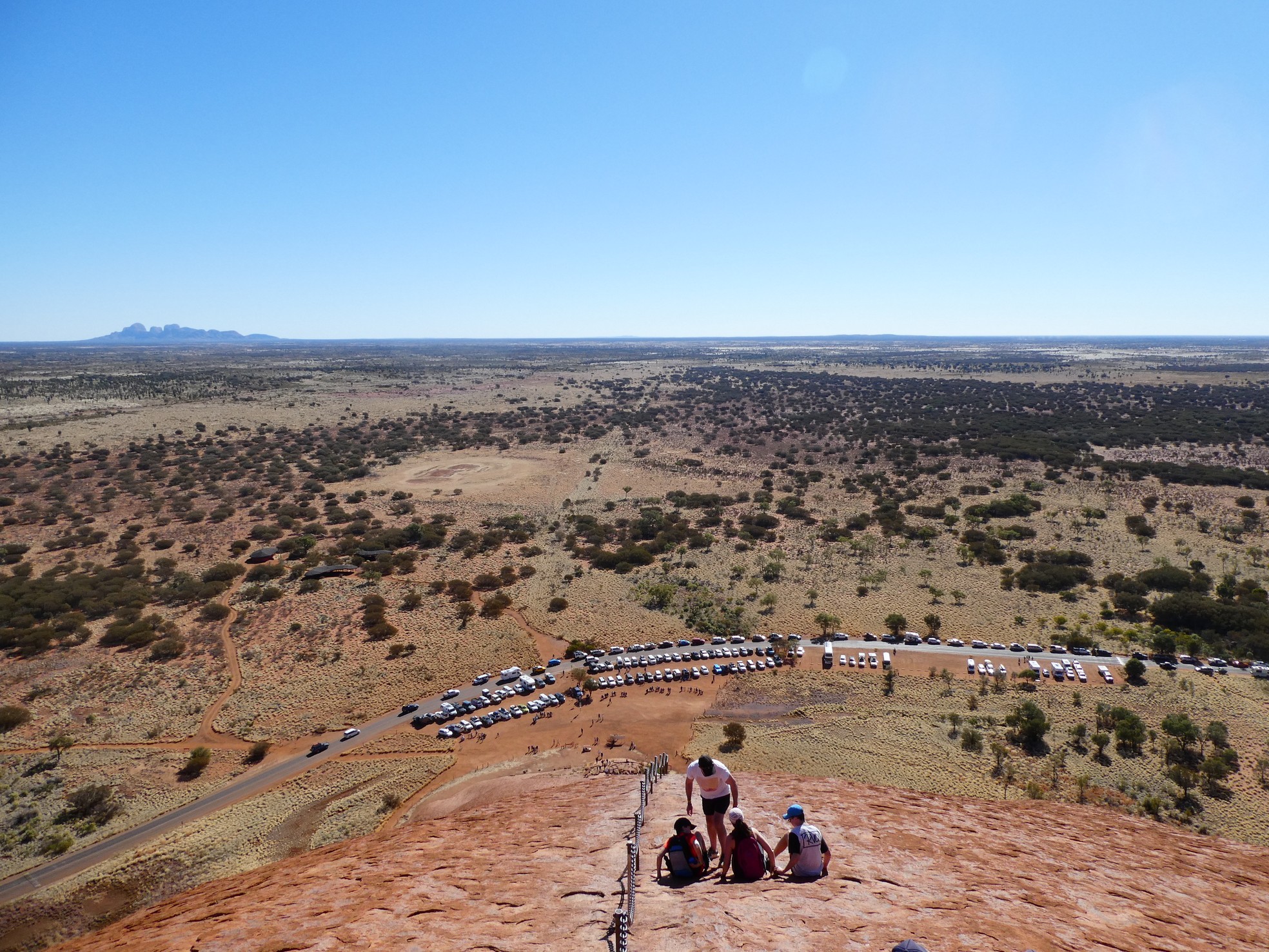
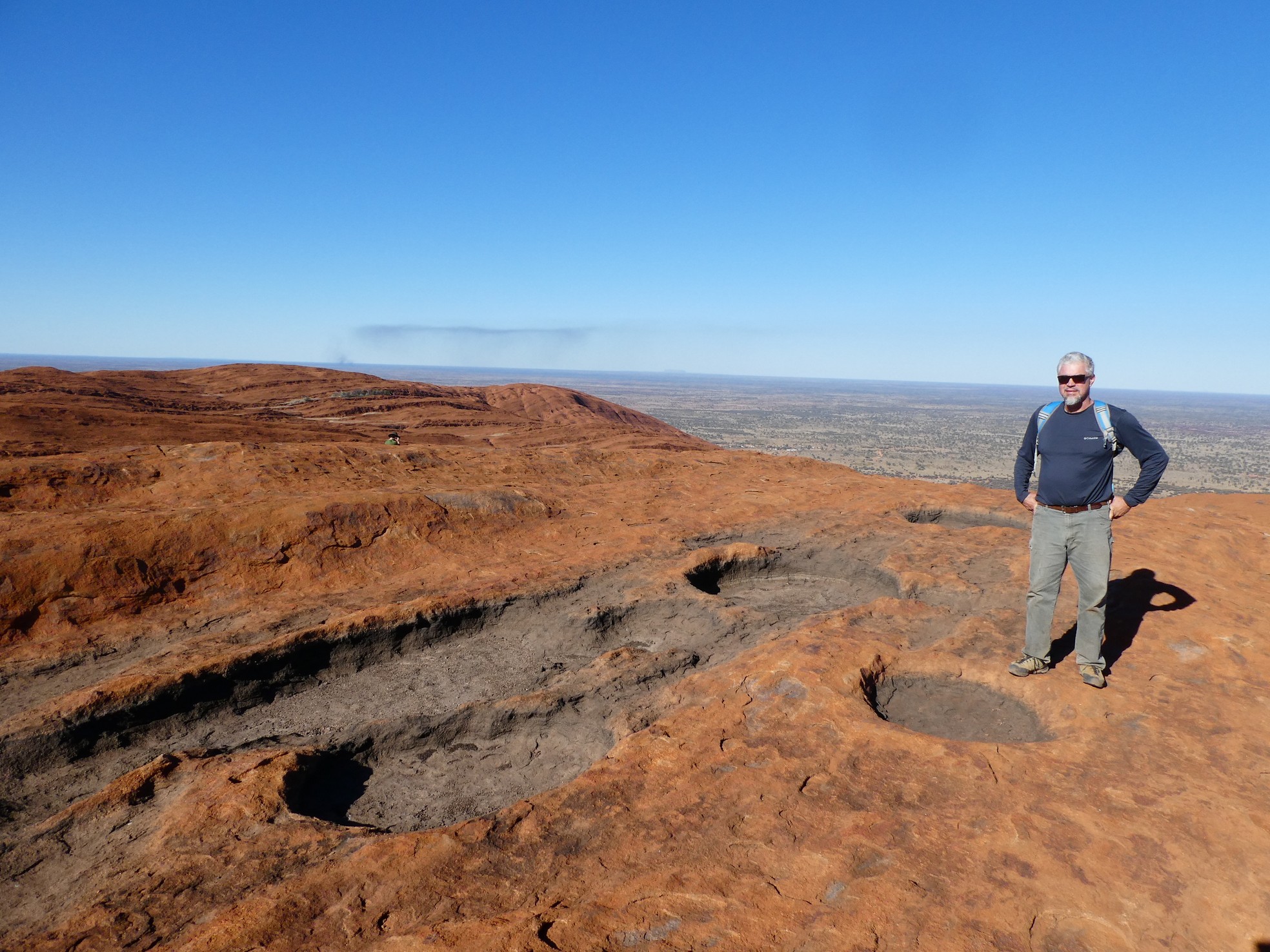
Once at the top, you had the opportunity to continue
the trek, up and down the many 'canyons' and 'valleys' that are carved in this
immense monolith. At some points, this crawling across the top was more
difficult than the initial climb due to no chains to use as leverage and some
paths were no wider than your foot. Our senses were overwhelmed with what
we were seeing and with a concern about our time, we ventured as far as we could
before taking several minutes to just absorb what we had done and what were
experiencing.

![]() Views over the back (east) side
Views over the back (east) side
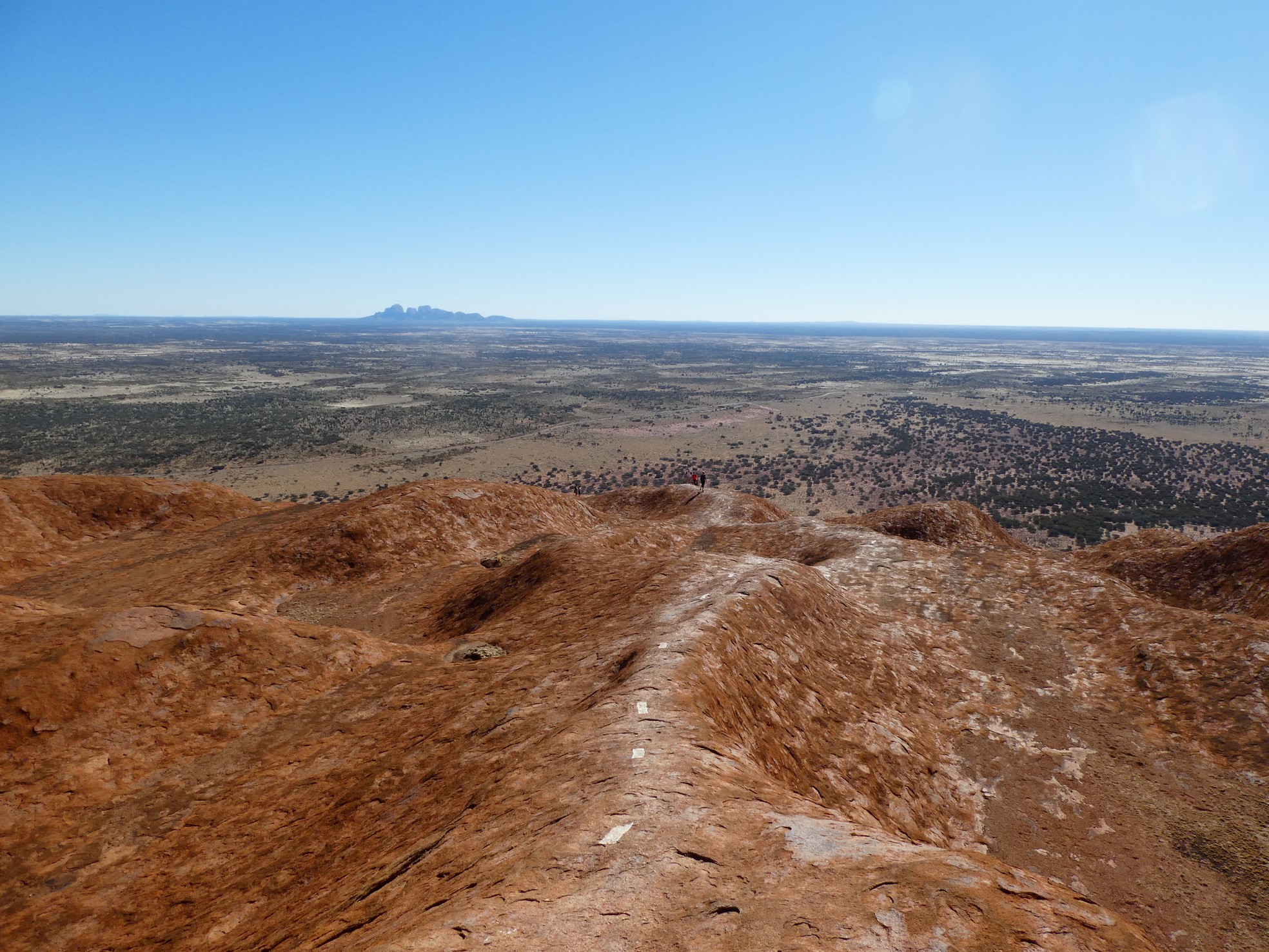
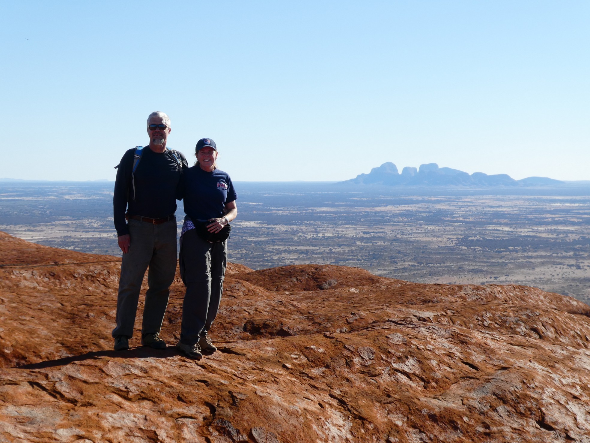 Views off the top with Kata Tjuta in background
 Gerson near dried water holes. Fire in background is the controlled burn
that is used to control and enhance the vegetation.
Gerson near dried water holes. Fire in background is the controlled burn
that is used to control and enhance the vegetation.
Alas, our time on top of the world had to come to an end and we had to scurry down the rock with much haste. Fortunately, Gerson was very sure-footed and he wasted no time in heading downward with little use for the chains. I chose to use the chains as a rappel line and conquered the steep in a quarter of the time it took me to climb up. It was quite fun!

 The descent and Gerson celebrating his success
 Gerson came back to get me on the run
As I alluded to earlier, we had arranged to enjoy an
evening event called "Sounds of Silence" for which, we had to be at the
rendezvous point at 5:00 p.m. We completed the climb with no time to spare
and we just made it back to the Ayers Resort area to catch the bus for our
'tour'. The Sounds of Silence is a sunset dinner/star gazing event that is
located in the middle of the desert, in between Uluru and Kata Tjuta. The
dinner was a mixed fare of lamb, kangaroo, crocodile and a variety of other
foods that you enjoy while the sun sets and turns Uluru blood red and makes Kata
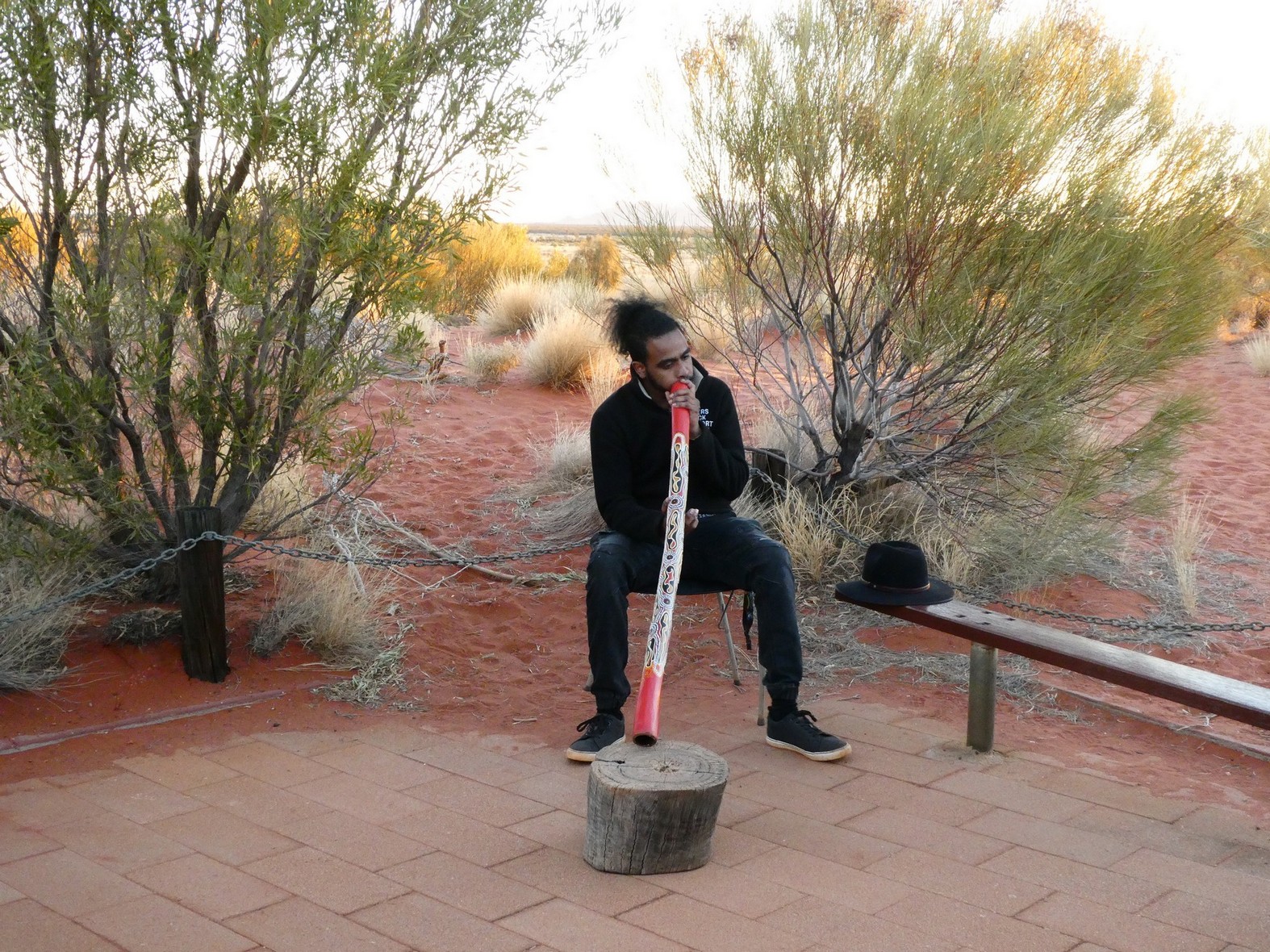
Tjuta glow. We even got to enjoy the sound of the didgeridoo (an
Aboriginal instrument) and a very humorous presentation about the stars.
What a fantastic day!
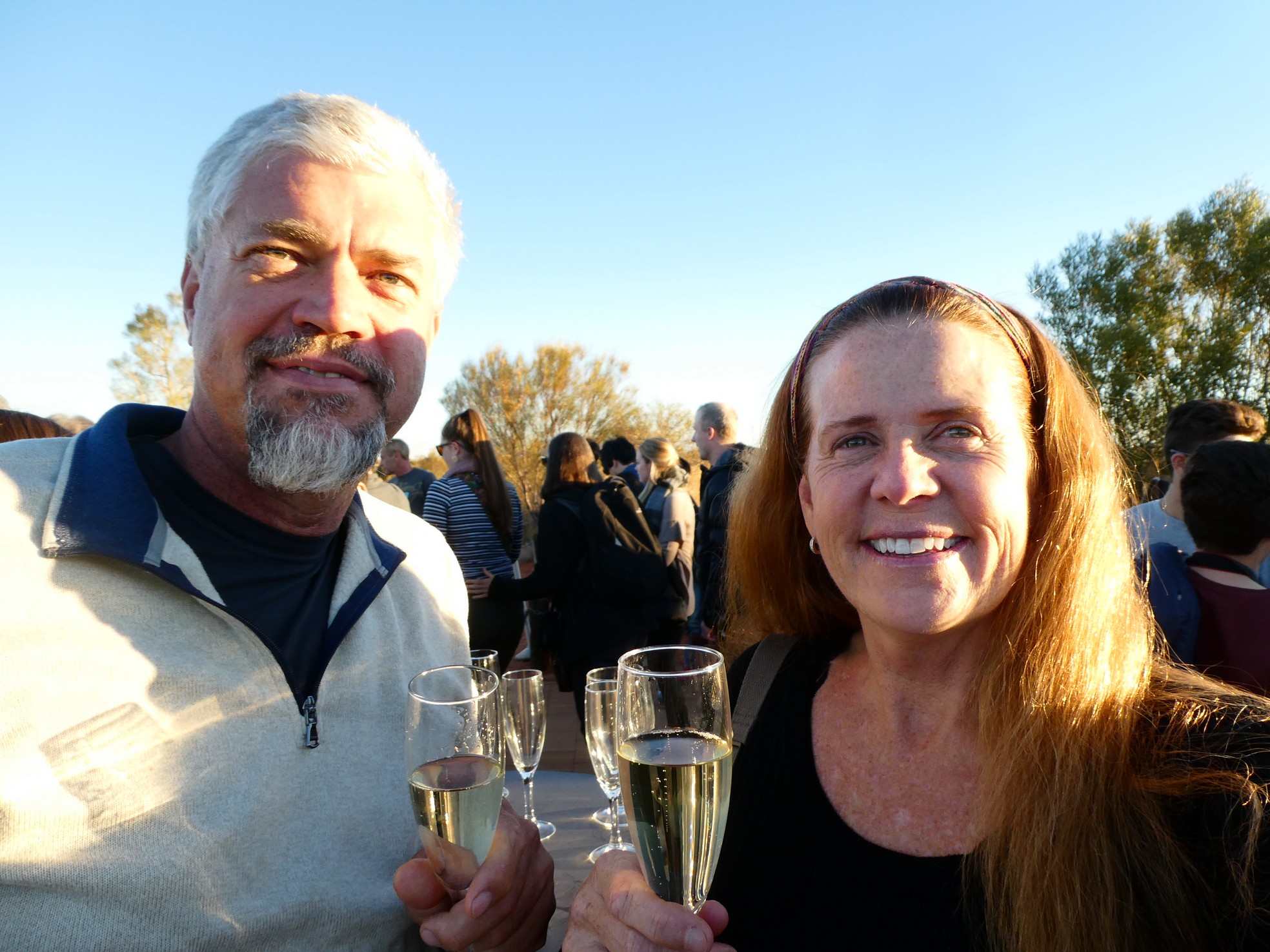
 Champagne and a bit of music to start
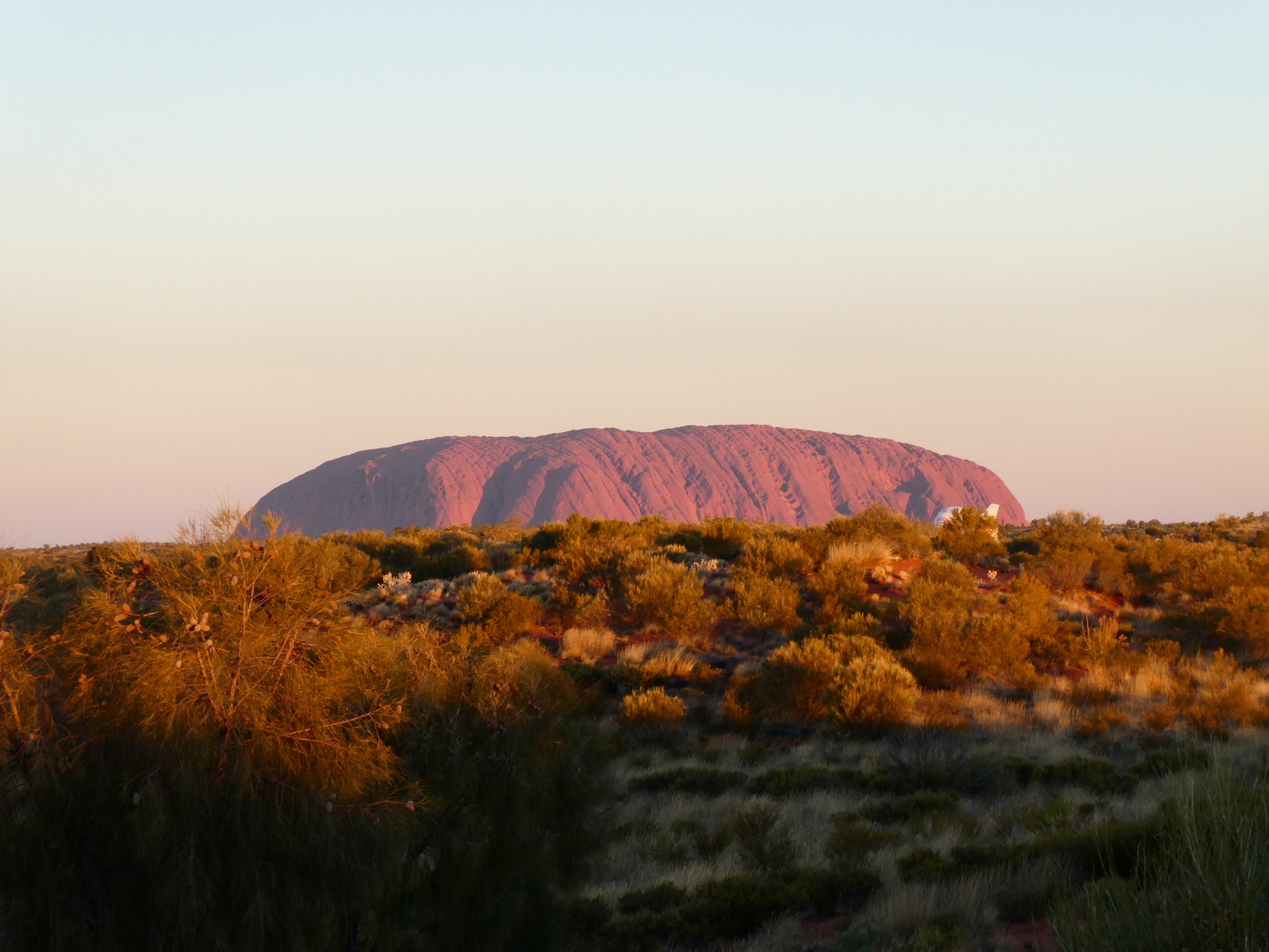
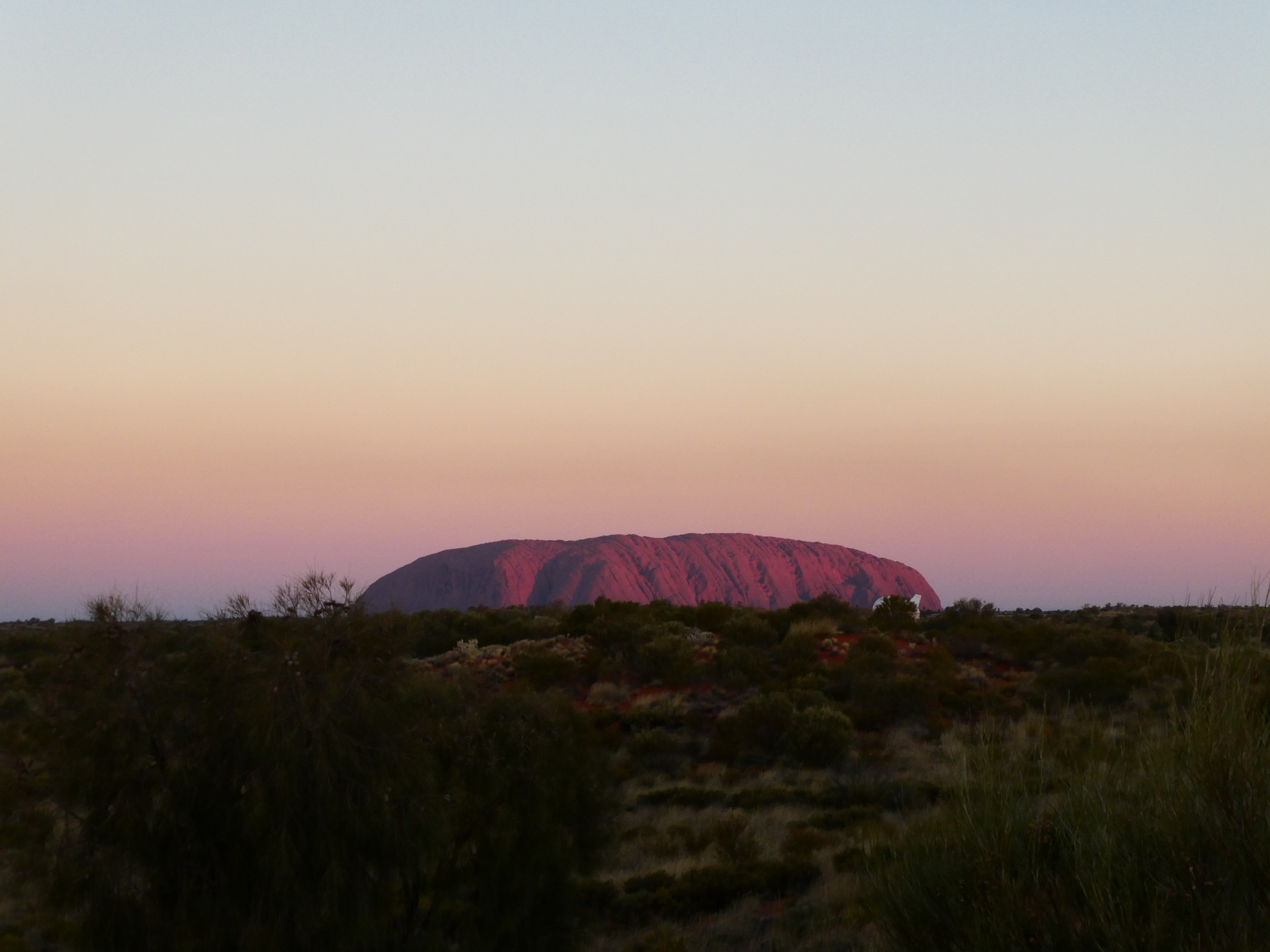
 Sunset on Uluru and Kata Tjuta
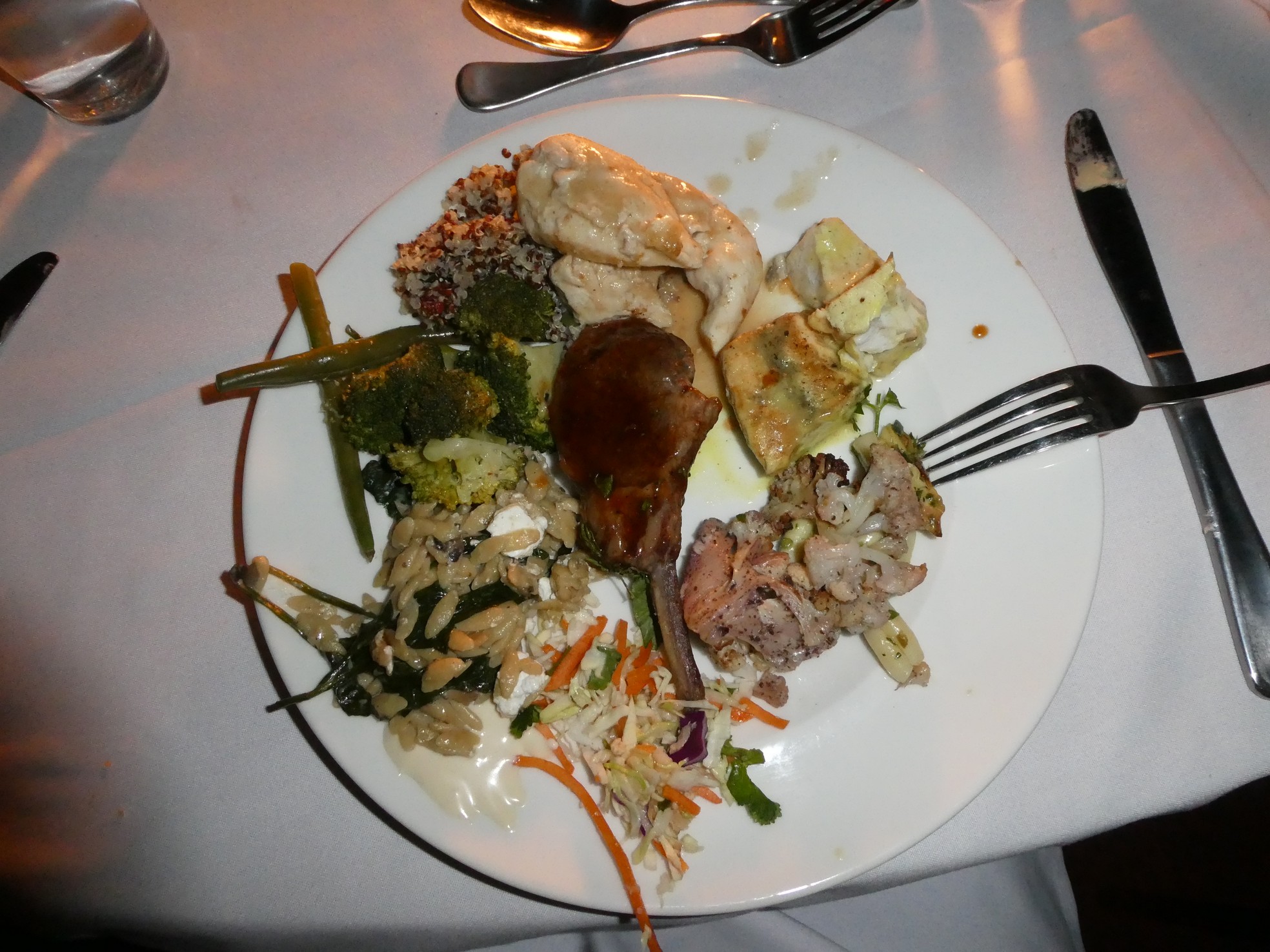 Din din was tasty
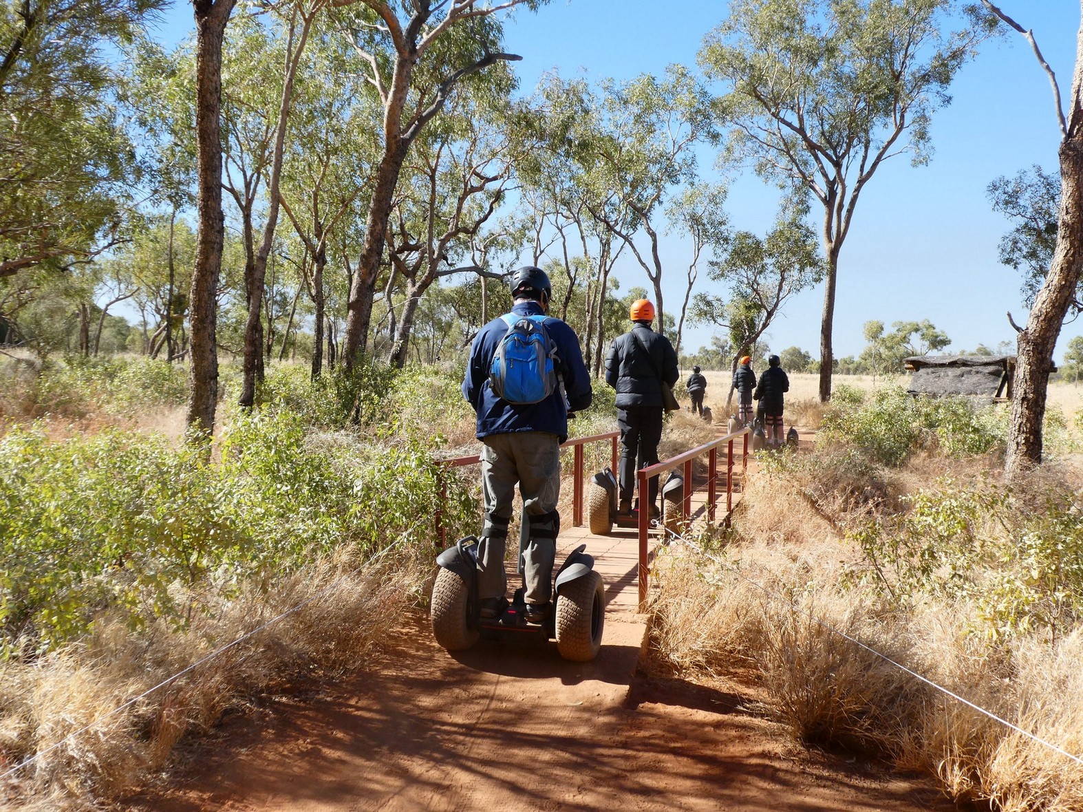
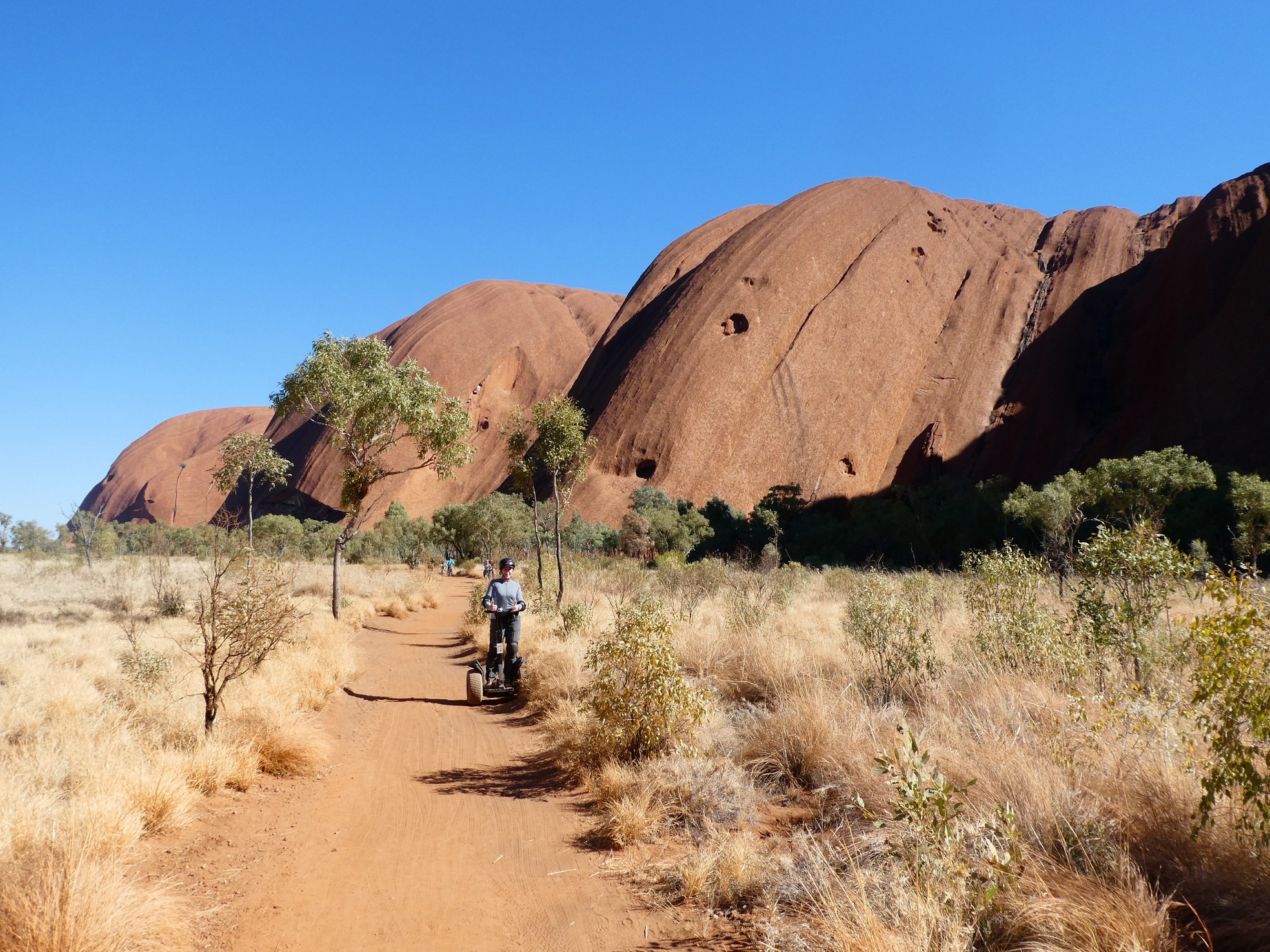
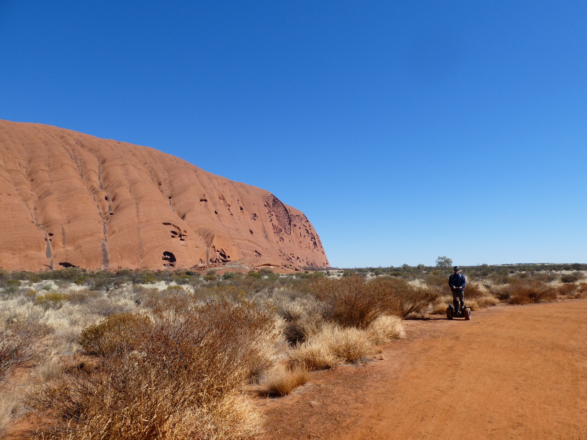
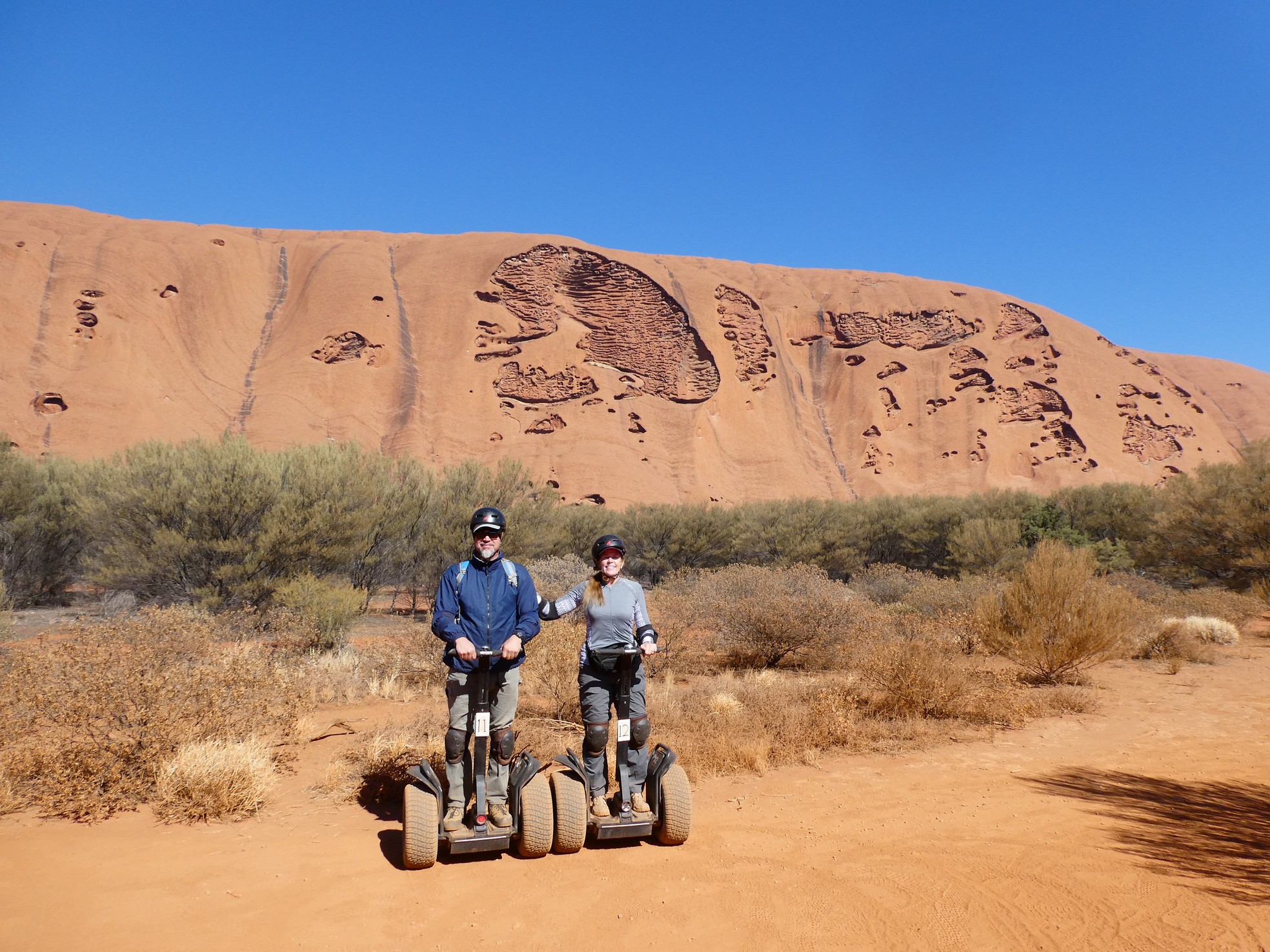
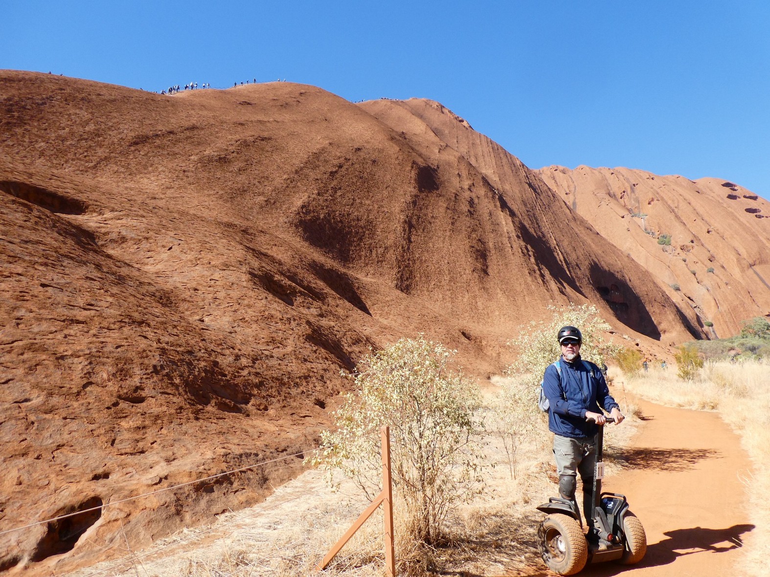
We had yet another day to spend around Uluru and we did it in style. Why walk when you can ride! Ride Segways, that is. We wanted to go all the way around Uluru, approximately 12km (9 miles) and riding the Segway was brilliant! We started off with a little walk to the Mutlitjulu Waterhole (that we had visited the day before) and then we were off and riding along the eastern face of Uluru.
 The Mututjulu waterhole

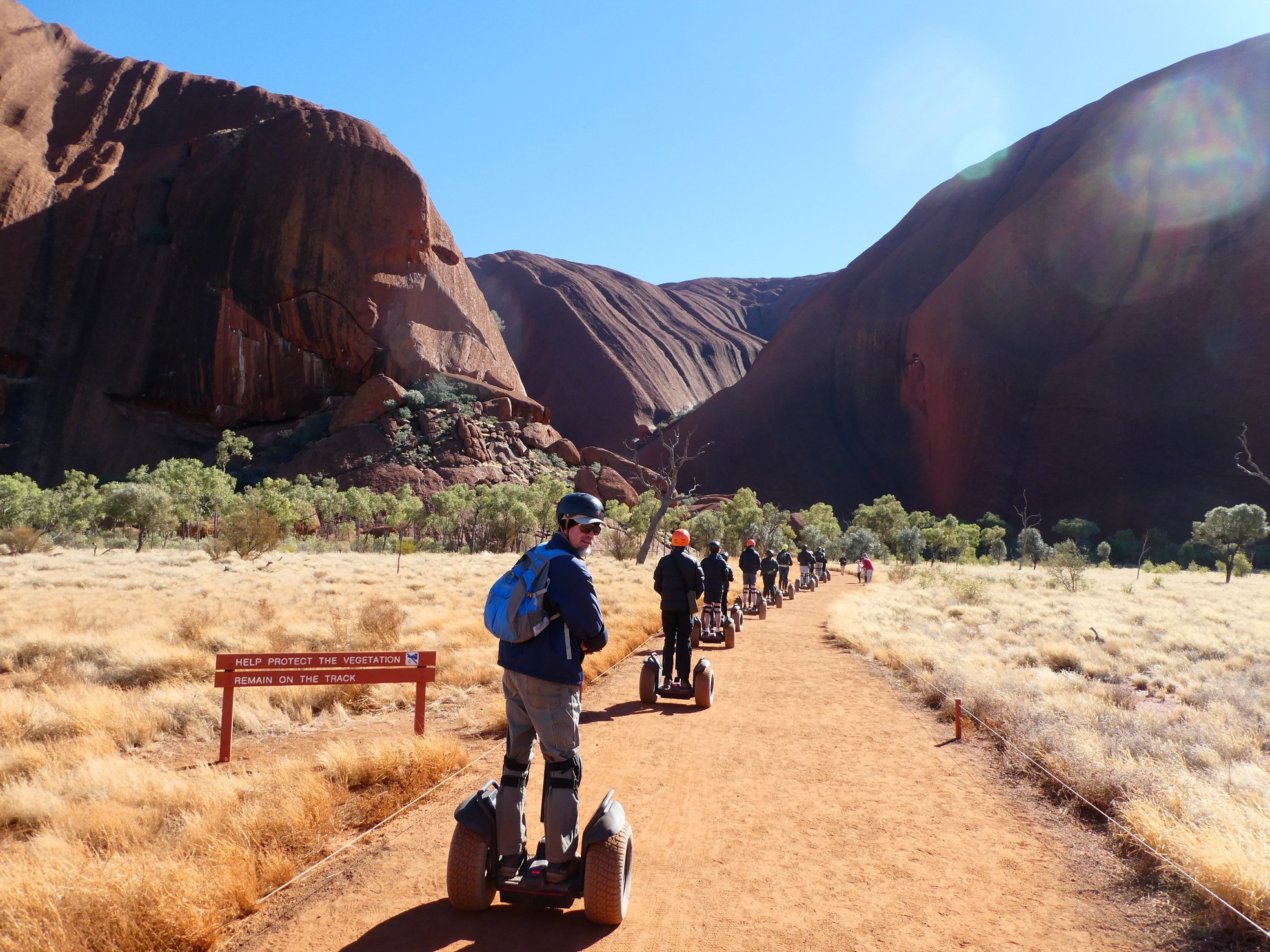
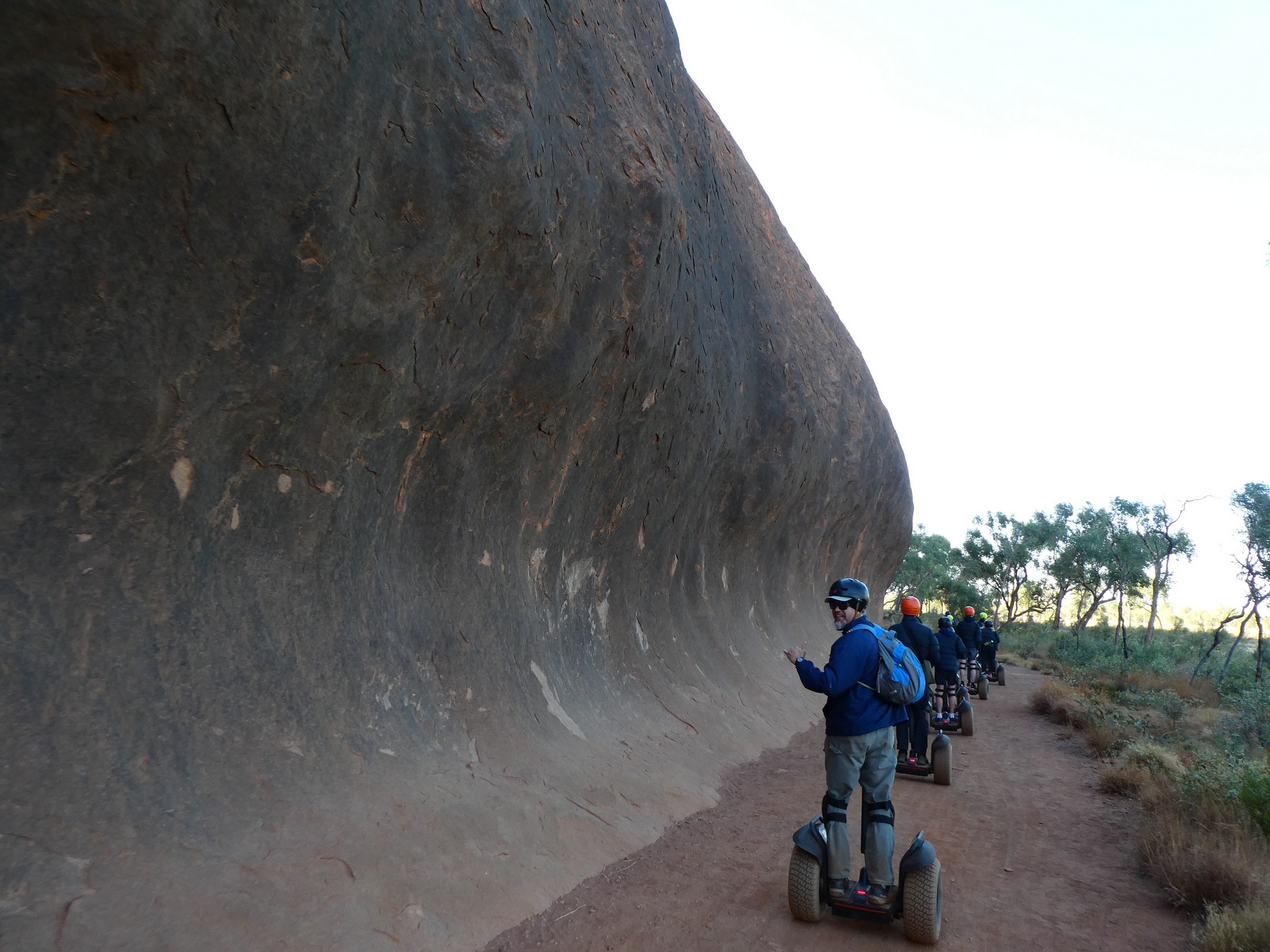

 Gerson at various points around the eastern side
 Around the northeastern side
![]()
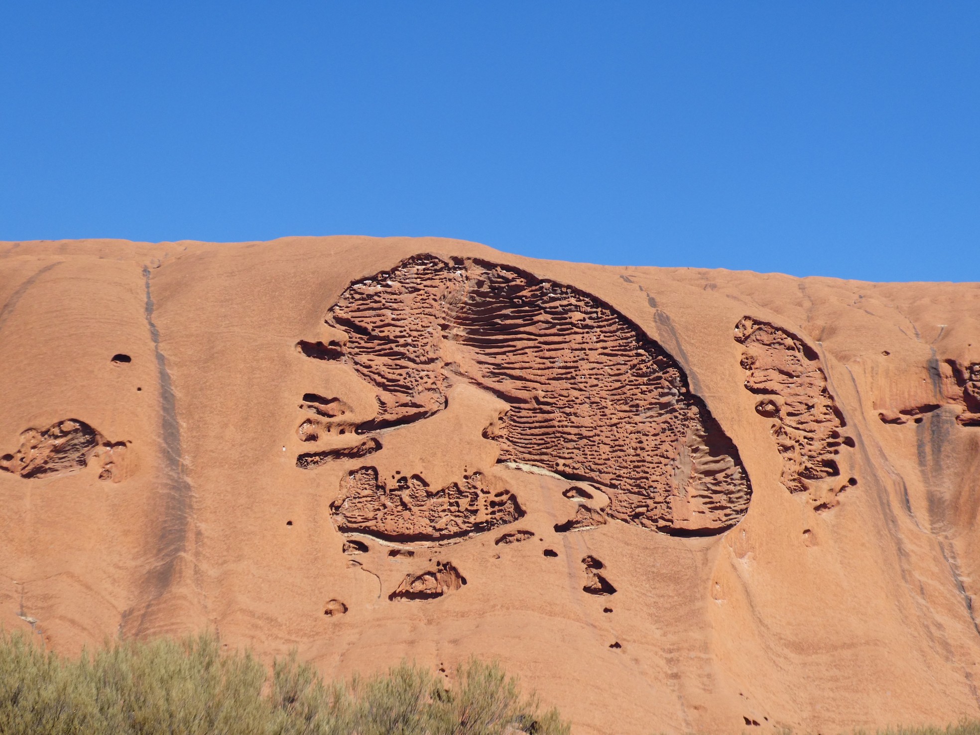
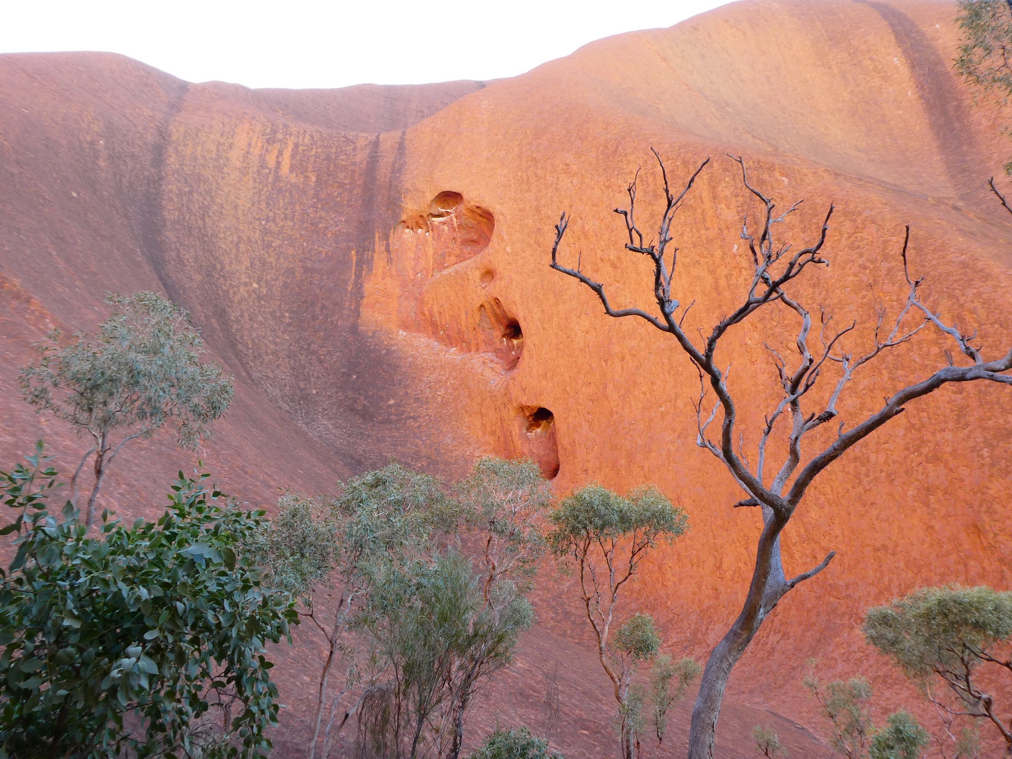
 Coming around the northern side - see the face in the rock wall?
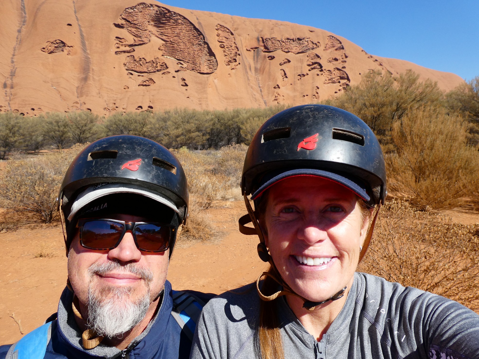
As we cruised along, the guide would stop now and again
to explain some of the areas we were viewing. There was one image in the
rock called the "Wallaby Man" and I thought it looked like Bart Simpson.
So much for my indigenes imagination.

![]()
![]()
 Around the north to the west side. Keep in mind, I am taking this photos
while riding the Segway!
Around the north to the west side. Keep in mind, I am taking this photos
while riding the Segway!

![]() From the west to the south side and a view to the climb area.
From the west to the south side and a view to the climb area.
The Segway tour was three hours long and after the Uluru climb the day before, we were plum tuckered out. We were so appreciative of the comfort of Cinderoo and just spent that afternoon regaling in our recent memories and making ready for our departure the next day. And, as though Uluru was not enough of excitement in the area, we also visited Kings Canyon in Watarrka National Park.

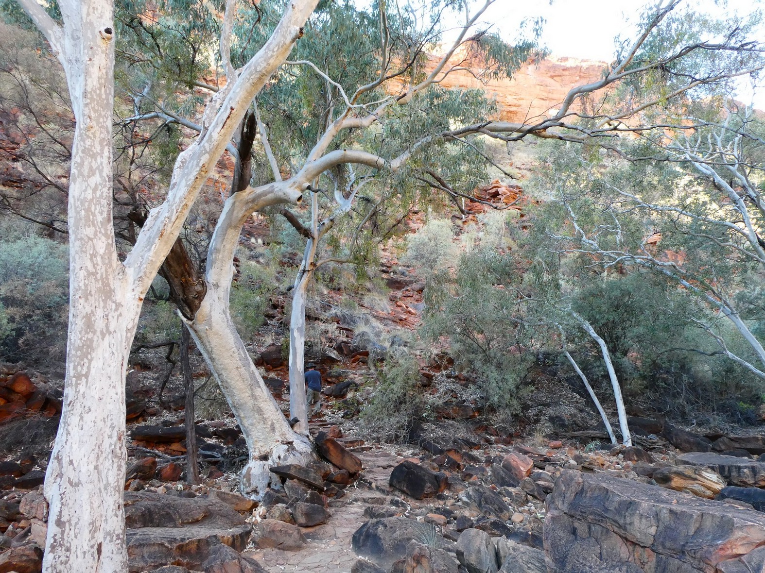 Kings Creek Walk was quite nice
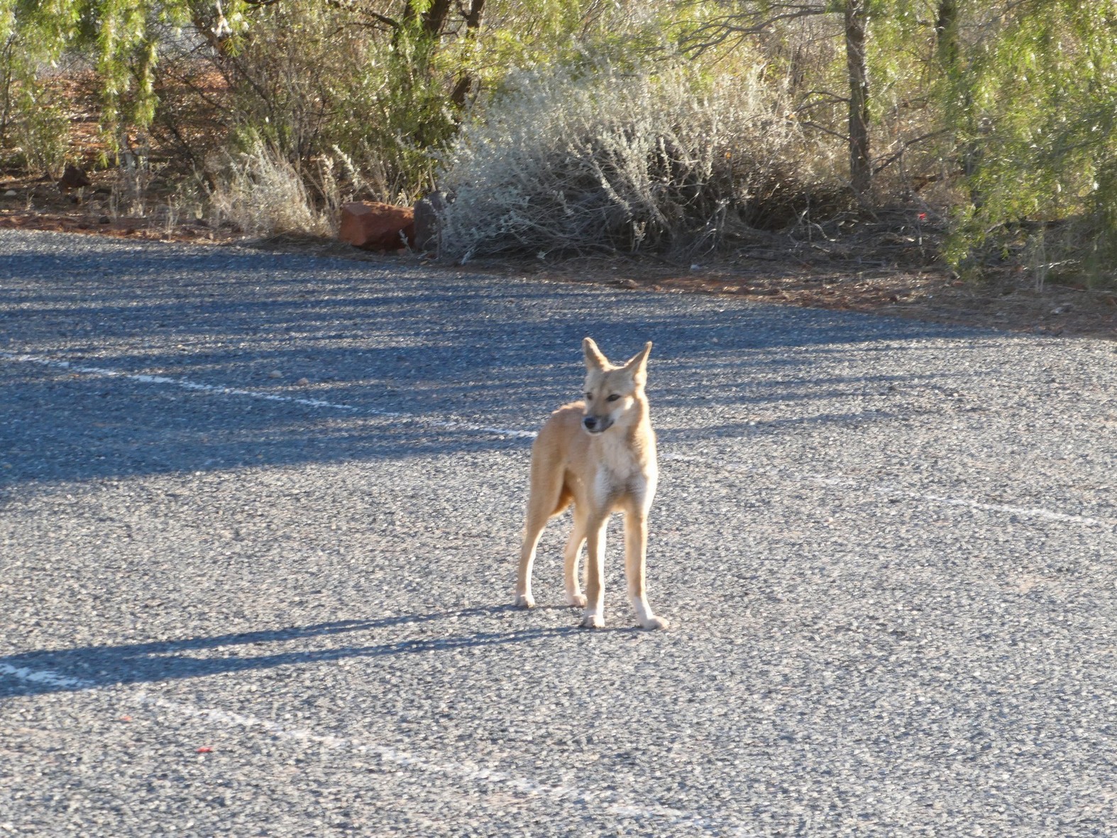
 As no pets are allowed in the National Park, we suspect this was a young Dingo

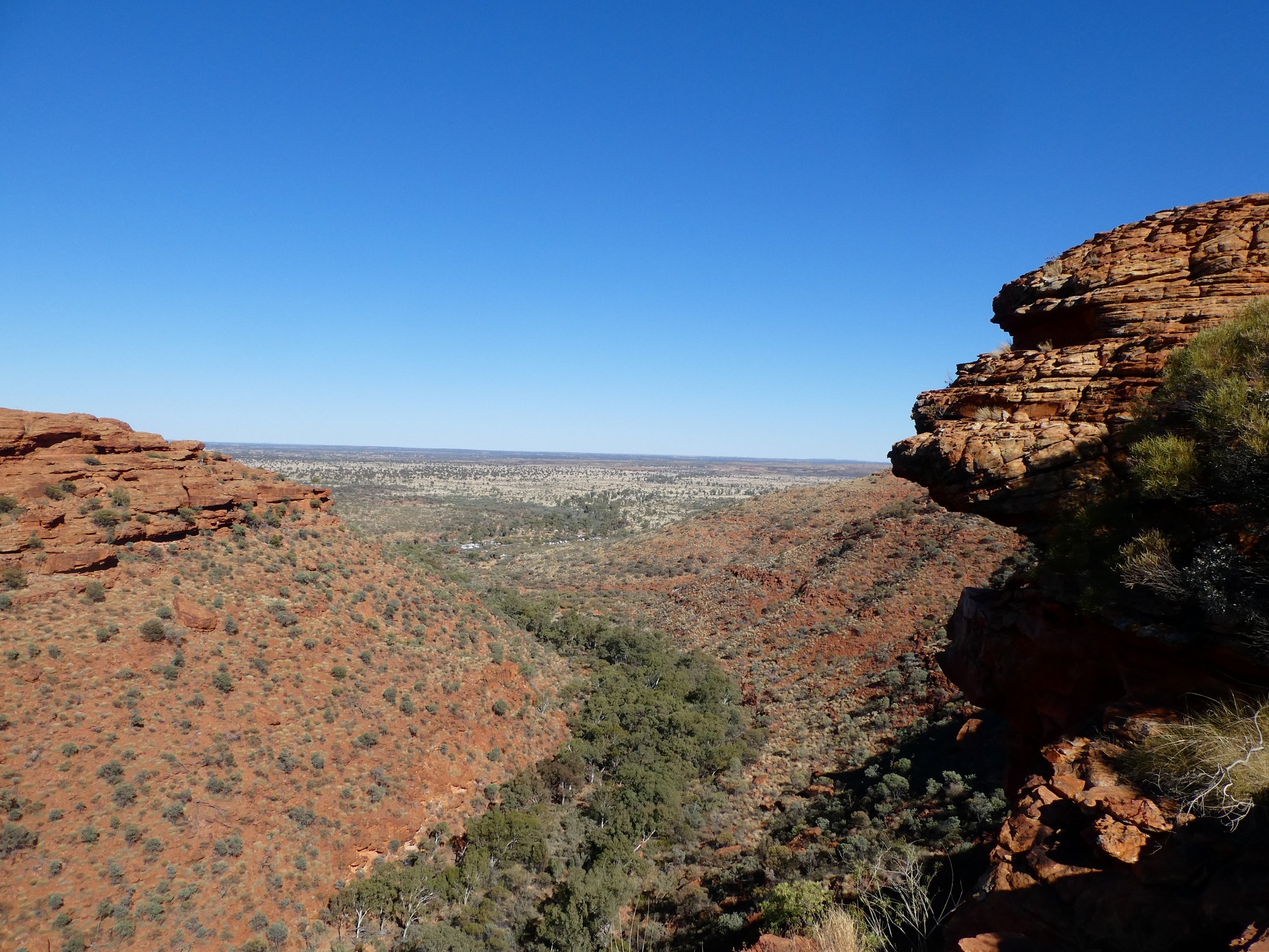
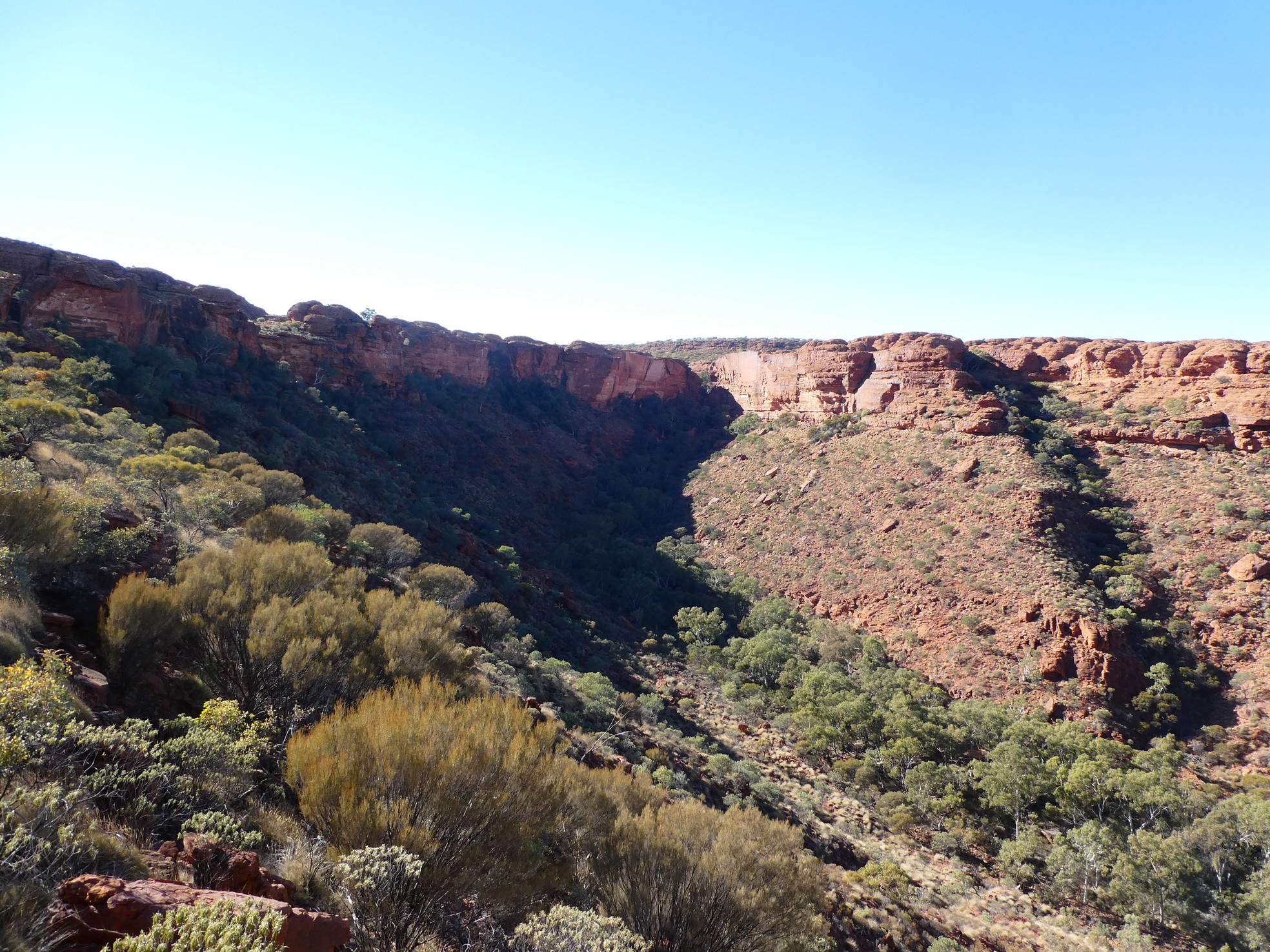 Views to Kings Canyon rock walls
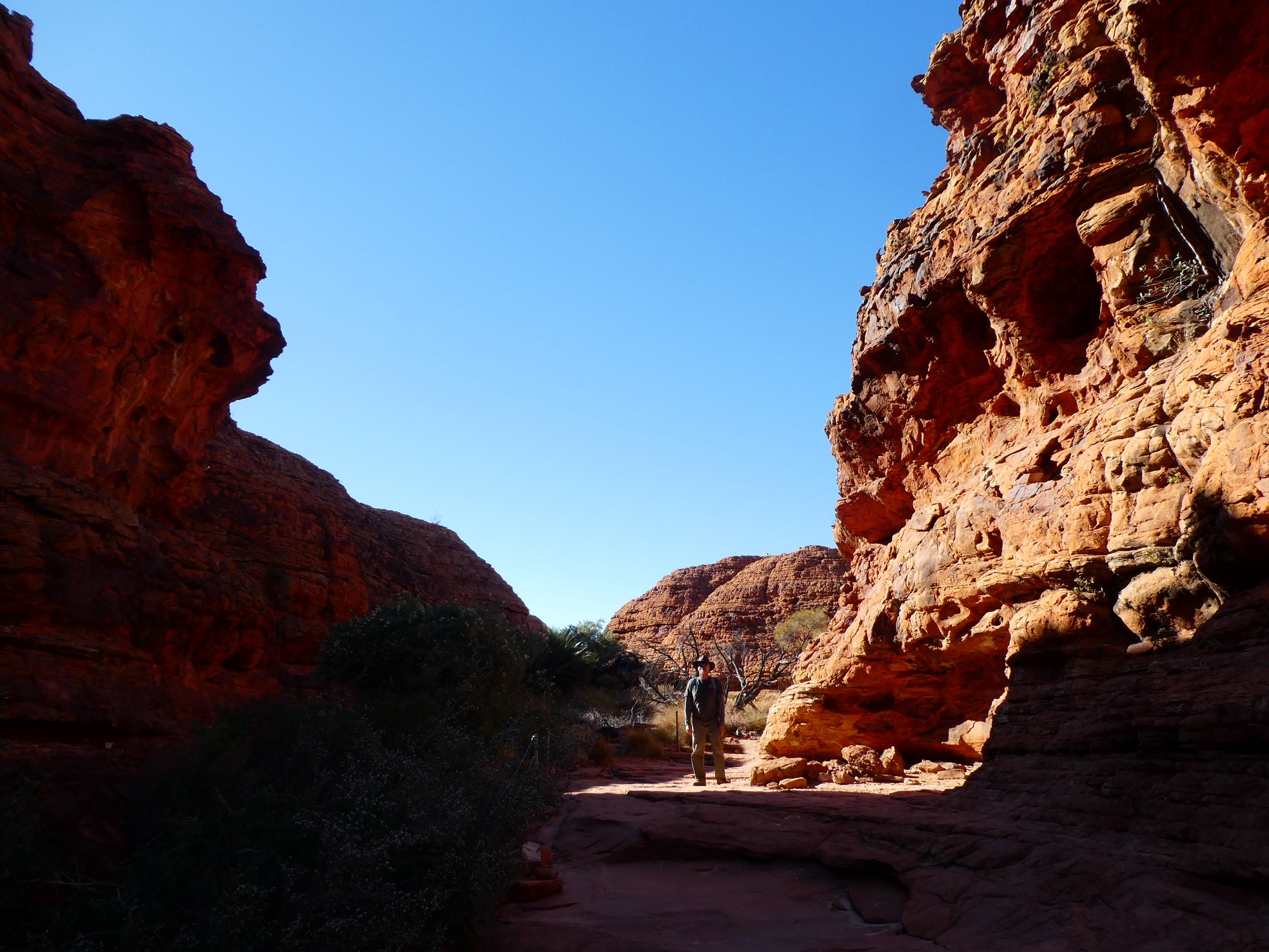
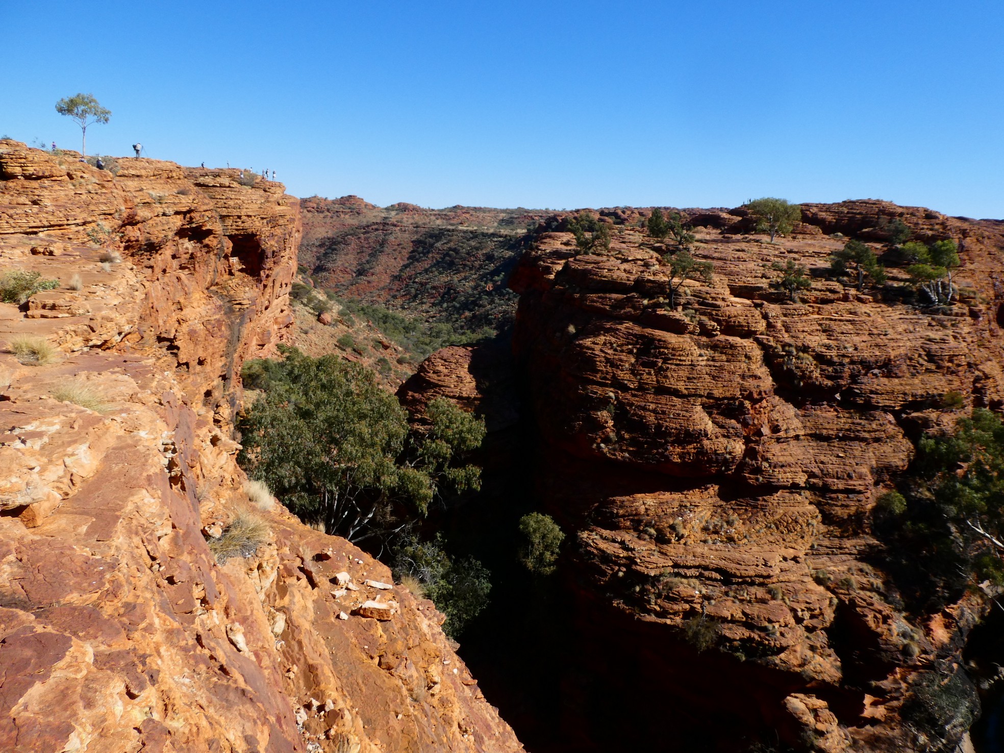
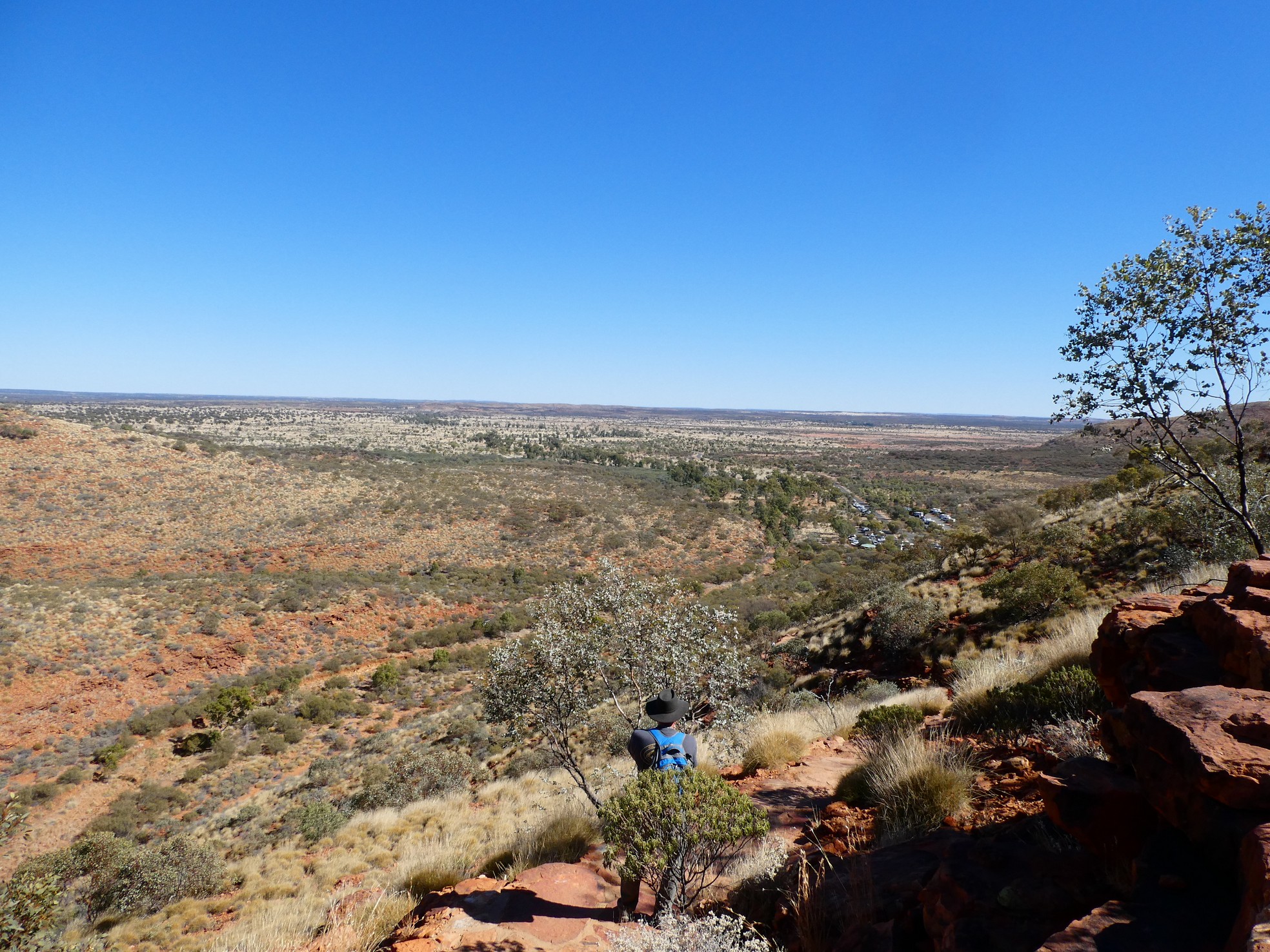
 Kings Canyon Rim walk and another rock playground
![]()
![]() The views just got better and better
The views just got better and better
![]()
![]()
![]()
![]() Similar to the Bungle Bungles but unique all the same
Similar to the Bungle Bungles but unique all the same
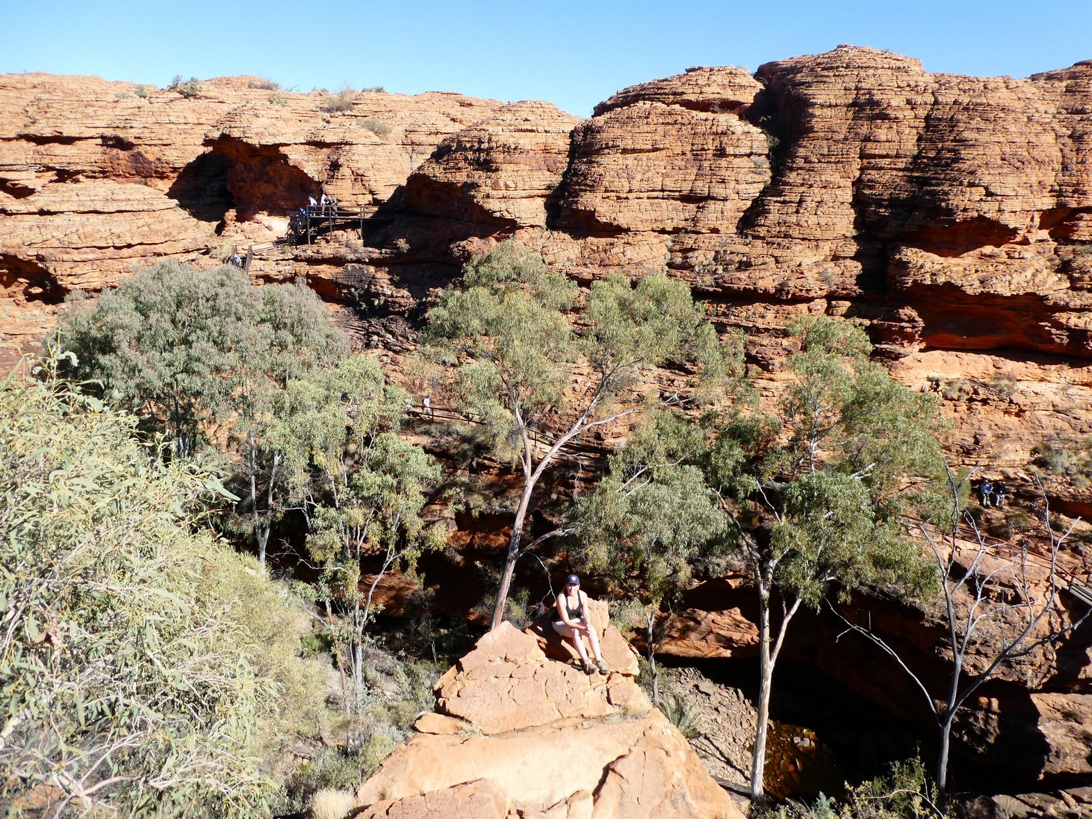
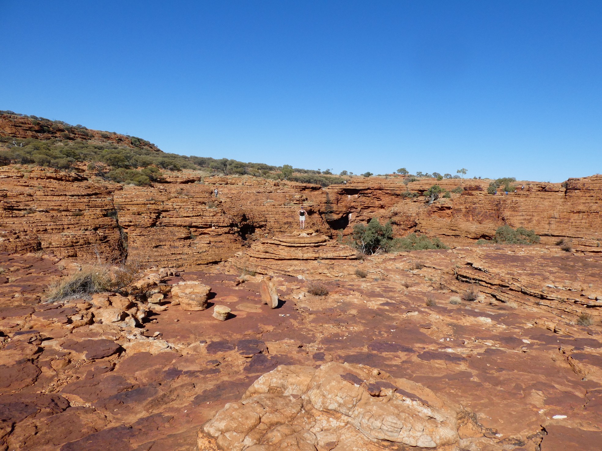
We were quite impressed with the differing terrain and
the similarities to gorges and rock formations we had seen before. We were
especially impressed with the breathtaking beauty of the sheer wall that makes
up part of Kings Canyon.
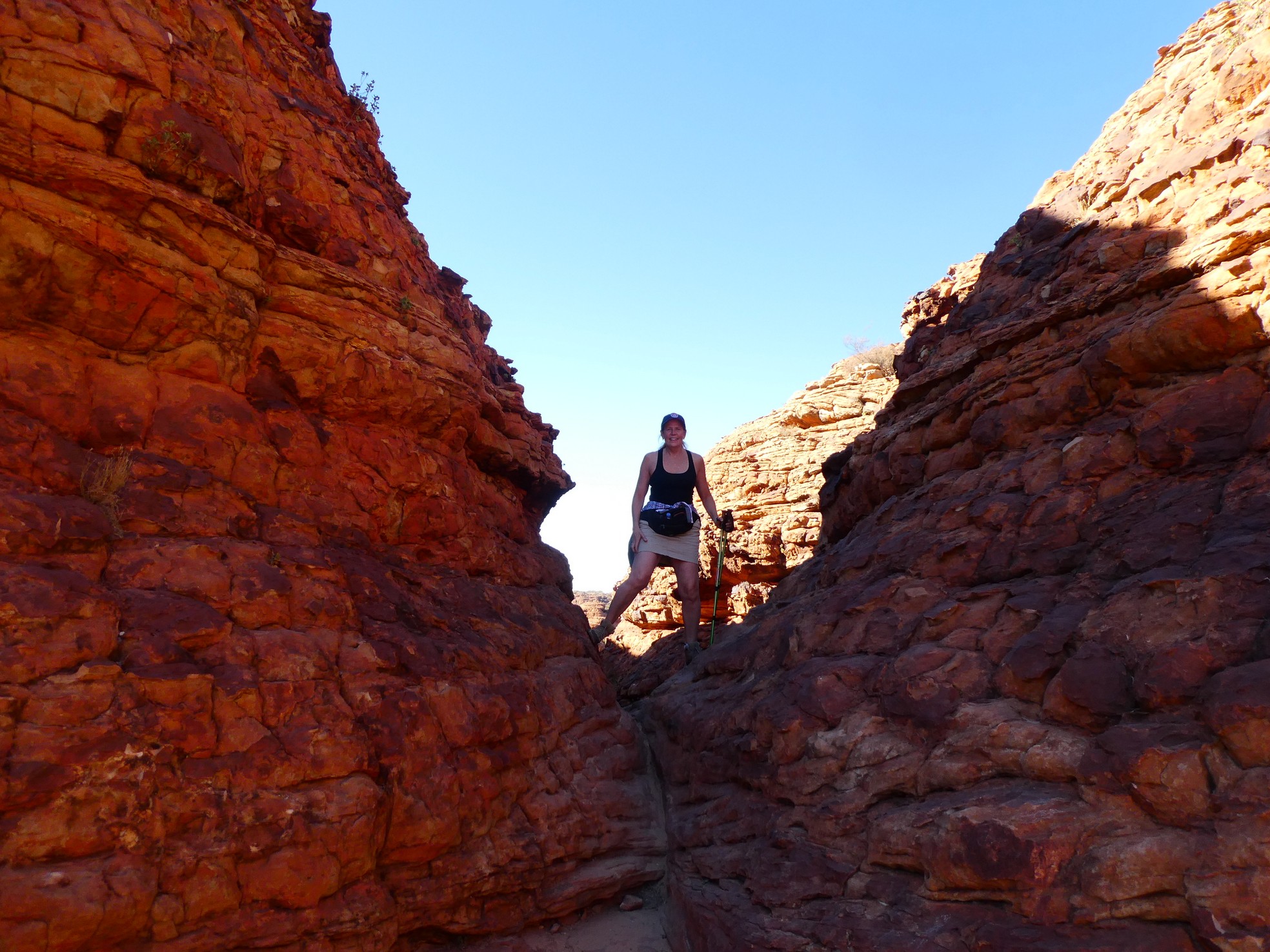
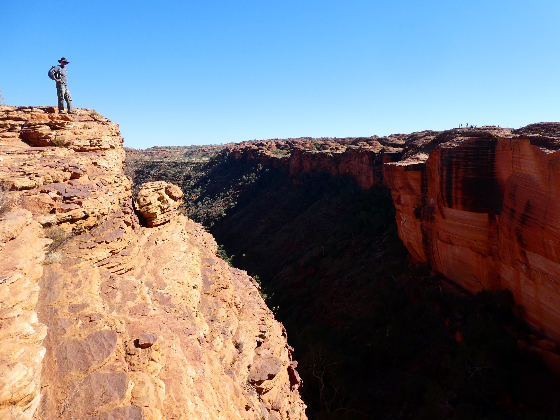
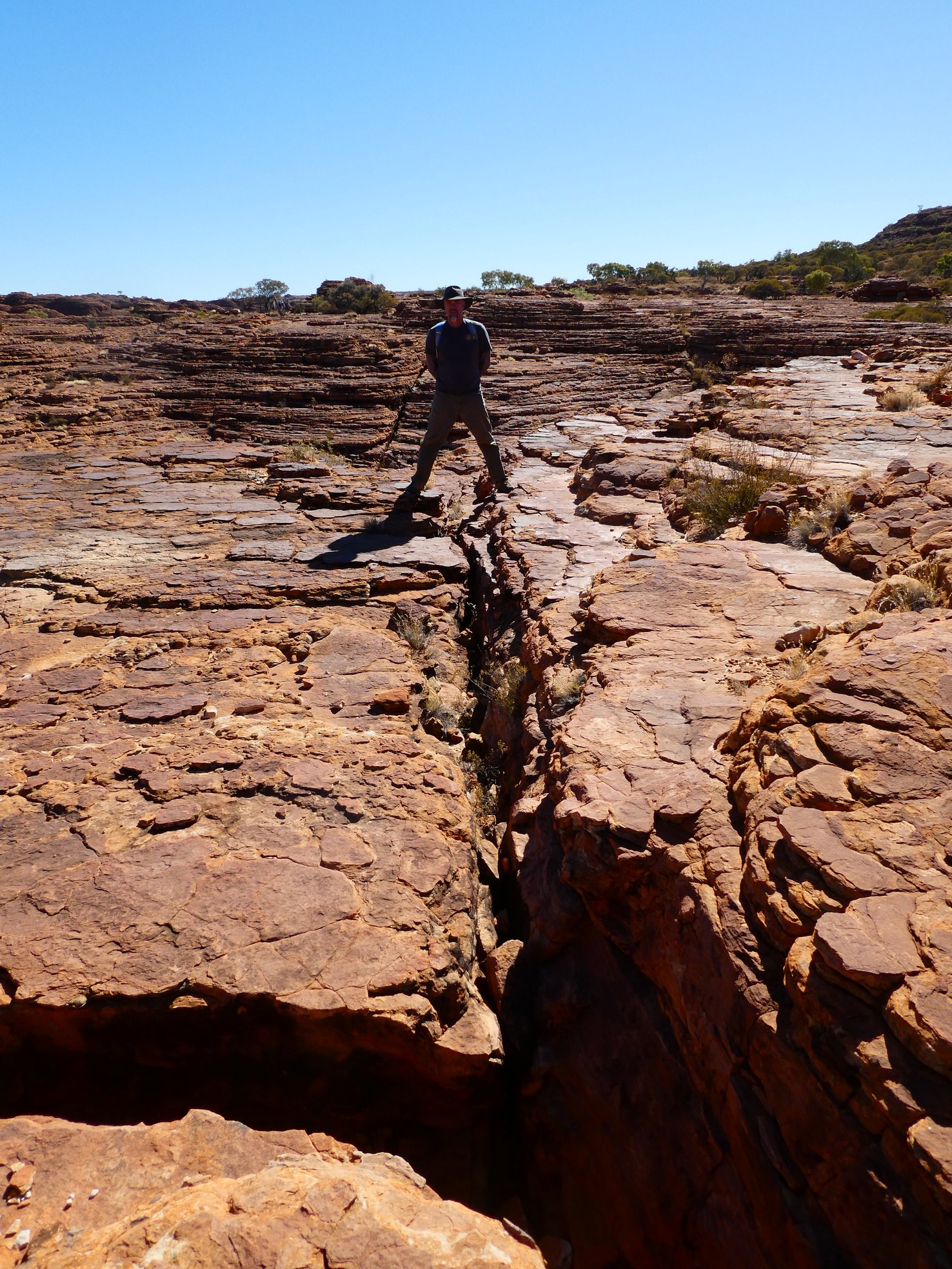 Gerson straddling a fissure that ran for hundreds of meters
![]() Views into the canyon
Views into the canyon
![]()
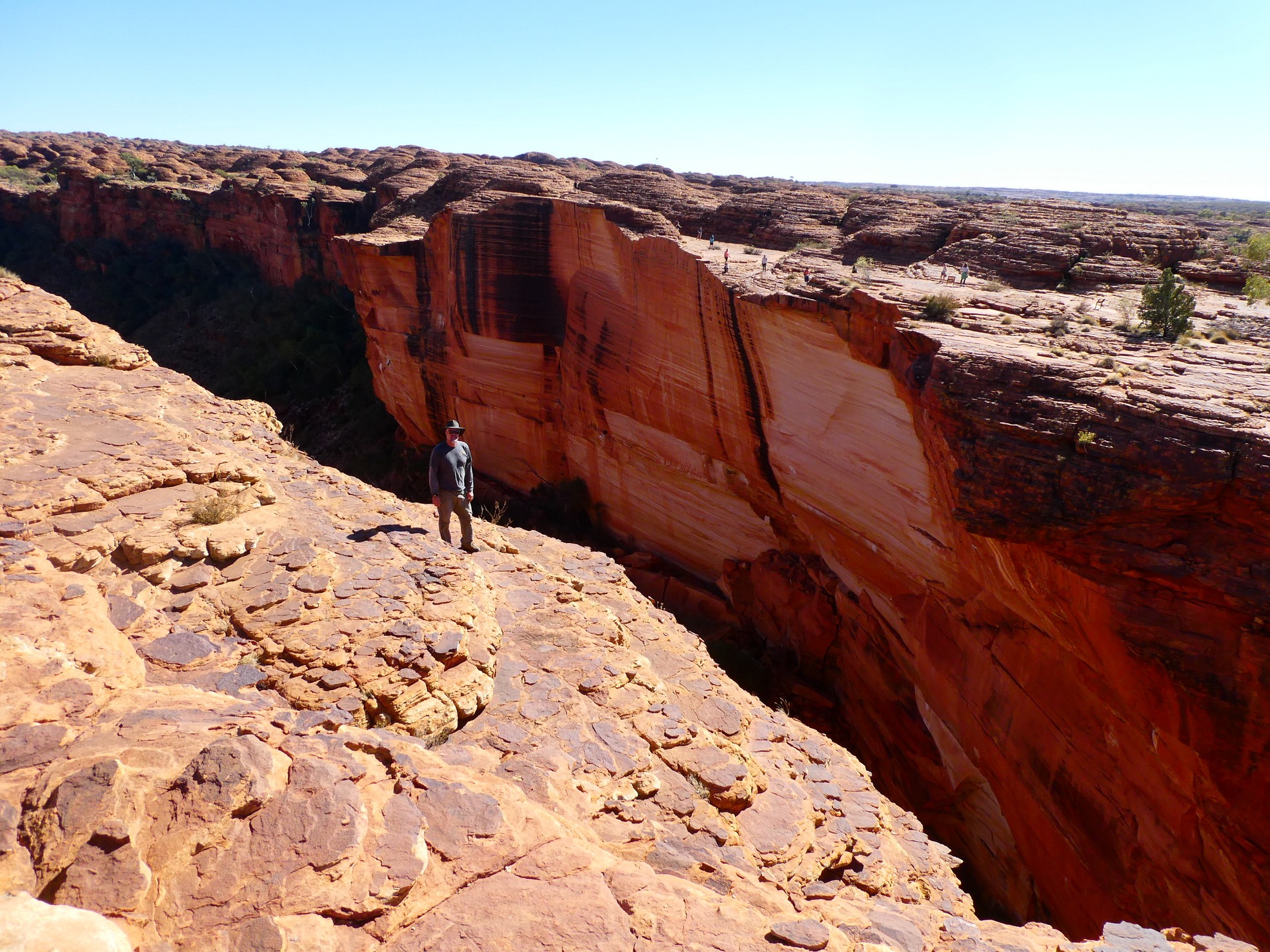
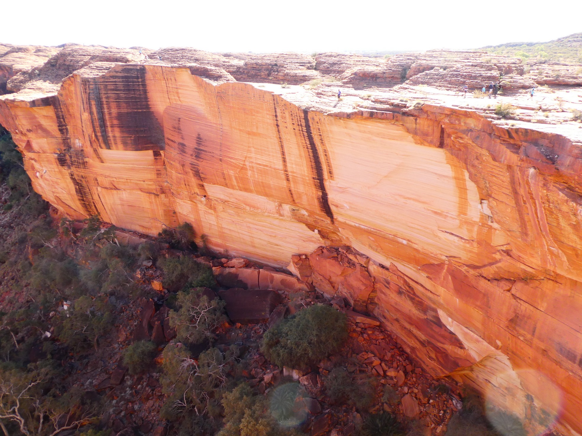
![]() The stunning and intimidating sheer wall of the canyon
The stunning and intimidating sheer wall of the canyon
 Gerson looking out over the back side of the canyon
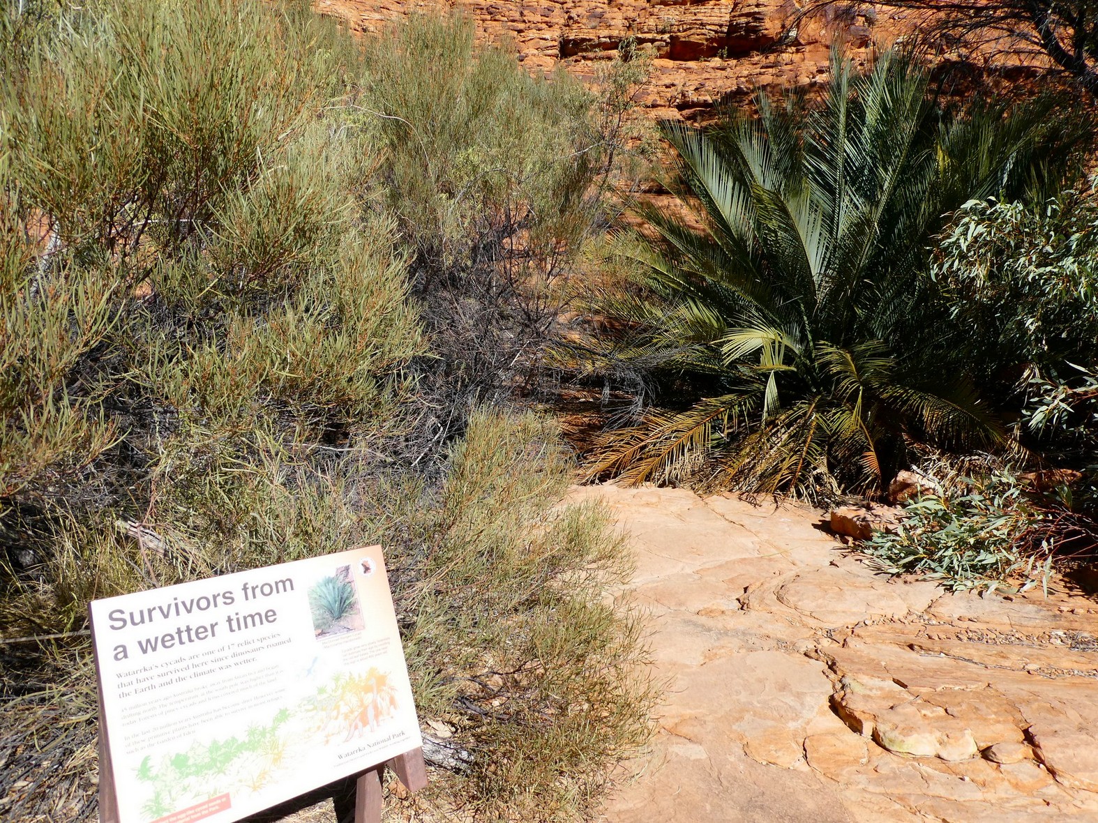 Cycads (palm bush) have survived from more tropical times during the period of
dinosaurs
Cycads (palm bush) have survived from more tropical times during the period of
dinosaurs
We ended the week by returning to the north, with a short stop in Alice Springs. What a week!